Sunday July 4 2021
Happy Birthday America! This is not our typical Independence Day Weather. After the storms erupted last night, dense fog and chilly air was how many began this morning.
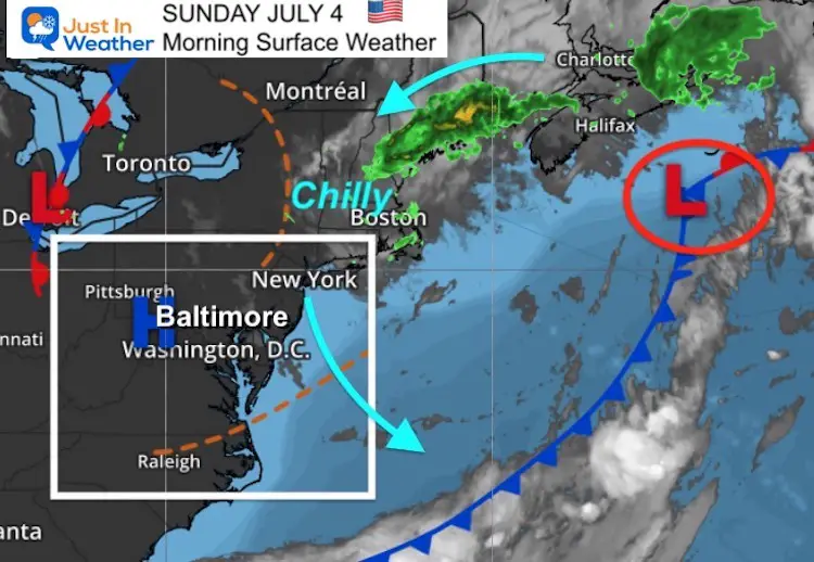
The reason it has been so cool is this nearly stalled storm nee Halifax, Nova Scotia. That is a winter pattern, and it had kept our region and New England under the grip.
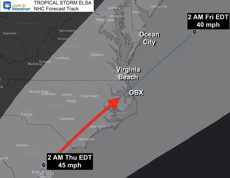
We continue to track Tropical Storm Elsa with a forecast track to Florida and close pass by Ocean City next week. Maps and timing below.
Morning Surface Weather
Extremes In Boston
My friend Meteorologist Jacob Wycoff shared this amazing weather flip in his town. They went from their hottest June day on record, to the coldest July afternoon on record in the span of just a few days.
What a crazy week… pic.twitter.com/g2JXlVTPTF
— Jacob Wycoff (@4cast4you) July 4, 2021
Additional stats in Boston
- June was the hottest June on record for Boston.
- June 28-30 was the hottest June 3-day stretch on record for Boston.
- 2nd most 90°+ days in June (9)
- 1st 100° day in nearly 10 years.
Weather Almanac:
TODAY July 4
Normal Low in Baltimore: 66ºF
Record 53ºF in 1986
Normal High in Baltimore: 86ºF
Record 100 F 2002*
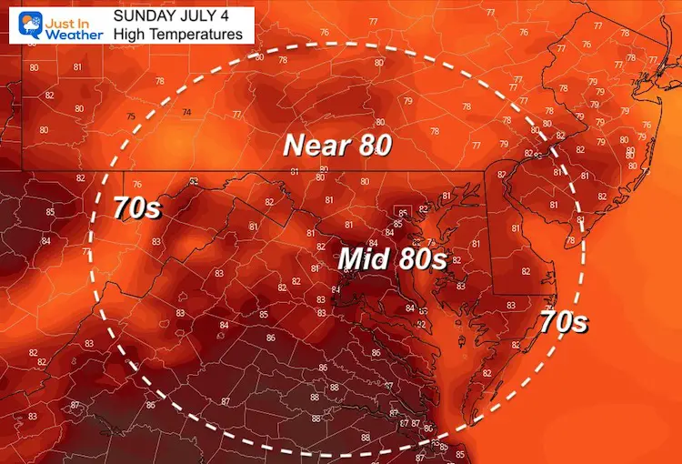
Afternoon Temperature Forecast
It will be warmer than yesterday, but still a little below our average.
Radar Simulation
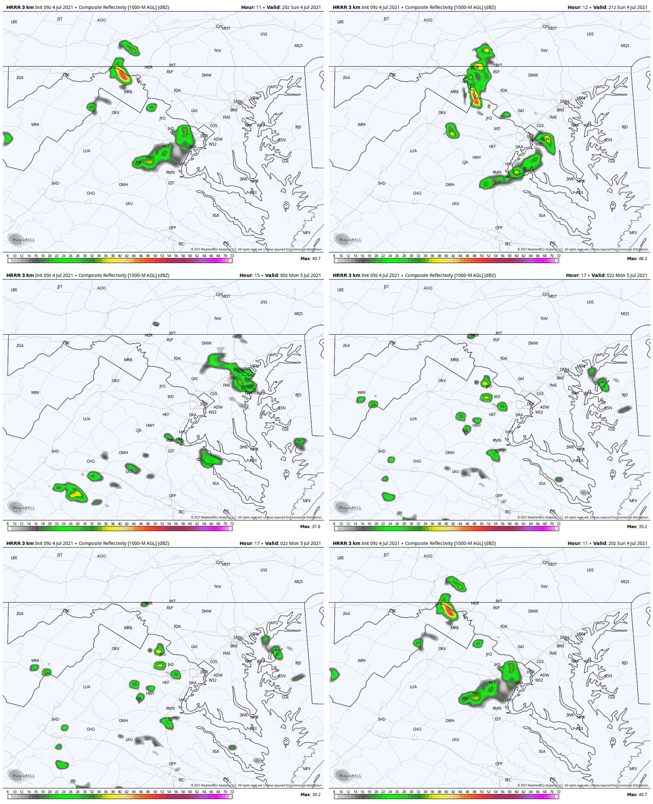
This HRRR Model shows a band of showers forming in the mountains after 2 PM, then reaching the western suburbs and maybe metro area by 6 PM. This will fade was the sun goes down, so fireworks celebrations should be OK.
Tropical Storm Elsa
This morning this storm was east of Jamaica. It has been downgraded to a Tropical Storm, but still a potent flood maker. So far, the forecast track to the US has not changed much.
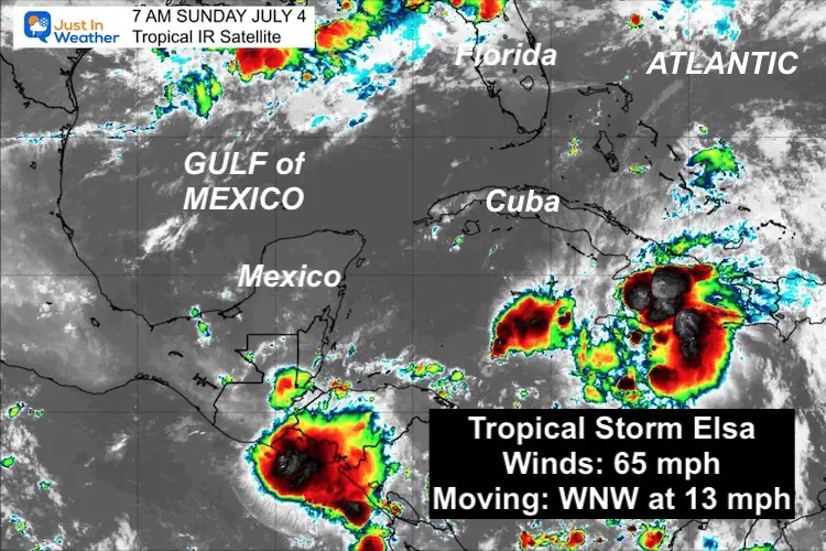
SUMMARY OF 800 AM EDT...1200 UTC...INFORMATION
----------------------------------------------
LOCATION...18.3N 76.2W
ABOUT 45 MI...70 KM ENE OF KINGSTON JAMAICA
ABOUT 145 MI...235 KM SE OF CABO CRUZ CUBA
MAXIMUM SUSTAINED WINDS...65 MPH...100 KM/H
PRESENT MOVEMENT...WNW OR 285 DEGREES AT 13 MPH...20 KM/H
MINIMUM CENTRAL PRESSURE...1007 MB...29.74 INCHES
Wind Impact:
This map shows when winds over 40 mph will reach an area. We can see the arrives in Florida Monday night. It may arrive in the Mid Atlantic Thursday night…
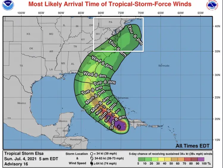
Large Forecast Map
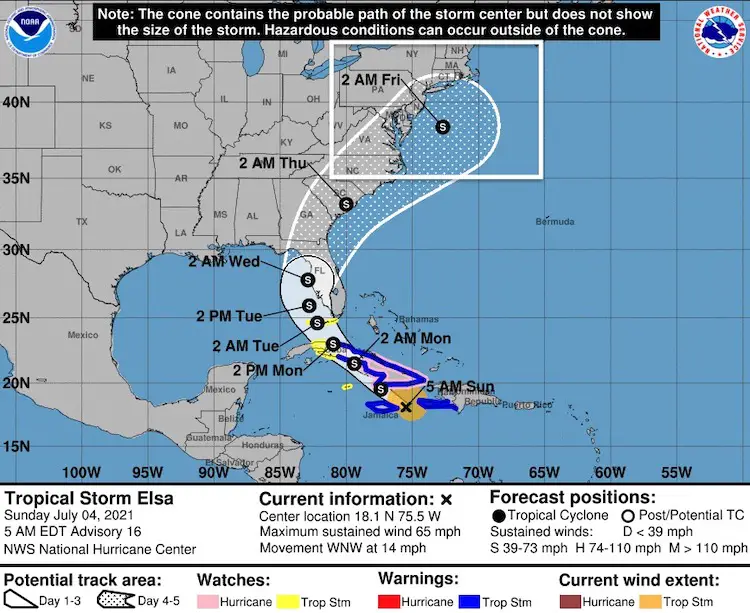
Closer Views
US Landfall near Tampa on Wednesday morning…
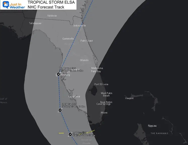
This will NOT be a direct hit, but a close enough path to impact our weather.
The track does come close to a direct pass between The Outer Banks (OBX) and Virginia Beach
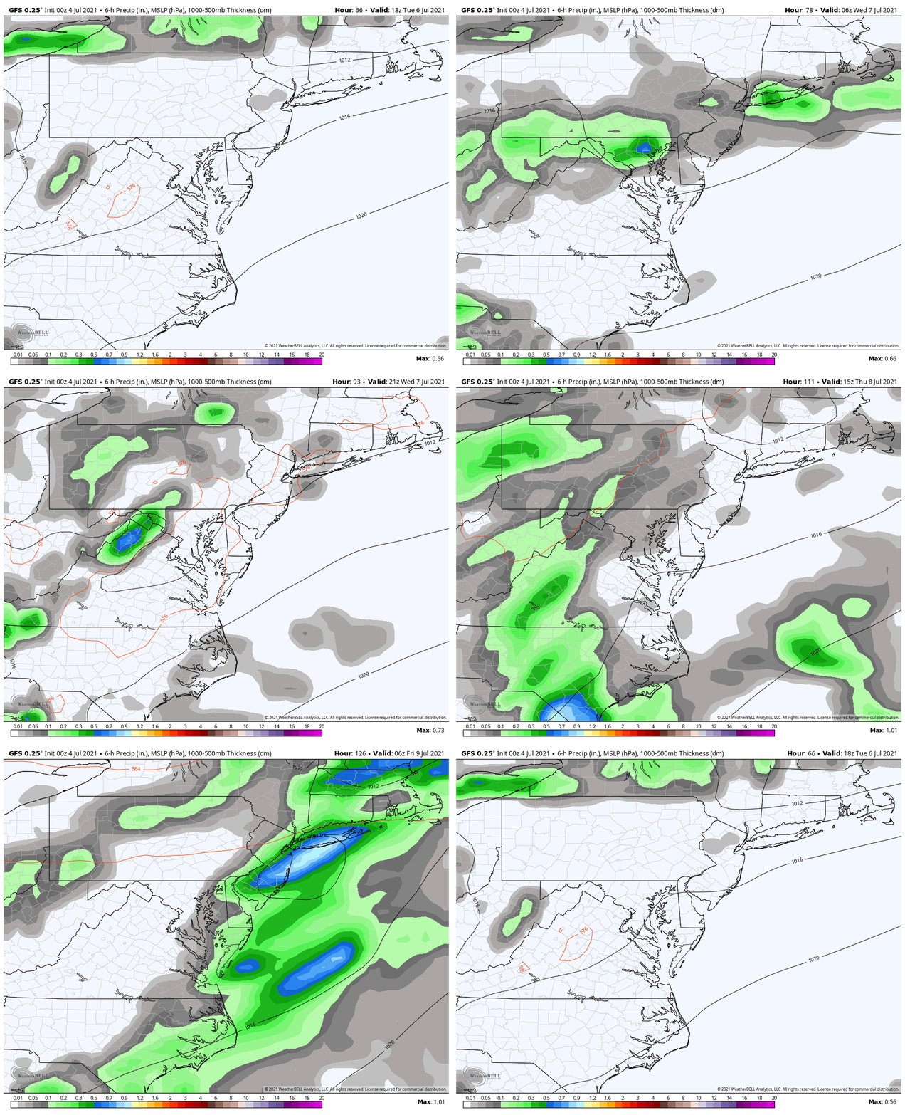
GFS Model Rainfall Simulation
7 Day Forecast
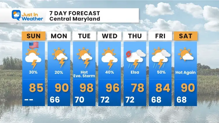
We will get back to the heat and then have to deal with both a a cold front to our west AND Tropical Storm Elsa.
The influence is expected to increase the storm threat Wednesday and Thursday.
In Case You Missed It:
Storm Video Top Shelf Cloud Photos and Damage July 1
Two Tornadoes Confirmed By NWS
Sunshine State Of Mind
I am done with the cold and snow (for the season). I am embracing my wife’s mantra of Sunshine State of Mind.
This was designed by Shannon Berk and we will be wearing it through spring and to the beach.
Double Benefit: Proceeds will be split between our nonprofit Just In Power Kids and the development of my new weather website. That has been scheduled to be ready to launch in May.
14 Local Maryland Pages (and York PA)
We have made a page for Maryland Weather which gives you the current conditions for 14 present area locations.
Please share your thoughts, best weather pics/video, or just keep in touch via social media

