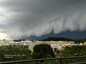
Friday July 2 2021
We broke the heat wave just in time for Independence Day Weekend. The weather this weekend will be good, but we are not completely in the clear. However, all outdoor plans should remain, just be aware of the slight chance for showers.
Below is a look at the way those showers may develop, and the outlook for the rest of the holiday into next week. We need to keep an eye on Hurricane Elsa. Besides the winds cranking at 85 mph now, it is moving quickly. Many long range models bring it onshore in Florida by Tuesday, then turning through the Mid Atlantic. More on that below.
Beaches
If you are heading to the Ocean City, Delaware, or already there, today was not your day. It is about to get better. Here is my Beach, with sun times and tides.
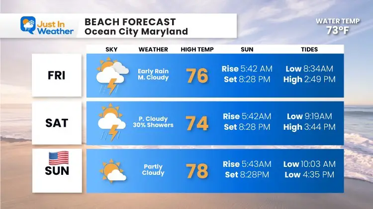
Saturday (Back Home)
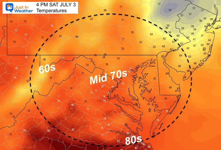
Afternoon Temperatures
Remaining in the 70s, this may either feel refreshing or chilly at the pool.
Radar Simulation —->
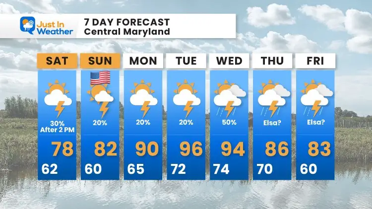
Yes it is true: A 30% chance for showers or thunderstorms can be used to describe the opportunity of it forming over your head AND the portion of the region that gets the rain.
Hurricane Elsa
This is a large and fast moving storm. It is very far away, but the forward speed and upper level pattern will try and bring it through the Mid Atlantic.
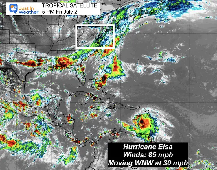
...HURRICANE WATCH ISSUED FOR EASTERN CUBA...


SUMMARY OF 500 PM AST...2100 UTC...INFORMATION
----------------------------------------------
LOCATION...14.2N 63.7W
ABOUT 505 MI...815 KM SE OF SANTO DOMINGO DOMINICAN REPUBLIC
ABOUT 180 MI...290 KM WNW OF ST. VINCENT
MAXIMUM SUSTAINED WINDS...85 MPH...140 KM/H
PRESENT MOVEMENT...W OR 280 DEGREES AT 30 MPH...48 KM/H
MINIMUM CENTRAL PRESSURE...991 MB...29.27 INCHES
US Impact
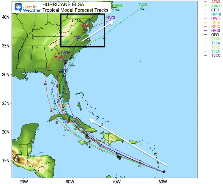
Below is a comparison of many different solutions to how the storm may track. There is good agreement for a landfall on Florida by Tuesday. However the impact may begin as soon as Sunday evening into Monday for the building collapse recovery efforts in Surfside, FL.
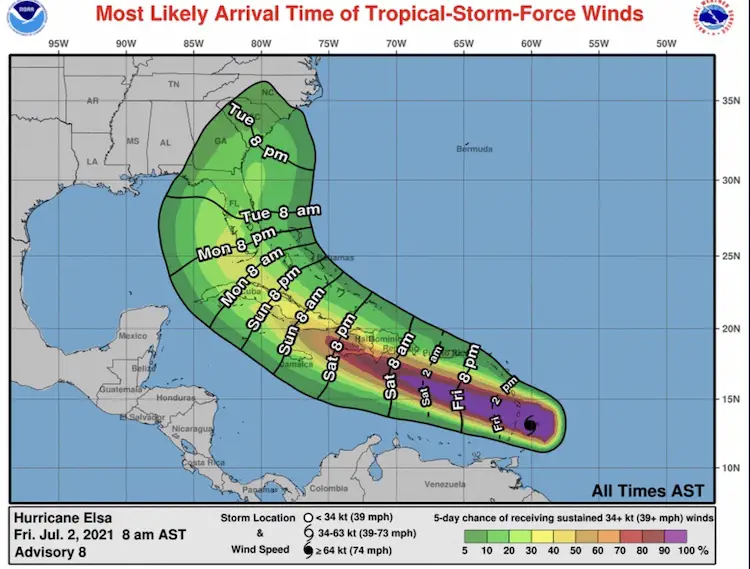
Looking Ahead to Next Week
Computer Model Guidance Tracks do have some agreement on the impact in the Southeast US. The turn to our south is tricky, because the core of the storm might miss our region, but can still send tropical moisture your way for a few days.
Depending on the speed and precise track, some really nice weather can follow right behind it.
If we get anything from Elsa, it would begin Wednesday and maybe continue with tropical downpours Thursday and Friday.
Tropical Models
GEFS Ensemble Members
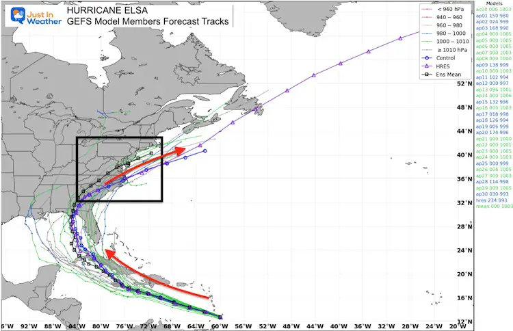
If you are vacationing at the beach in the Mid Atlantic through the Outer Banks, this will kick up the surf and rip currents as it exits the coast and heads out to sea Thursday and Friday.
In Case You Missed It
July 2: Storm Recap Video, Photos, Radar Loop, and Storm Damage Map
Sunshine State Of Mind
I am done with the cold and snow (for the season). I am embracing my wife’s mantra of Sunshine State of Mind.
This was designed by Shannon Berk and we will be wearing it through spring and to the beach.
Double Benefit: Proceeds will be split between our nonprofit Just In Power Kids and the development of my new weather website. That has been scheduled to be ready to launch in May.
14 Local Maryland Pages (and York PA)
We have made a page for Maryland Weather which gives you the current conditions for 14 present area locations.
Please share your thoughts, best weather pics/video, or just keep in touch via social media

