May 7 2021 at 2 PM
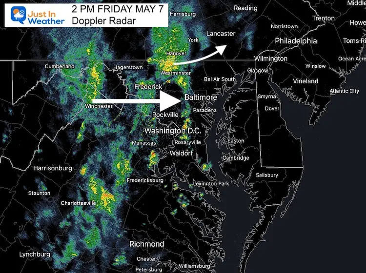
This afternoon rain appeared to arrive a few hours earlier than expected. In fact, Doppler Radar below shows the rain 1 to 2 hours ahead of the short term forecast on the High Resolution Rapid Refresh Model. Compare them below, but you will see the rain forecast through this evening is still a go!
My son’s baseball practice is likely cancelled, but we expected that anyway. Do you have outdoor plans?
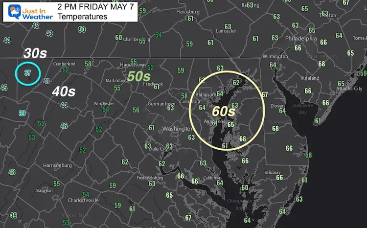
What might be a bigger shock to the system could be the drop in temperatures. While metro areas and Delmarva have reached the 60s, western Maryland has dropped into the 30s!
It’s more likely the 40s reach metro areas this evening. Still quite chilly for May.

Doppler Radar at 2 PM

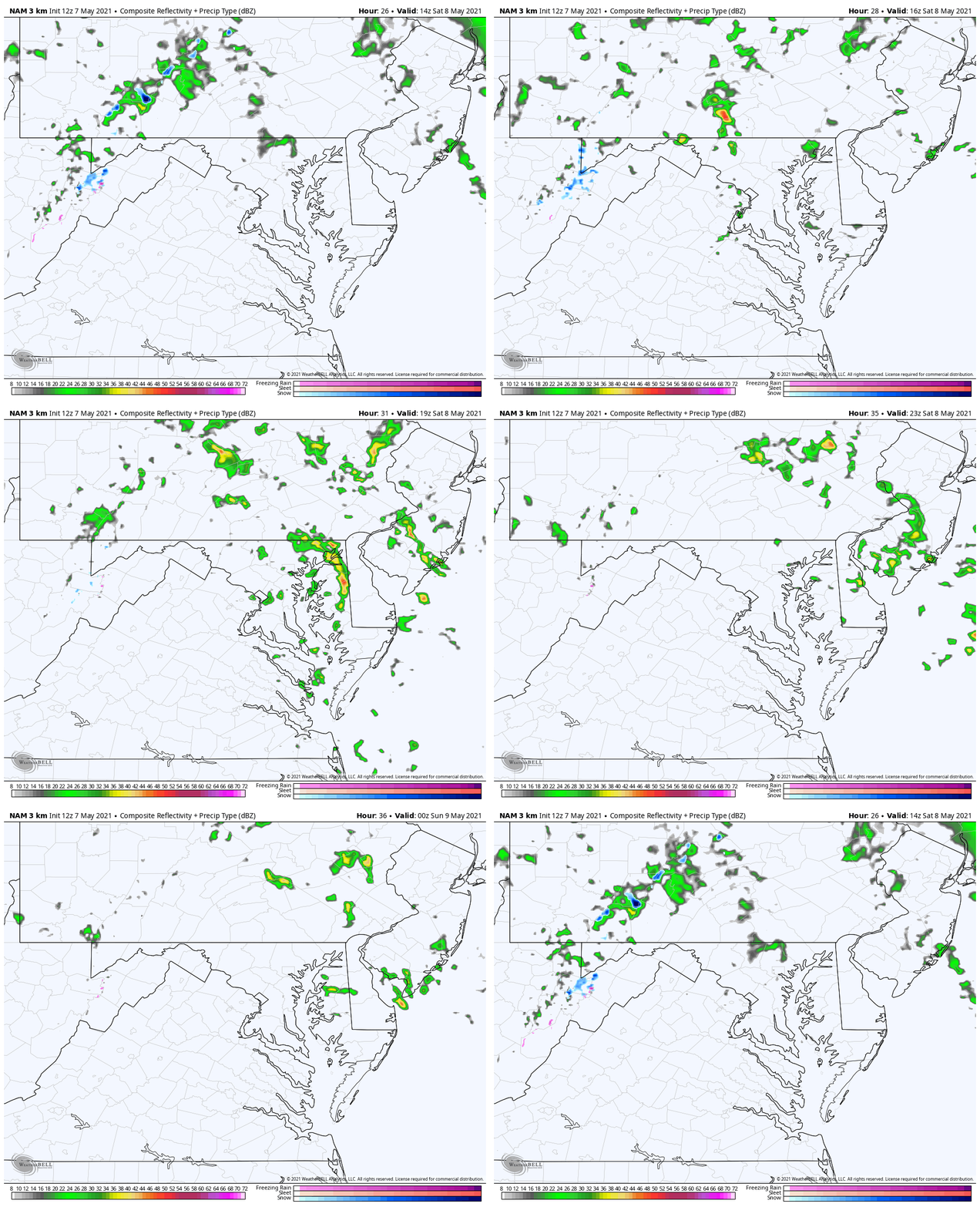
Radar Simulation —-> slider
Notice the first slide is for 3 PM, matching up with what arrived 1 hour earlier.
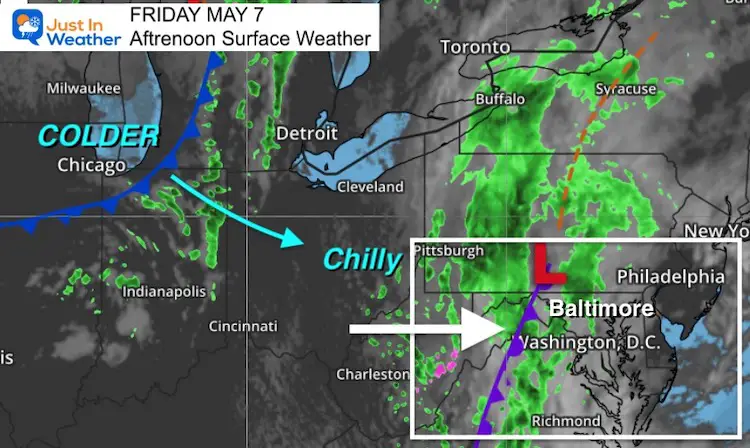
Afternoon Weather Map
Behind this band of rain, another cold front will reach us with a reinforcing shot of cold air and showers on Saturday afternoon.

Saturday Afternoon Radar Animation
It will be chill, and the low freezing level may produce graupel, sleet, or small hail in stronger impulses during the afternoon.
See your local weather forecast timeline here…
I will have an update on the Mother’s Day Forecast in a follow up report.
14 Local Maryland Pages (and York PA)
We have made a page for Maryland Weather which gives you the current conditions for 14 present area locations.
Sunshine State Of Mind
I am done with the cold and snow (for the season). I am embracing my wife’s mantra of Sunshine State of Mind.
This was designed by Shannon Berk and we will be wearing it through spring and to the beach.
Double Benefit: Proceeds will be split between our nonprofit Just In Power Kids and the development of my new weather website. That has been scheduled to be ready to launch in May.
Please share your thoughts, best weather pics/video, or just keep in touch via social media
Facebook: Justin Berk, Meteorologist
Twitter: @JustinWeather
Instagram: justinweather


