Tuesday May 4 2021
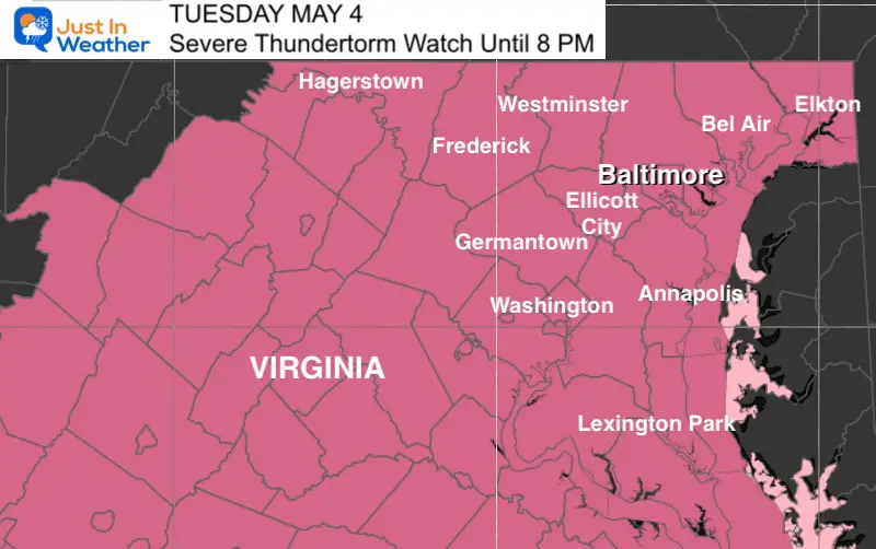
Soon after my previous report, The National Weather Service issued a Severe Thunderstorm Watch for our region until 8 PM. This reinforced what we discussed earlier as a cluster of storms will move through our region. Perhaps in two waves during late afternoon and this evening.
Metro areas are most likely to see the peak activity between 5 PM and 8 PM. We we have a wider window for western areas earlier and Bay/Delmarva into the evening and dark hours tonight. See the live radar below and compare to the two latest computer model simulations to help track the timing.
Severe Thunderstorm Watch
Almost all of Virginia, and most of Maryland west of the Chesapeake Bay.
This includes Hagerstown, Frederick, Westminster, Baltimore, Bel Air, Elkton, Germantown, Mt. Airy, Ellicott City, Annapolis, and south to Lexington Park and St. Mary’s

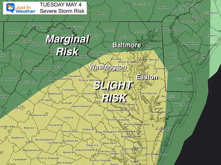
Severe Thunderstorm Risk Factors Factors
Not all storms will reach severe limits, and not all parts of a severe cell will produce this. But here are the criteria possible:
- Dangerous Lightning
- Flash Flooding
- Wind Gusts to 60 mph
- Hail over 1 inch in diameter
- Isolated Tornadoes
Risk Map

Radar Simulations and Live Radar
I’ve placed the radar between the two simulations so it is easy for you to scroll and compare.
HRRR Model —-> slider
Live Radar and Lightning
NAM 3 Km Model —-> slider
Sunshine State Of Mind
I am done with the cold and snow (for the season). I am embracing my wife’s mantra of Sunshine State of Mind.
This was designed by Shannon Berk and we will be wearing it through spring and to the beach.
Double Benefit: Proceeds will be split between our nonprofit Just In Power Kids and the development of my new weather website. That has been scheduled to be ready to launch in May.
14 Local Maryland Pages (and York PA)
We have made a page for Maryland Weather which gives you the current conditions for 14 present area locations.
Please share your thoughts, best weather pics/video, or just keep in touch via social media


