Tuesday April 20 2021
The weather in spring can get wild, but what is about to happen is among the strangest we’ve had in our area. Contrasting warm days with a last gasp of winter is more unusual in the third week of April, but that is what is about to happen.
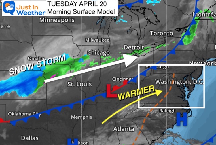
Today we will push the 70s, but a developing storm is about to dump at least 6 inches of snow across parts of the Midwest to upstate New York and New England. Some will reach western Maryland.
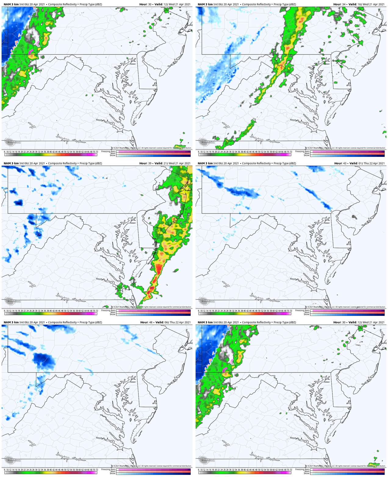
As the cold front reaches us, strong thunderstorms will mark the drop in temps and a few mornings that follow may bring in frost to central Maryland.
Morning Surface Weather
This is the developing storm, already bringing some snow from Kansas to Chicago suburbs. We stay on the warm side today, but that cold front will clash in a hard way!
Weather Almanac: Climate Data For Baltimore
Normal Low in Baltimore: 44ºF; Record 27ºF in 1904
Normal High in Baltimore: 66ºF, Record 94ºF 1941
Temperatures
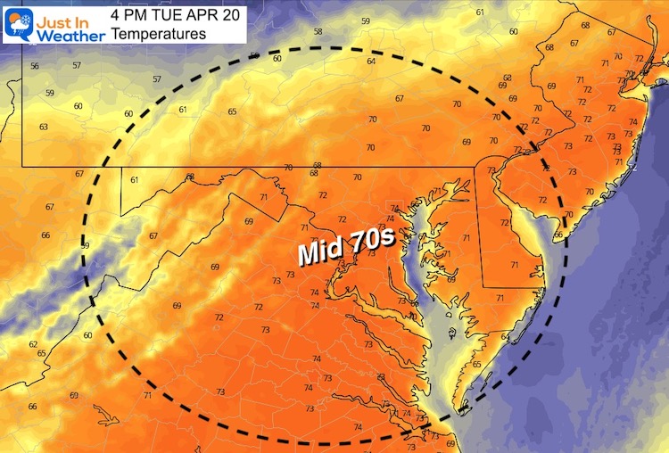
Tuesday Afternoon
Forecast Snapshot: Central Maryland
Today: 70s
Wednesday: Thunderstorm And Strong Winds
Thursday Morning: Frosty

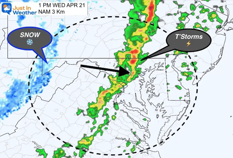
Wednesday Highlight
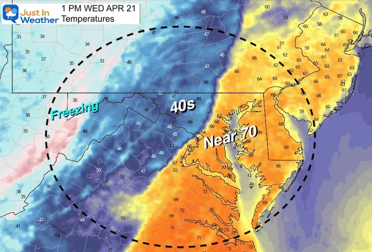
The early afternoon weather map shows the line of thunderstorms in central/metro areas while snow will be falling in western Maryland and the mountains.
Temperatures
Metro areas will get near 70ºF, then fall into the 40s behind the front.
Storm Animation:
Wednesday Morning To Thursday morning. Some snow showers or flurries may reach the inland suburbs.
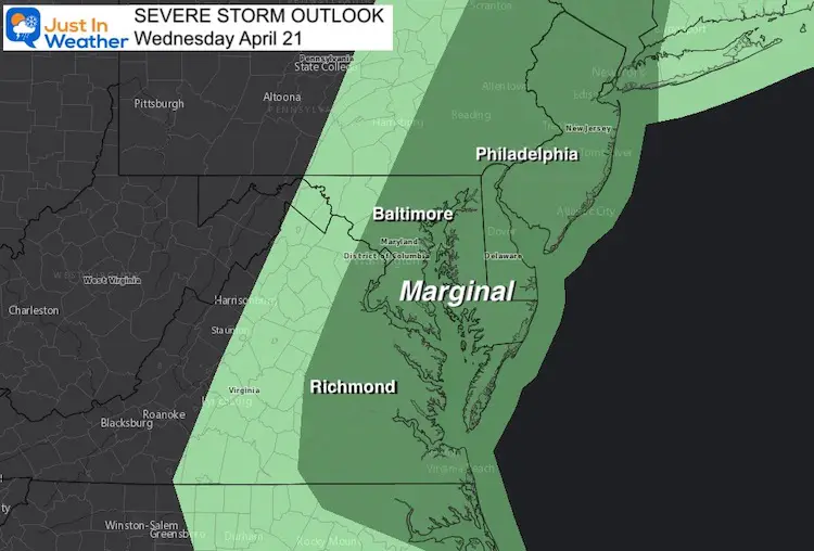
Severe Storm Outlook
We have a marginal risk for storms to turn severe. This includes damaging winds over 58 mph, large hail, and an isolated tornado.
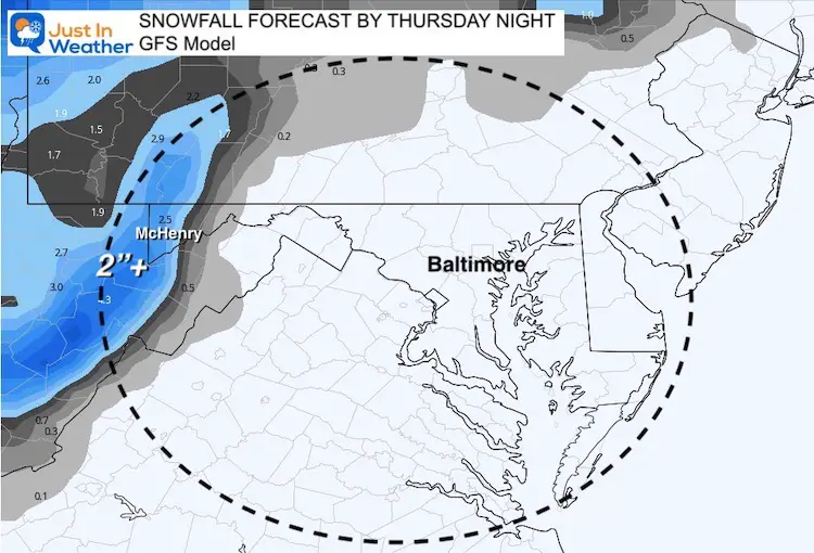
Snow Forecast:
Western Maryland could get two inches, at least on the grassy areas.
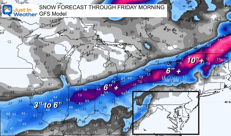
Region View:
A large path of 3 to 6+ inches of snows expected. Heavier snow (6″ tp 10″+) will include Cleveland, Buffalo, Syracuse, northern New England and to Quebec in Canada.
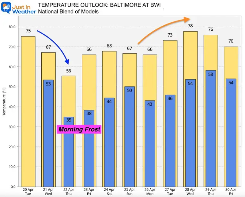
Temperature Outlook
Note: Wednesday’s High will be before the cold front. Quick drop behind it.
The chance for frost will be dependent on the winds… Lighter winds and more frost likely Friday morning.
Some warming is trying to move in sooner next week.
Sunshine Sate Of Mind
I am done with the cold and snow (for the season). I am embracing my wife’s mantra of Sunshine State of Mind.
This was designed by Shannon Berk and we will be wearing it through spring and to the beach.
Double Benefit: Proceeds will be split between our nonprofit Just In Power Kids and the development of my new weather website. That has been scheduled to be ready to launch in May.
14 Local Maryland Pages (and York PA)
We have made a page for Maryland Weather which gives you the current conditions for 14 present area locations.
Please share your thoughts, best weather pics/video, or just keep in touch via social media
Facebook: Justin Berk, Meteorologist
Twitter: @JustinWeather
Instagram: justinweather
Maryland Smoothie King Is Now Supporting Our Nonprofit Just In Power Kids


