Tuesday April 6 2021
Thanks to a band of clouds overnight, and even some sprinkles, we have a mild start to today. This blanket of clouds is part of a larger pattern dragging air from the north. This will bring in a few more impulses of showers, but not well organized over the next few days. The cooler air will return by the end of this week.
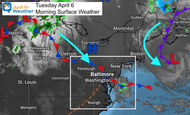
Morning Surface Weather
Low Pressure continues to hang out east of New England while the next cluster of clouds around the Great Lakes keeps sending clouds our way.
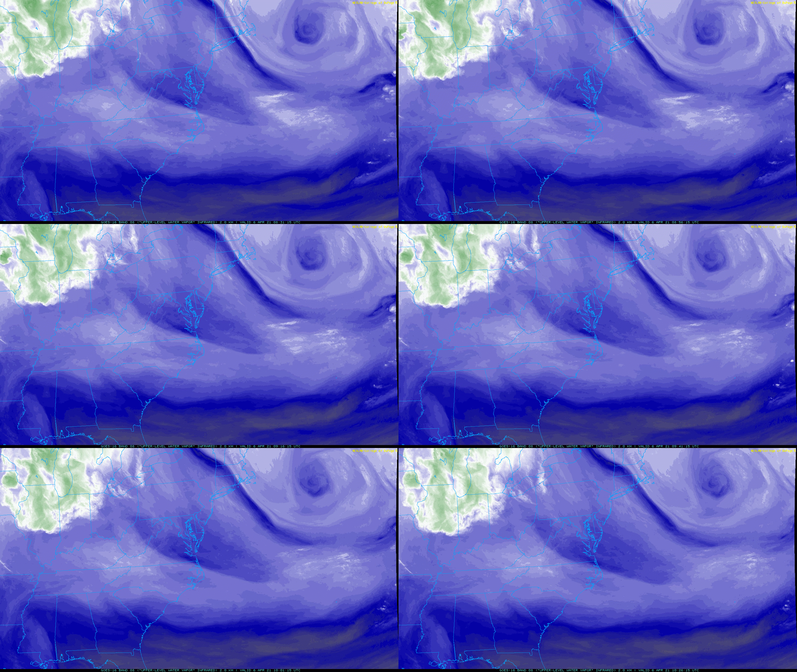
Morning Satellite Loop
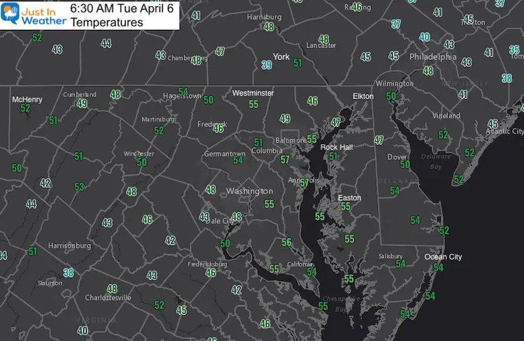
Morning Temperatures
Mild start around our region with most areas in the mid 50s.
Weather Almanac
Normal Low in Baltimore: 40ºF; Record 24ºF in 2016
Normal High in Baltimore: 61ºF, Record 90ºF 2010
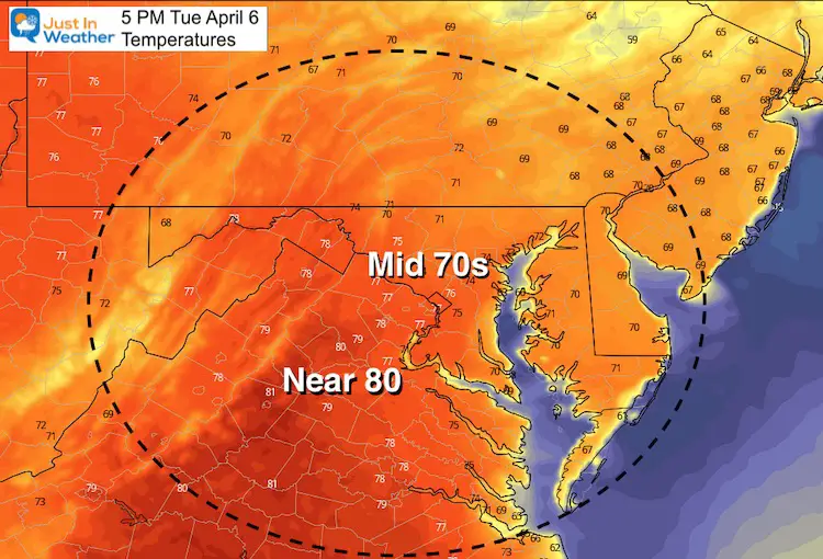
Tuesday Afternoon Temperatures
Sunshine Sate Of Mind
I am done with the cold and snow (for the season). I am embracing my wife’s mantra of Sunshine State of Mind.
This was designed by Shannon Berk and we will be wearing it through spring and to the beach.
Double Benefit: Proceeds will be split between our nonprofit Just In Power Kids and the development of my new weather website. That has been scheduled to be ready to launch in May.
Forecast Snapshot: Central Maryland
Here we see showers entering the picture overnight tonight.
Wednesday we may see more showers during the day, then gain on Friday as temps cool down.

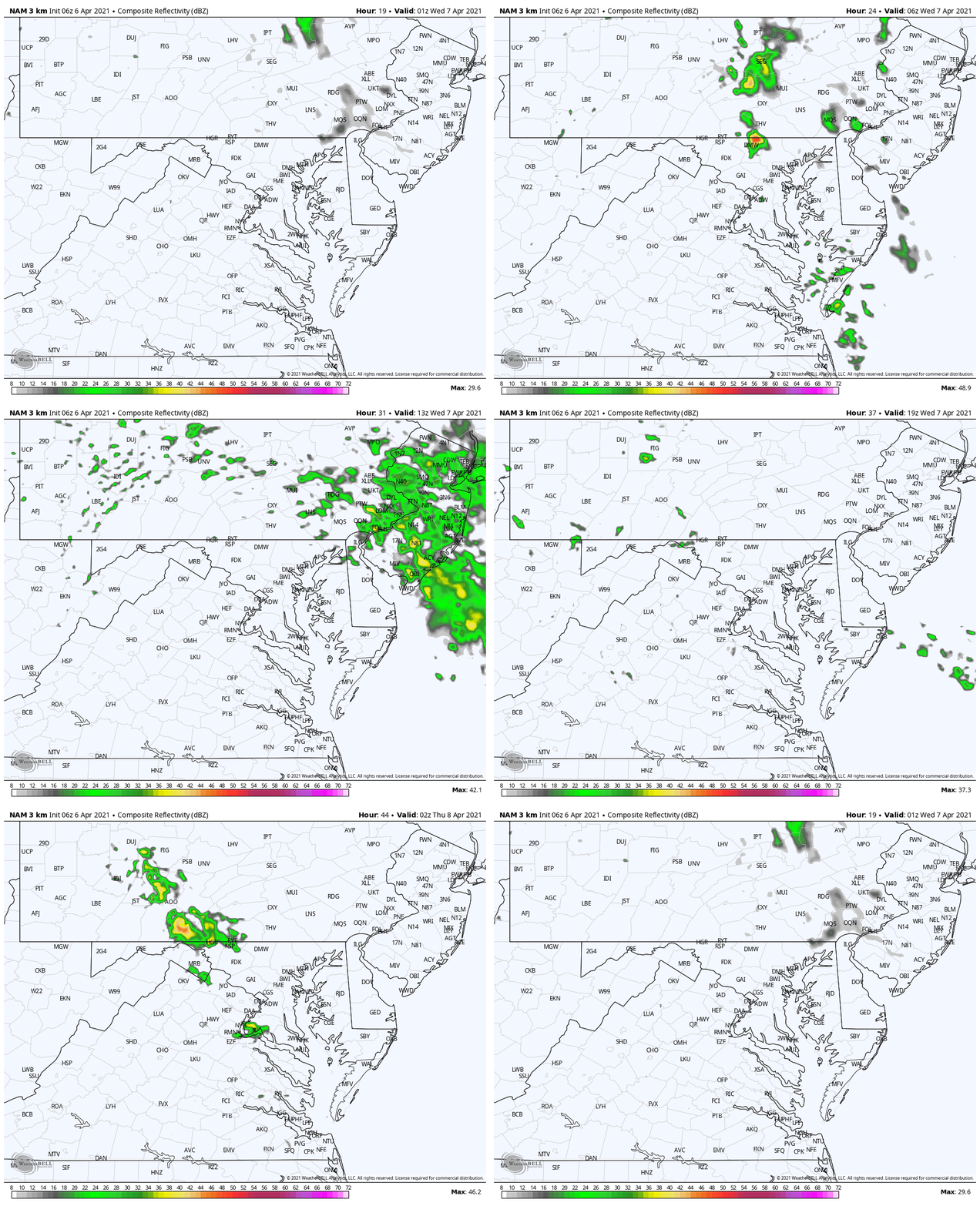
Rain Animation:
Impulses of rain showers tonight through tomorrow night. This is not region wide and well organized, but will keep the threat of rain around.
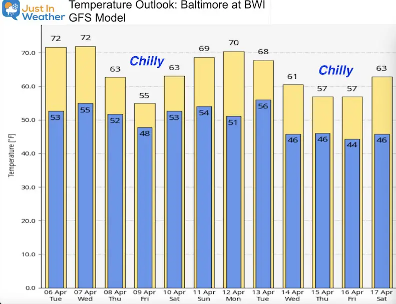
Temperature Outlook
The push of cooler air from the northeast will arrive Friday.
Maryland Smoothie King Is Now Supporting Our Nonprofit Just In Power Kids

14 Local Maryland Pages (and York PA)
We have made a page for Maryland Weather which gives you the current conditions for 14 present area locations.
Please share your thoughts, best weather pics/video, or just keep in touch via social media

