Friday April 2 2021
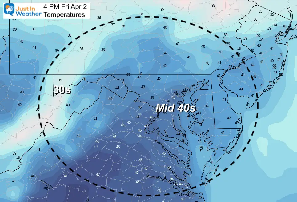
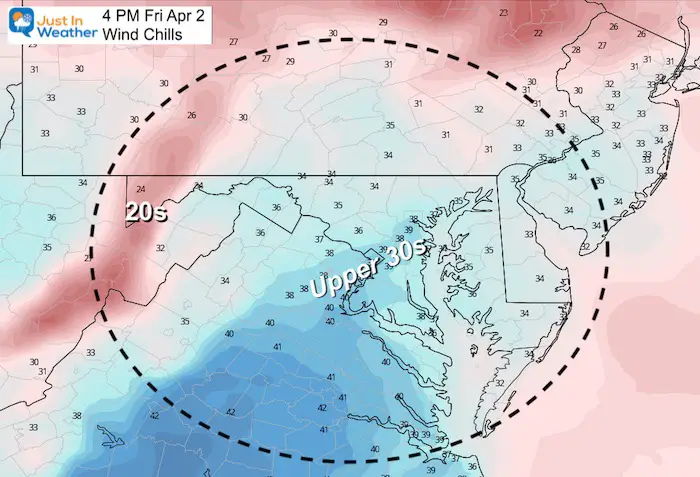
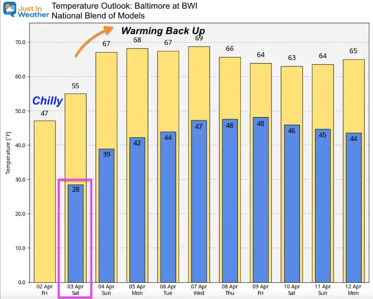
Cold winds have continued to produce snow flurries and even some bursts to coat the ground in spots of northern Baltimore County this morning. But the main story today will be the temperatures. It will continue to feel like winter, even into the afternoon. But we will warm back up by Easter Sunday.
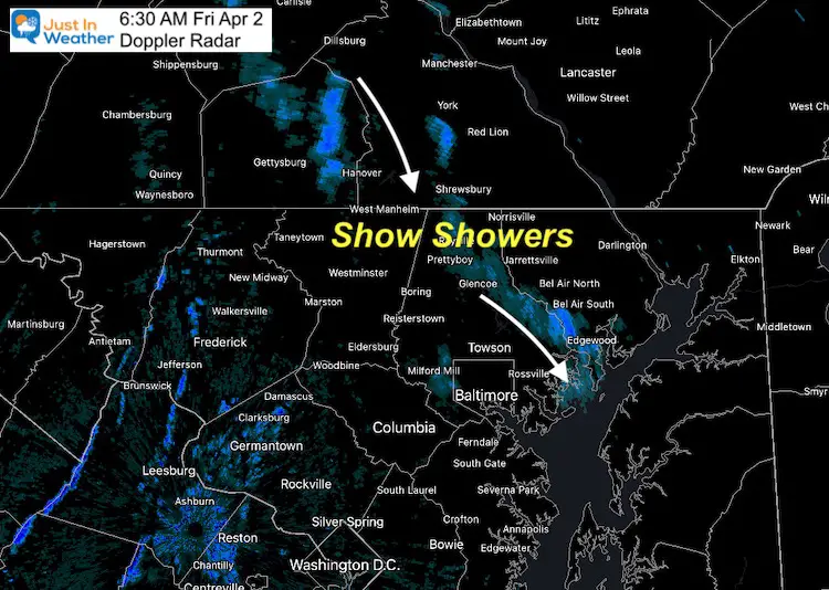
Doppler Radar Snapshot
Snow showers and flurries have continued through daybreak. This has been between Gettysburg and York in PA, pushing down southeast through The Hereford Zone and along the Baltimore and Harford County line. Roads are likely OK, a brief coating on the ground in the path is possible.
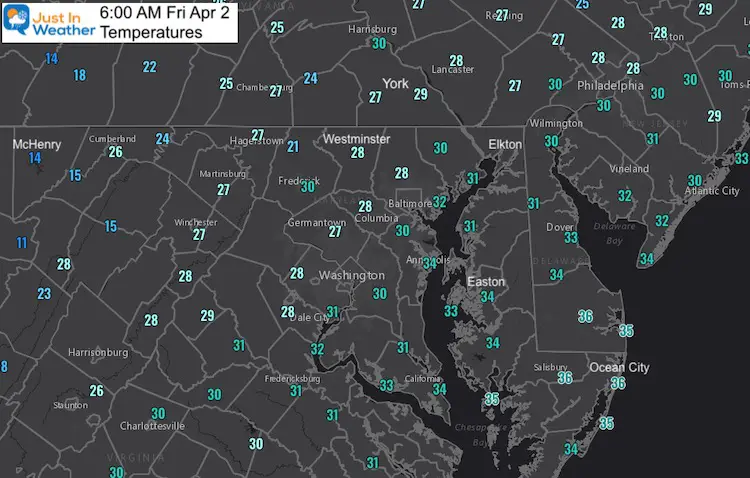
Morning Temperatures
Much of our map shows 20s and 30s, with the coldest readings in the mid teens in the western mountains.
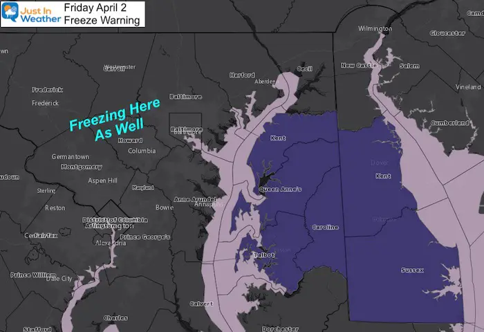
Freeze Warning: Delmarva
This freeze warning across central Eastern Shore and Delaware is because the growing season may have begun there. We still have freezing temps west of the Bay, and will be there again tomorrow morning…
If you have hoses connected to your outside faucet, let’s hope the line is open or you might have a burst.
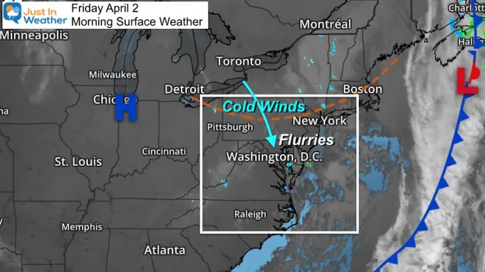
Morning Surface Weather
The winds remain cold from the north as the old storm departs and High Pressure builds in.
Weather Almanac
Normal Low in Baltimore: 39ºF; Record 23ºF in 1907
Normal High in Baltimore:60ºF, Record 88ºF 1963
Snow: Trace in 1924
Afternoon Temperatures
Afternoon Wind Chills
Graupel Snow Photos And Video From Thursday
See the rare type of snow that fell on April 1
Forecast Snapshot: Central Maryland
See the rain forecast below

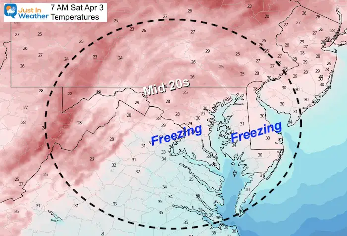
Saturday Morning
One more drop below freezing….
Saturday Afternoon
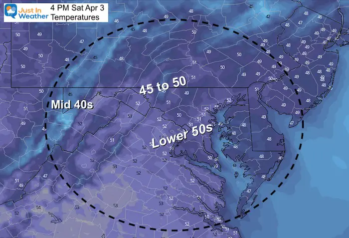
Looking Ahead:
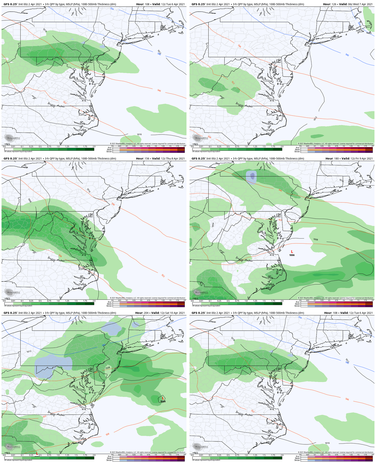
Quiet weather expected into early next week. We may see rain showers on Tuesday, then the next storm appears to arrive earlier on Thursday into the start of next weekend.
Temperature Outlook
14 Local Maryland Pages (and York PA)
We have made a page for Maryland Weather which gives you the current conditions for 14 present area locations.
Please share your thoughts, best weather pics/video, or just keep in touch via social media


