Friday January 29 2021
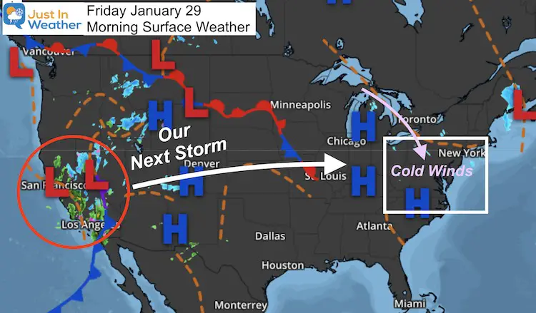
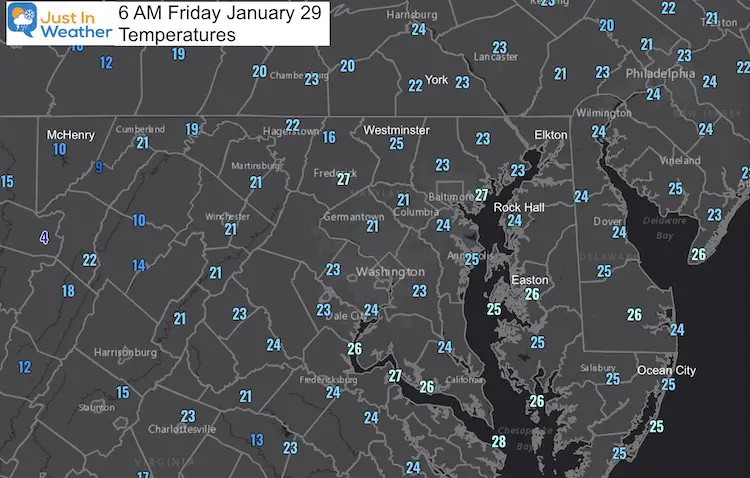
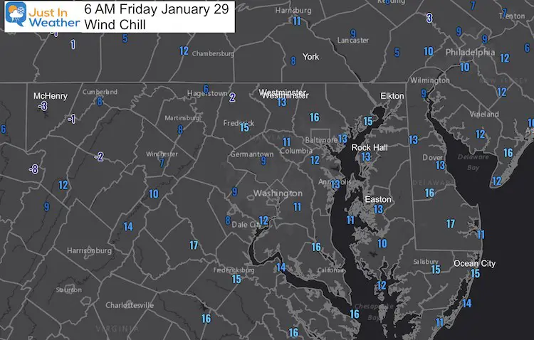
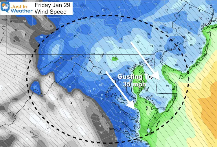
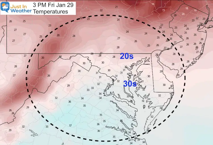
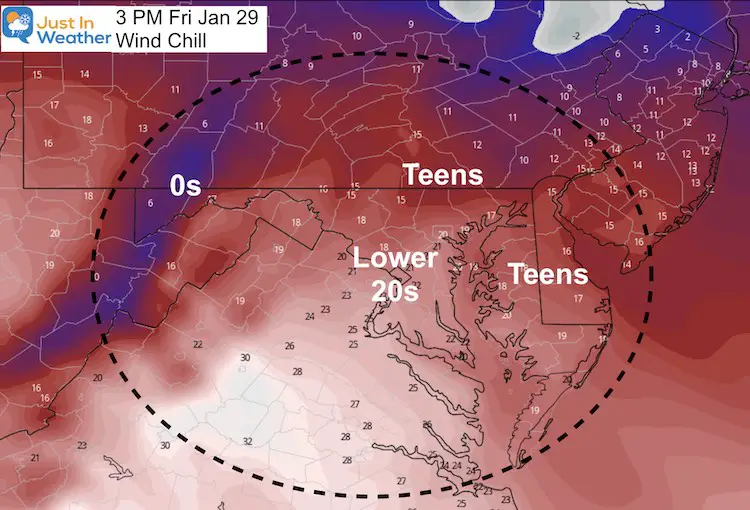
It will snow on Sunday! FITF! Before jumping in to the storm arrival, we should look at the cold air in place today. Arctic air continues to surge in and this will be the coldest day many of us have felt in two years. Winds will be gusting up to 35 mph and it will feel like the teens or lower 20s. Lake Effect Snow to our north will send a mix of clouds our way.
Our next storm is in California today. We will track that across the nation, likely to bring us out first flakes on Sunday between 7 AM and noon. Below is a look at the timeline and snowfall just for Sunday. There will be some more stuff to follow afterwards.
Friday Morning Weather
Temperatures
Wind Chill
Forecast Maps Today
Winds
Strong winds form the Northwest all day, but will peak around noon. Expect 15 too 20 mph with gusts to 5 mph.
Afternoon Temperatures
Afternoon Wind Chill
Forecast Snapshot: Central Maryland

Sunday Snow Timeline —> slider
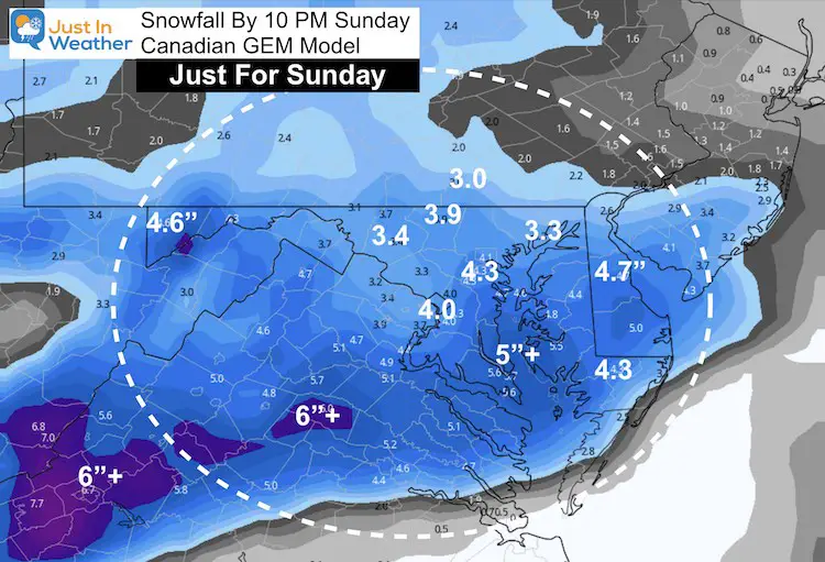
This is the Canadian GEM Model. There are a few different solutions, however I am sticking with this for now.
How Much Snow On Sunday
At this time it looks like much of the region should be in for 3 to 6 inches of snow on Sunday. Remember there will be more to the storm, but that all depends on how the coastal Low develops on Monday.
My First Call Expectations
Start: First Flakes Sunday between 7 AM and Noon
Much of the region will see accumulating snow on Sunday, and it could last most of the day.
How much snow depends mostly on the location of the coastal low formation, and rapid intensification. The establishes the cold air AND how much moisture comes in off of the ocean.
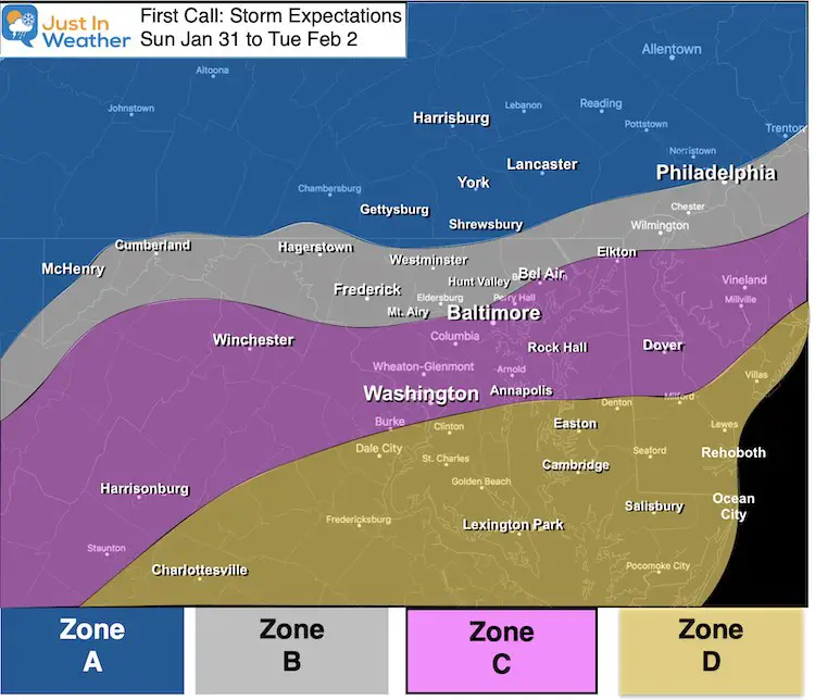
Zone A:
- Mostly snow for the entire event through Tuesday morning. This should be the highest snow totals.
Zone B:
- Sunday: Snow into Sunday night with moderate accumulation.
- Monday: Mixing with sleet and freezing rain is likely at some point. This region may remain icy.
- Monday Night into Tuesday: Back to all snow, ending by noon Tuesday. Additional accumulation likely.
Zone C:
- Sunday: Mostly snow with moderate accumulation.
- Sunday Night into Monday: Mixing with and changing to all rain is more likely. This would allow time to thaw roads.
- Monday Night into Tuesday: Monday Night into Tuesday: Back to all snow, ending by noon Tuesday. Additional accumulation likely.
Zone D:
- Sunday: Starting with snow with stickage and accumulation to impact travel. *It takes less here to do more than inland.
- Sunday Night into Monday: Most likely to turn to all rain at some point.
- Monday Night into Tuesday: Monday Night into Tuesday: Back to all snow, ending by noon Tuesday. Additional accumulation likely.
Temperature Outlook
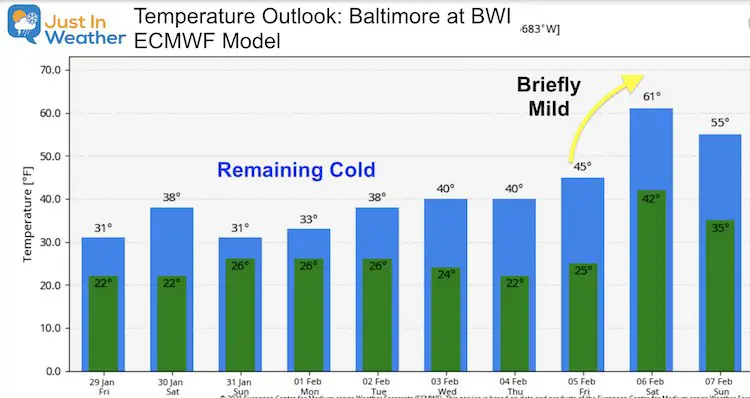
FITF
Please share your thoughts, best weather pics/video, or just keep in touch via social media
Facebook: Justin Berk, Meteorologist
Twitter: @JustinWeather
Instagram: justinweather
14 Local Maryland Pages (and York PA)
We have made a page for Maryland Weather which gives you the current conditions for 14 present area locations.
FITF Shop Open
My ‘bonus’ daughter Jaiden and wife showing off our popular Maryland Hoodies. Unisex and women’s items all produced in Maryland.
Click here to see this and many other new items.
Also see:
Maryland Weather Page
I wanted to keep it simple. Just the basics for a quick view at any time.


