Sunday January 17 2021
Here we are finally getting back to winter air. After Baltimore hit a high temperature of 49ªF yesterday, we will gradually get colder starting today. This is not the deep freeze, but the first step in a progressive pattern that should be with us at least through the end of the month.
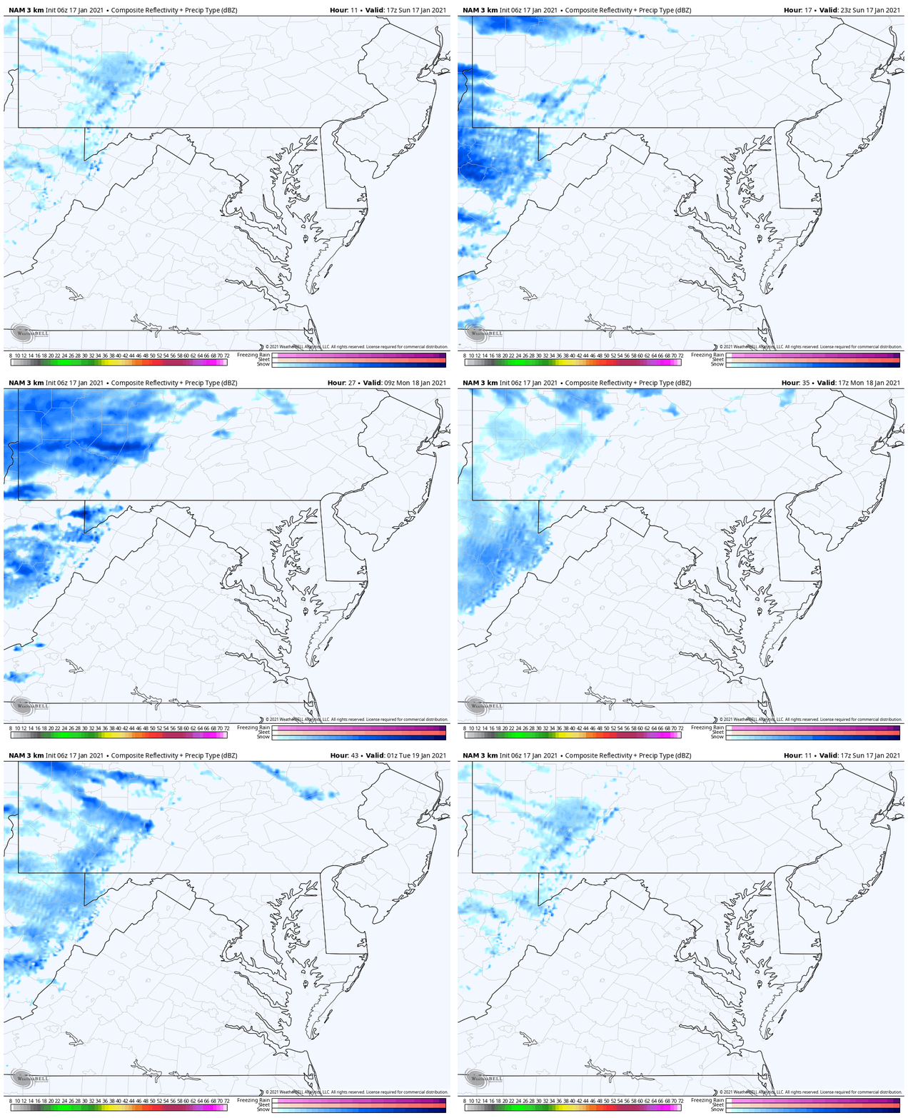
What about snow? Well, for now it looks like western Maryland continues to get fresh powder as well as the Great Lakes region. I included two live web cams below.
We my get flurries tomorrow. There is one potential storm in the pipeline, but it is just over one week away. As I have shown a few times, those carrots have not played out, so I will NOT show it now. But it will be hard to remain dry for a few weeks with what is on the way.
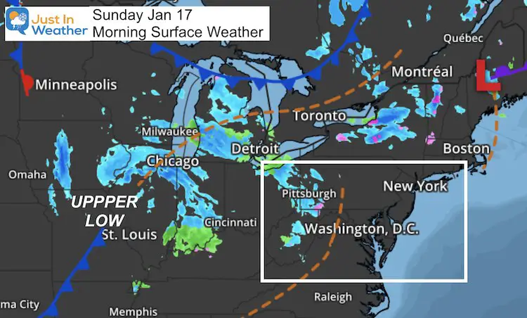
Morning Surface Weather
Plenty of snow bands are rotating around the Upper Low. Locally we miss out on them, but get the clouds and colder air. Western Maryland will continue to get snow showers and minor accumulation.
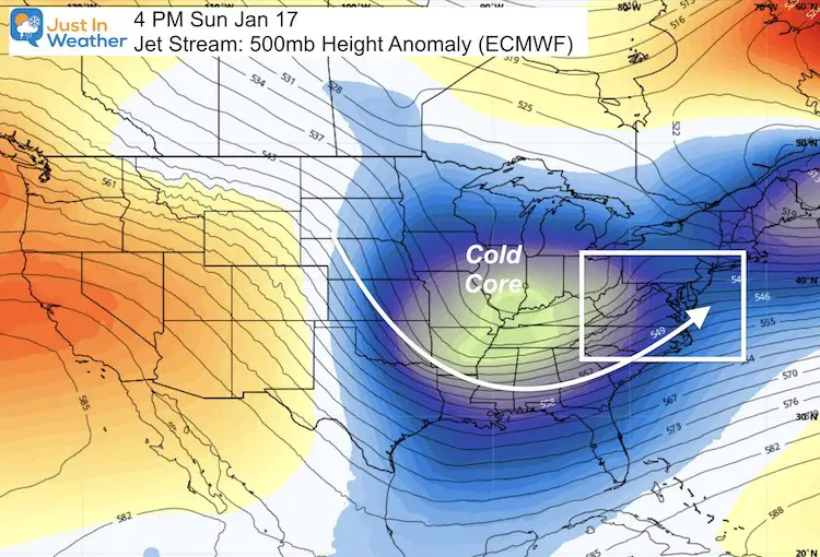
Jet Stream
Sunday Afternoon: The core of the upper Low will be in the Mid-West.
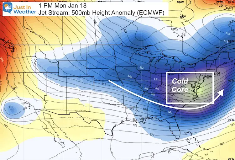
Monday Afternoon: The Core will be moving off of the Delmarva coast.
Central Maryland Forecast

Western Maryland Snow
Snow Cam 1
Get an up-close view of live conditions at Wisp Resort!
This webcam is positioned at The Greene Turtle Deep Creek Lake and shows Wisp Resort, including a zoomed-in view of Squirrel Cage, The Face, the terrain park, Boulder, the mountain coaster, the tubing park and a shot of McHenry Cove at Deep Creek Lake!
Snow Cam 2
This webcam is positioned at the very popular Lakeside Creamery and Copper Kettle Popcorn Factory.
Views of Deep Creek Lake, Deep Creek Lake State Park, the Glendale Road Bridge, and more!
Web Cams Provided By
Railey Realty and Railey Vacations
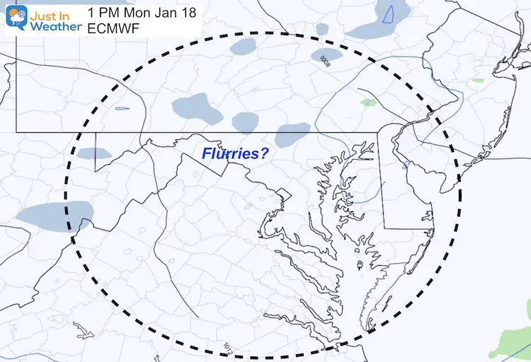
Monday Afternoon Flurries?
The European Model on spits out a few possible flakes with the instability in the afternoon.
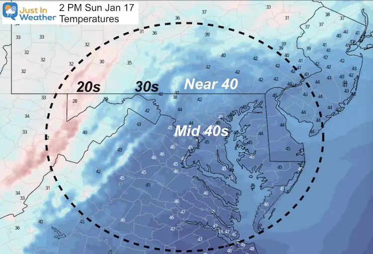
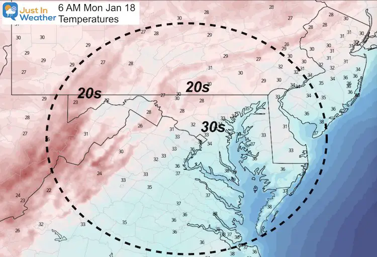
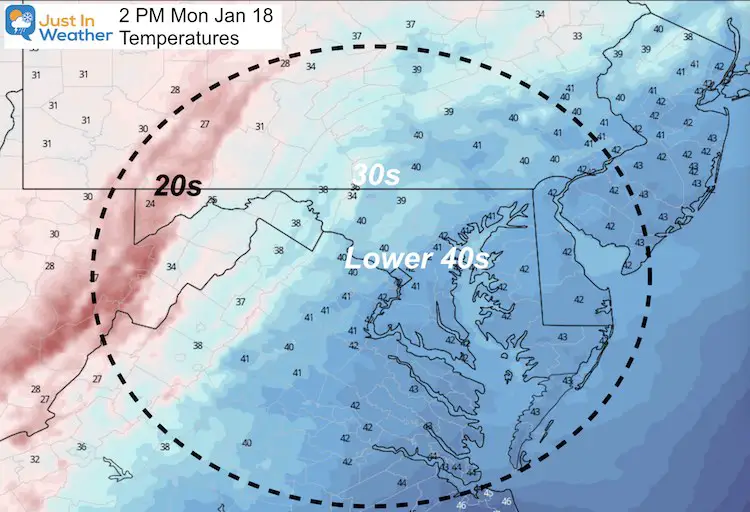
Temperature Forecast
Sunday Afternoon
Monday Morning
Monday Afternoon
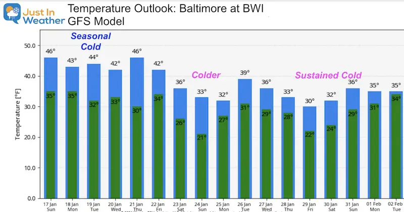
Temperature Outlook
This first showing of cold air is near or slightly above the seasonal average. That has already been addressed in previous posts as a swing and a miss.
All of that Polar Vortex disruption talk has been happening. Missing the first wave, doesn’t mean the next will be the same.
But, we are no longer seeing the deep cold long off in the future. The second push and sustaining cold is consistently targeting next weekend through the end of the month.
Please share your thoughts, best weather pics/video, or just keep in touch via social media
Facebook: Justin Berk, Meteorologist
Twitter: @JustinWeather
Instagram: justinweather
Email Updates
Please make sure you sign up (above or click here to sign up for email alerts…. ) for my newsletter. This way you will get an email to make sure you are notified of each post.
14 Local Maryland Pages (and York PA)
We have made a page for Maryland Weather which gives you the current conditions for 14 present area locations.
FITF Shop Open
My ‘bonus’ daughter Jaiden and wife showing off our popular Maryland Hoodies. Unisex and women’s items all produced in Maryland.
Click here to see this and many other new items.
Also see:
Also See:
December Climate, Sun Data, Solstice, ISS Flyovers, Moon, Planets, and The Great Conjunction
Maryland Weather Page
I wanted to keep it simple. Just the basics for a quick view at any time.

