Thursday December 3 2020
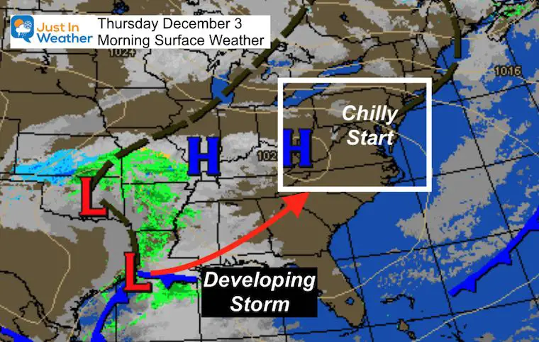
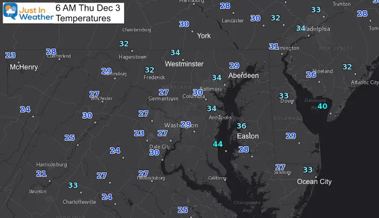
This morning is clear and chilly. Many areas have temperatures dropped into the 20s and lower 30s, but it will not be this cold for the next storm. It will be chilly with heavy rain starting tomorrow.
The track of this storm from the Louisiana Gulf Coast to the East Coast is what I projected in my winter outlook. This should be a common theme this winter. But the cold air needed for wintry precipitation is limited this time. However, there may be enough on the back end to mix with sleet and snow.
Morning Surface Weather
Morning Temperatures
The 20s have been reached in the Capital District and even Lower Eastern Shore.
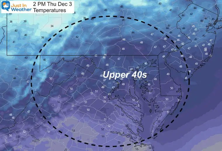
Afternoon Temperatures
High clouds will be moving in, which may provide views of solar halos or sun dogs.
Temps remain a little below average.
Friday Weather
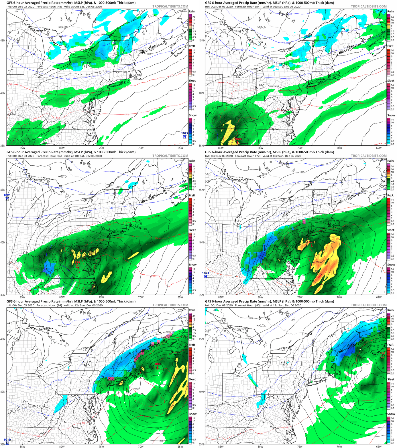
The storm may spread light rain showers in the morning. The steady rain will develop during the afternoon and evening. Heavy rain will fall with increasing wind overnight and Saturday morning. This storm will become a snow maker for New York and New England.
The GFS Model is now showing that hint of sleet (purple) for northern Suburbs early Saturday. Compare to the European Model slider below.
European ECMWF Model Forecast —> slider
Here we can see more pronounced period of snow/sleet for northern Maryland and Southern PA early Saturday morning.
My Take:
As I wrote last night, the snow from the last storm was more than expected and still on the ground. That can play a role with supporting the colder air feeding into this next storm. This is why I believe models will be trending a little colder. This would result in a better chance to at least end the next storm with some wintry precipitation in our region.
I am not seeing a winter storm for our region, just snow and and sleet for the last few hours possible. This is also important to pick out now, so we can stay ahead of model bias with future storms this winter.
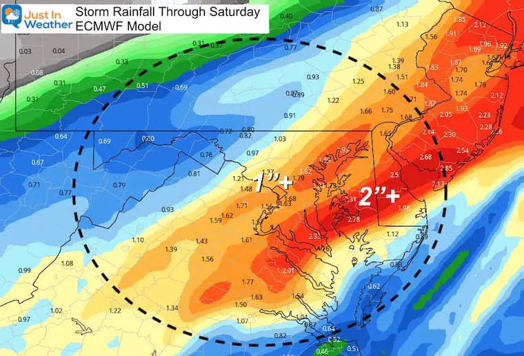
Storm Total Rain
This will be a heavy rain event with most of our region east of the mountains in the 1 to 2 inch range.
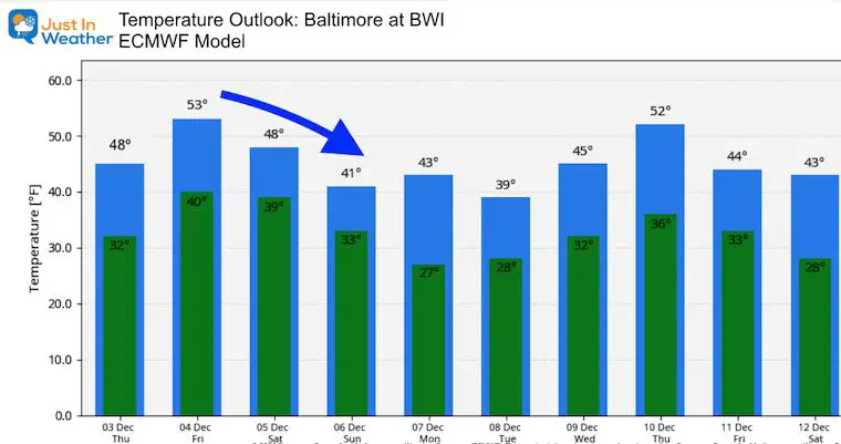
Temperature Outlook
Do you remember the NOAA Outlook was for a warmer than normal December? That obviously was wrong.
So looking long term, we need to consider the lack of confidence, even if you see any bump up. The overall upper level pattern supports a more wintry set up.
Also See:
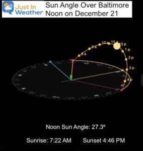
December Climate, Sun Data, Solstice, ISS Flyovers, Moon, Planets, and The Great Conjunction
14 Local Maryland Pages (and York PA)
We have made a page for Maryland Weather which gives you the current conditions for 14 present area locations.
Maryland Weather Page
I wanted to keep it simple. Just the basics for a quick view at any time.
New Caps and Hats
My Final Winter Outlook: Snow Forecast
FAITH IN THE FLAKES STORE OPEN
My ‘bonus’ daughter Jaiden is showing off our popular Maryland Hoodie. Click here to see this and many other new items.
Please share your thoughts, best weather pics/video, or just keep in touch via social media
-
Facebook: Justin Berk, Meteorologist
-
Twitter: @JustinWeather
-
Instagram: justinweather
Email Updates
Please make sure you sign up (above or click here to sign up for email alerts…. ) for my newsletter. This way you will get an email to make sure you are notified of each post.
Just In Power Kids:
A portion of proceeds go to our programs Providing FREE holistic care for kids in cancer treatment and up to 5 years post treatment and caregivers.


