Tuesday November 10 2020
We continue with high temperatures in the upper 70s in metro areas and today should be the last one for a while. Yesterday BWI reached 77ºF, missing the record by one degree. This time the record of 75ºF. is well within reach, and I expect Baltimore’s station at BWI will get there.
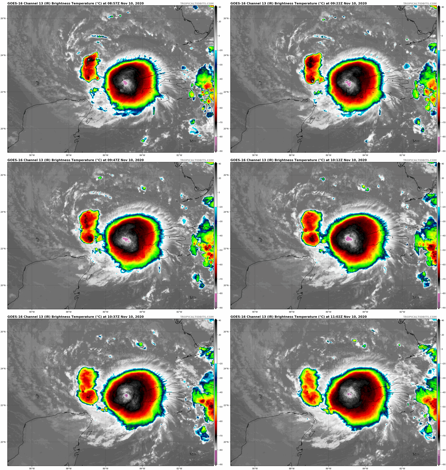
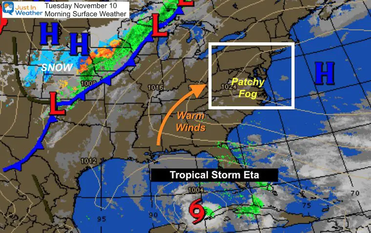
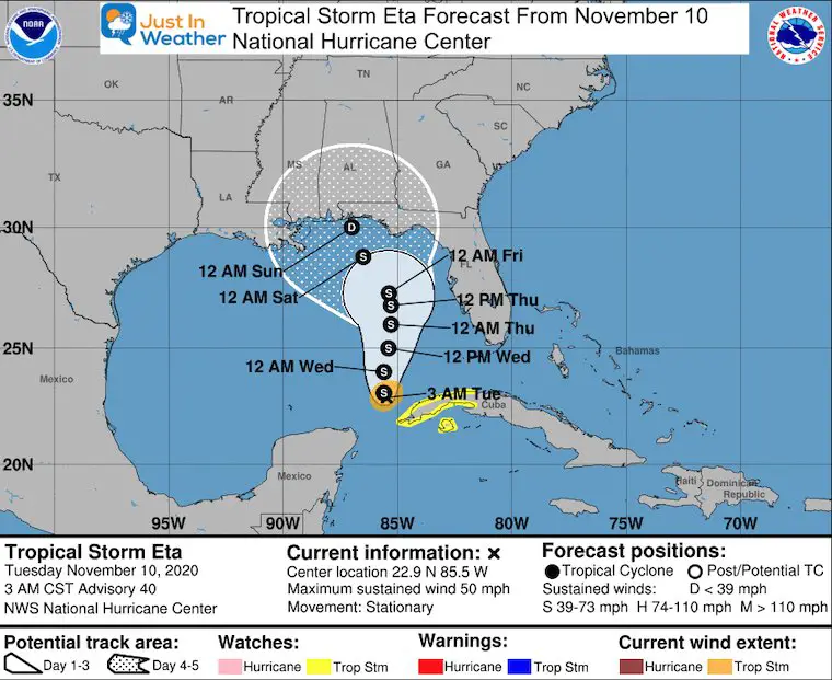
Tropical Storm Eta is stationary this morning off the west coast of Cuba. It will make the turn north and feed a lot of moisture into the cold front heading our way. The timing is a little slower, with rain more likely to reach us Wednesday afternoon into Thursday morning. Some areas will be at risk for flooding.
Morning Surface Weather
There are areas of fog again this morning. It will burn off this morning, and you might notice a hint of humidity with the warm afternoon.
First: Tropical Storm Eta
- Winds: 50 mph
- Movement: ‘Stationary’
Tropical Satellite Loop
National Hurricane Center Forecast
This will linger off the coast all week long. It is not directly aiming for us. However, it will continue to send lots of moisture north our way.
Forecast Animation
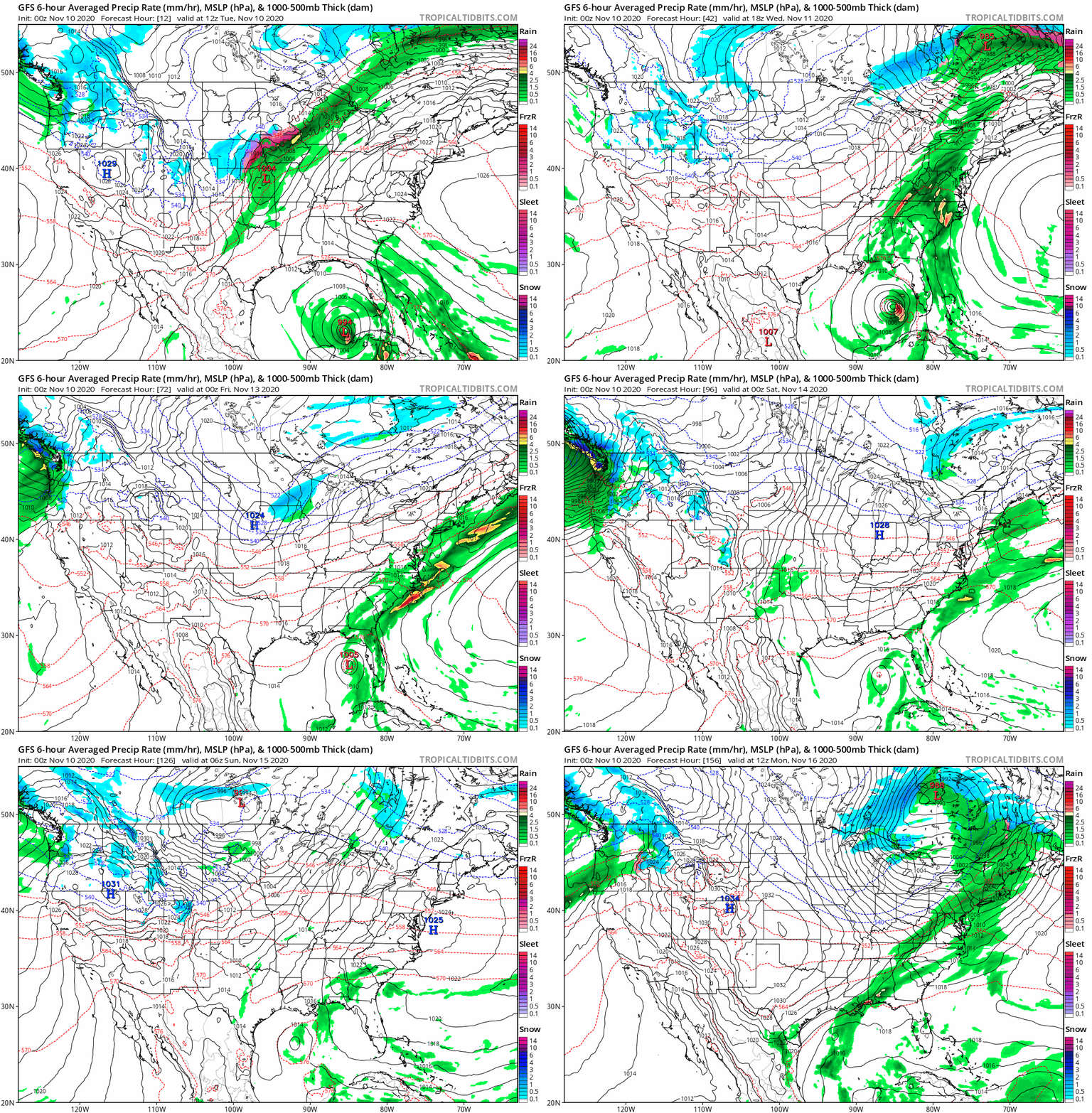
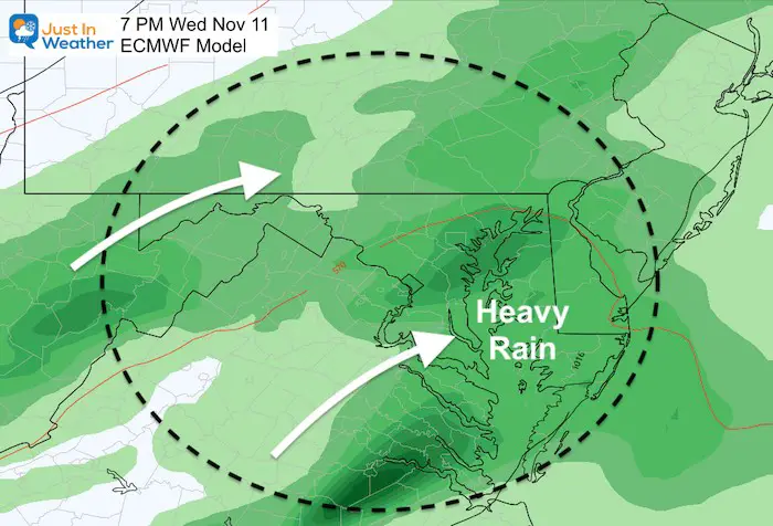
This shows a lot of moisture thrown well north into our region on Wednesday as it links up with a cold front. The timing is a little later in the day for the arrival. This also shows the center wondering in the Gulf of Mexico into next weekend, but feeding a second round of rain.
Wednesday Snapshot
Rainfall Forecast
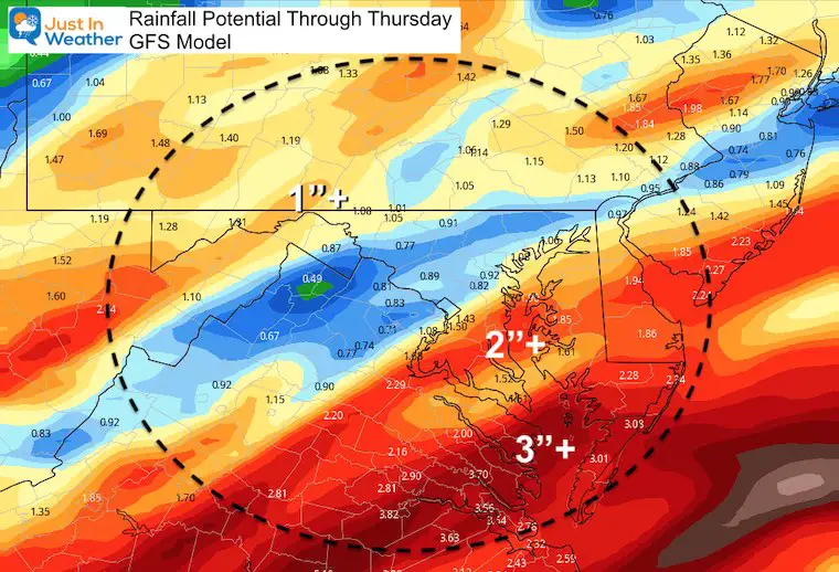
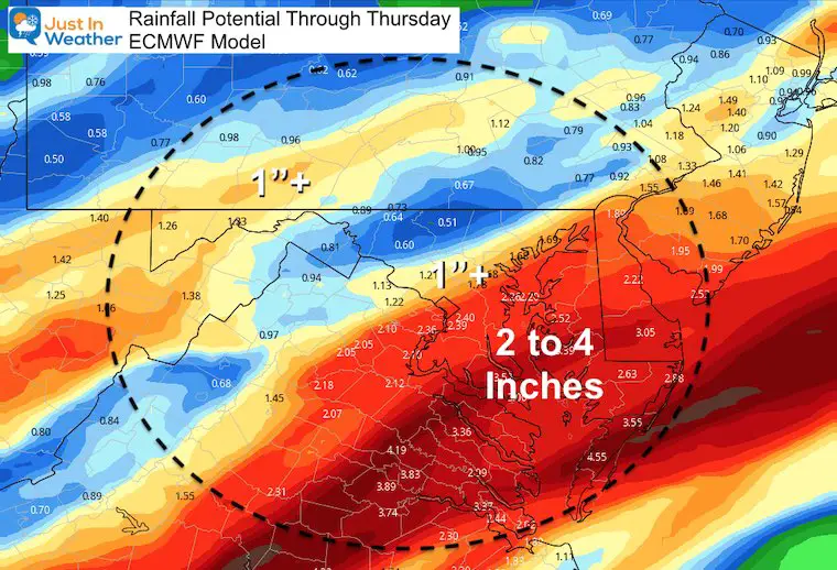
The flooding potential will be in areas that get into the 2 to 3+ inch range of rainfall.
GFS Model
The GFS Model has split the rainfall for the first wave midweek. This is based on the push of the center of Eta farther west of Key West.
ECMWF
The European Model has increased the overall rainfall for this first wave, and shifted the heaviest rain a little east.
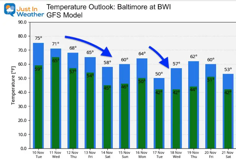
Temperature Forecast
Normal High = 59ºF
Baltimore at BWI record high: 75ºF in 1999
The recorded high has been warmer than the forecast. So I expect the same today.
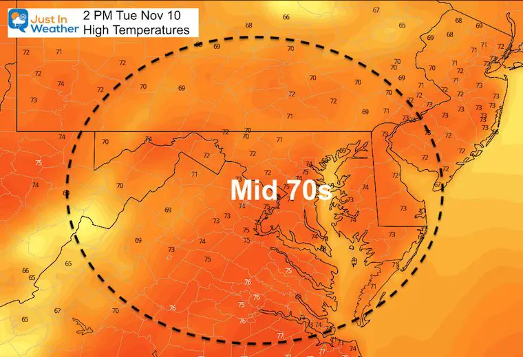
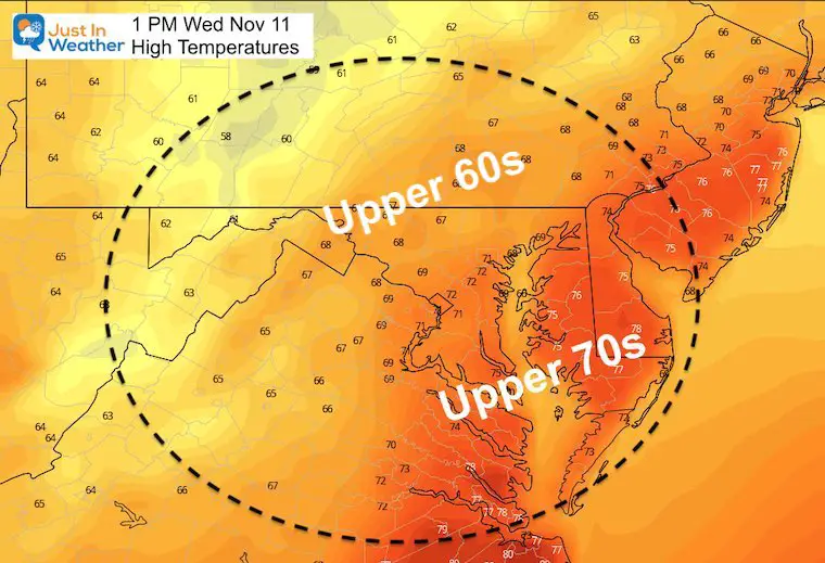
Wednesday
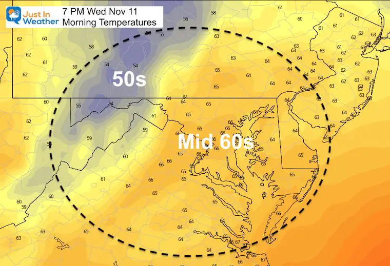
Baltimore at BWI record high: 75ºF in 1999
Temperature Outlook
14 Local Maryland Pages (and York PA)
We have made a page for Maryland Weather which gives you the current conditions for 14 present area locations.
Maryland Weather Page
I wanted to keep it simple. Just the basics for a quick view at any time.
Please share your thoughts, best weather pics/video, or just keep in touch via social media
-
Facebook: Justin Berk, Meteorologist
-
Twitter: @JustinWeather
-
Instagram: justinweather
Email Updates
Please make sure you sign up (above or click here to sign up for email alerts…. ) for my newsletter. This way you will get an email to make sure you are notified of each post.
Also See
Help Solve The Mystery
UFO, Meteor, Or Something Else Caught On Cam In Owings Mills MD This Week?
Explore More:
Autumnal Facts and Weather Stats
Record Low Tied at BWI and Frost Photos Sep 20
Typical First Frost and Freeze
Also See:
July 2020 The hottest on record. Will it hint at snow this winter?
Comet NEOWISE Viewing All July (photos/video)
Other Links:
Baltimore Weather At BWI May Not Be As Hot As Reported
Construction at the airport close to the weather station may be added artificial heat. Click here or the image for the details.
Just In Power Kids:
Proceeds go to our programs Providing FREE holistic care for kids in cancer treatment and up to 5 years post treatment and caregivers.


