November 10 2020
Over the last seven days, Baltimore has reached the 70s every day and set two record high temperatures. That included today with a high of 78ºF, nearly 20 degrees above normal. That is about to end with some heavy rain over the next two days.
The rain will arrive later Wednesday morning, then bring heavy bands and some potential thunder. It will be an abrupt change Wednesday and Thursday.
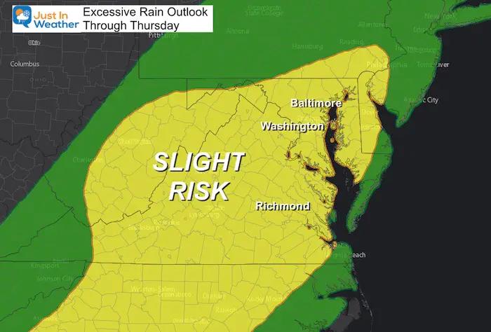
Excessive Rain Outlook
Our region has the potential for flooding. The Slight Risk here is for rainfall that could reach into the 2 to 4 inch range.
Below is a look at the rain timeline and three different computer model rainfall forecasts.
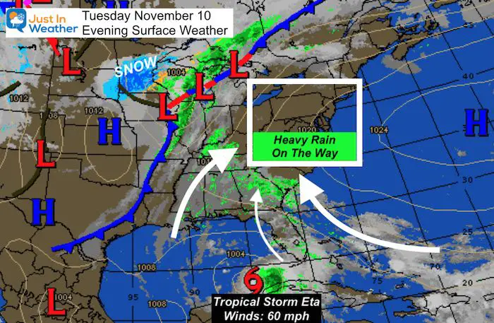
Tuesday Evening Weather Set Up
The combination of a cold front and moisture well ahead of Tropical Storm Eta will team up to send a lot of moisture our way.
Note: Tropical Storm Eta has 60 mph winds and is closer to Cuba than the US for now. It will drift north, but we are not getting the storm itself. For the purpose of this post, I am only showing our rain. I will update the storm details in my next report.
Rain Timeline(s)
Radar Simulation Wednesday —> slider
Radar Simulation Thursday —> slider
How Much Rain?
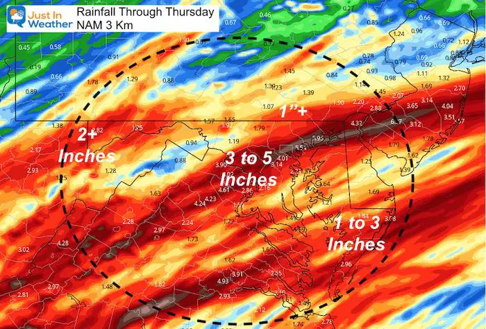
Let’s compare this NAM 3 Km Model to the GFS and ECWMF below.
NAM 3 Km
This shows the highest rain totals, and is often a little overblown. It is likely to be a little too high this time as well.
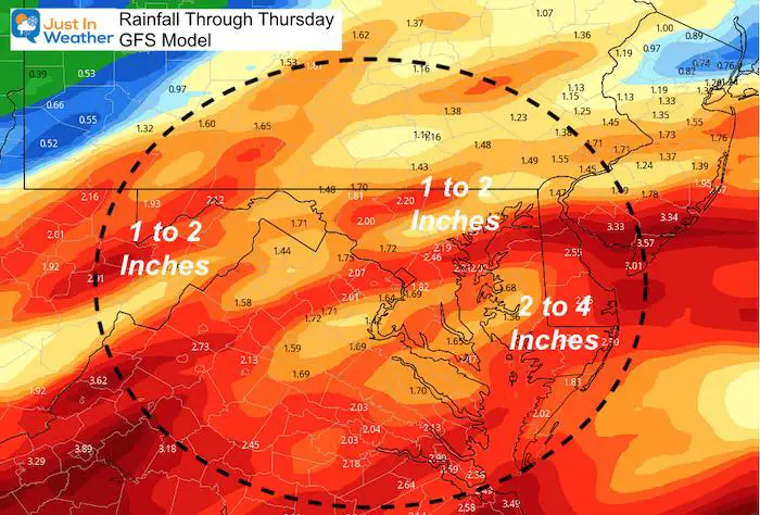
GFS Model
This seems a little more realistic. A general 1 to 2 inches of rain, with higher spots in central Maryland.
Higher amounts are likely in southern Maryland and on Delmarva.
European Model
This is the lowest of the three model outputs. This is similar in layout to the GFS, with the most rain across southern Maryland and Delmarva.
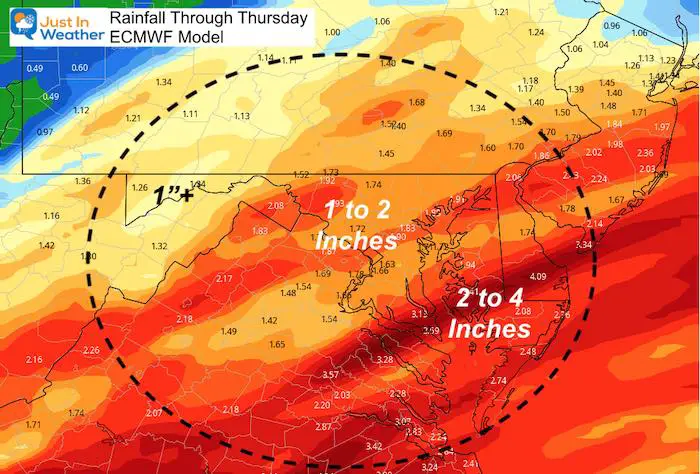
My Take Away:
The regional threshold for flooding would be in the 2 to 3 inch range. However, we could also have some downpours with storm drains clogged with leaves. So some isolated flooding is possible with less total rain, but quick bursts.
The entire event will be ending during Thursday. So there will be improvement to end the work week, but it will no be as warm.
Forecast Snapshot
Click the image for the local weather pages or see your town in the list below.
14 Local Maryland Pages (and York PA)
We have made a page for Maryland Weather which gives you the current conditions for 14 present area locations.
Maryland Weather Page
I wanted to keep it simple. Just the basics for a quick view at any time.
Please share your thoughts, best weather pics/video, or just keep in touch via social media
-
Facebook: Justin Berk, Meteorologist
-
Twitter: @JustinWeather
-
Instagram: justinweather
Email Updates
Please make sure you sign up (above or click here to sign up for email alerts…. ) for my newsletter. This way you will get an email to make sure you are notified of each post.
Also See
Help Solve The Mystery
UFO, Meteor, Or Something Else Caught On Cam In Owings Mills MD This Week?
Explore More:
Autumnal Facts and Weather Stats
Record Low Tied at BWI and Frost Photos Sep 20
Typical First Frost and Freeze
Also See:
July 2020 The hottest on record. Will it hint at snow this winter?
Comet NEOWISE Viewing All July (photos/video)
Other Links:
Baltimore Weather At BWI May Not Be As Hot As Reported
Construction at the airport close to the weather station may be added artificial heat. Click here or the image for the details.
Just In Power Kids:
Proceeds go to our programs Providing FREE holistic care for kids in cancer treatment and up to 5 years post treatment and caregivers.


