October 5 2020
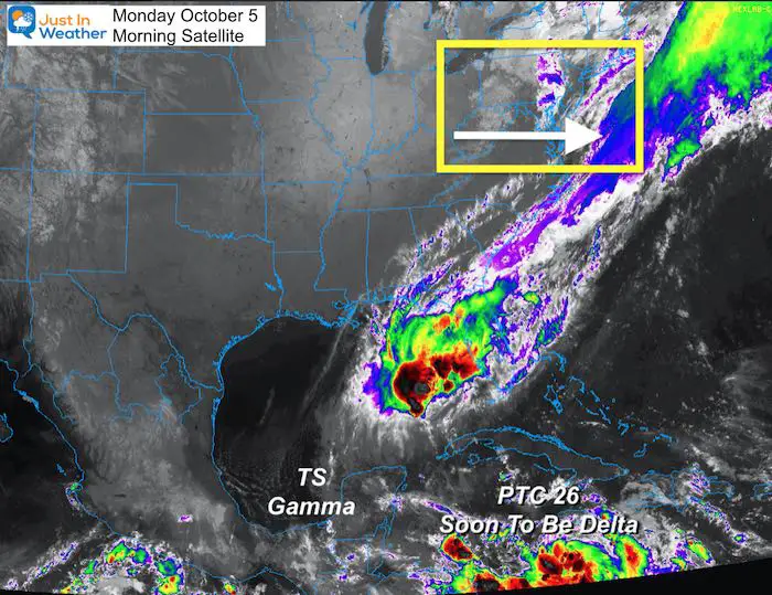
A band of rain this morning marks the latest frontal boundary moving through our area. The ground may be wet, but the sky will be clearing for most of us during the morning. I have a live radar widget below.
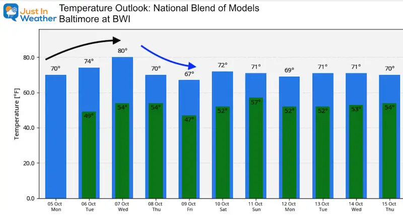
This week will show us a warming trend that gets the 80s back to metro areas mid week. Then we cool back down and have to watch the tropics. The National Hurricane Center has Tropical Storm Delta forming today and tracking towards New Orleans by Friday. The may then turn our way with rain over the weekend.
Morning Set Up: Satellite
Live Radar Widget
Pinch and slide to change the view.
Outlook Forecast:
High Temperature—> slider
The warmest day should be Wednesday
Tropical Weather
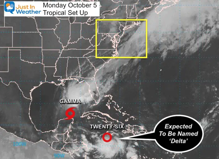
There are two systems of note this morning.
- Tropical Storm Gamma has winds of 50 mph, and just crossed the Yucatan Peninsula. Most of this rain is well to the north and feeding into the rain over Florida.
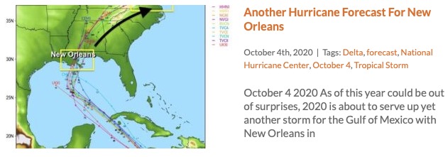
- Potential Tropical Cyclone Twenty-Six is in the Caribbean Sea and is expected to be named Tropical Storm Delta later today. This is forecast to reach New Orleans as a Hurricane on Friday.
Early Forecast Concerns:
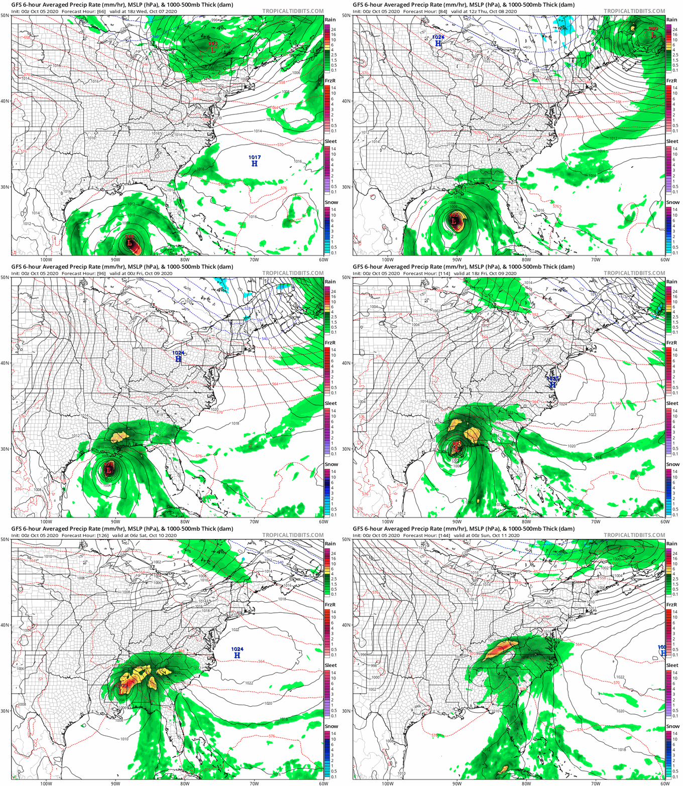
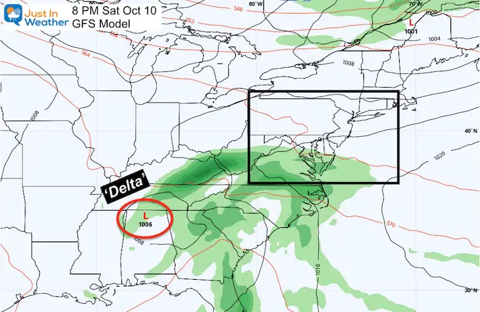
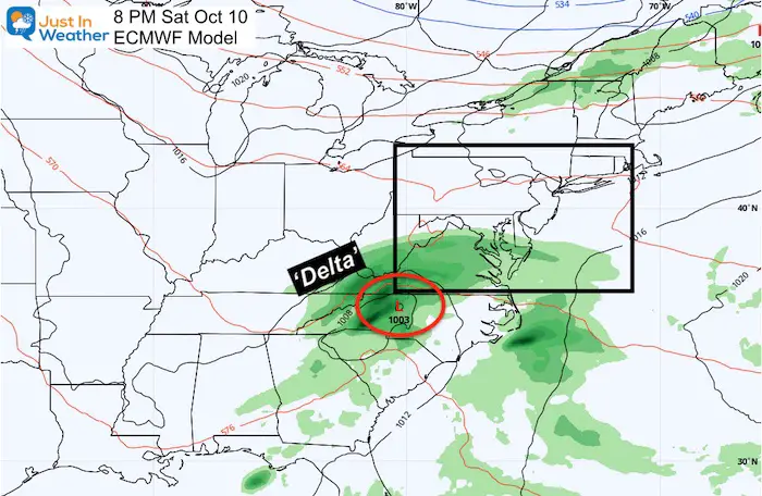
It is really early to lock this down since the storm has not been named yet. Plus we still have to first track landfall and intensity. But the preliminary outlook shows ‘Delta’ making landfall as a hurricane ‘near’ New Orleans, then curving into the Mid Atlantic next weekend:
Weekend Forecast Plots
The GFS Model (shown above) is the slower version tracking inland. But it is not the only option, as the European Model is more aggressive bringing in more rain and sooner. There is still uncertainty if and when rain will reach us.
Also See:
Also See
Sunflower Season: Millers Farm Photos And Info
Temperature Outlook
Much Cooler Pattern Next Week, Warmer Up During October
Help Solve The Mystery
UFO, Meteor, Or Something Else Caught On Cam In Owings Mills MD This Week?
Explore More:
Autumnal Facts and Weather Stats
Record Low Tied at BWI and Frost Photos Sep 20
Typical First Frost and Freeze
14 Local Maryland Pages (and York PA)
We have made a page for Maryland Weather which gives you the current conditions for 14 present area locations. Many of these match up with the spots on our route. Please use this list below are reference. I will include them daily with my articles on the kids.
Maryland Weather Page
I wanted to keep it simple. Just the basics for a quick view at any time.
Please share your thoughts, best weather pics/video, or just keep in touch via social media
-
Facebook: Justin Berk, Meteorologist
-
Twitter: @JustinWeather
-
Instagram: justinweather
Email Updates
Please make sure you sign up (above or click here to sign up for email alerts…. ) for my newsletter. This way you will get an email to make sure you are notified of each post.
Also See:
Severe Storm Report Photos And Video From Thursday
Maryland Trek Team Shirt
Also See:
July 2020 The hottest on record. Will it hint at snow this winter?
Comet NEOWISE Viewing All July (photos/video)
Maryland Strong Love ❤️
My ‘bonus’ daughter made this map of Maryland a few years ago. We brought it back for needed positivity. Now on her pick of tanks, and this cool Maryland T for men or women.
Click here or on the image to see more
This is all LOCAL: Made by Maryland Print House; Proceeds support my Maryland Trek 7 this August for Just In Power Kids.
Related Posts
2020 Tropical Storm and Hurricane Names and Naming History
Atlantic Tropical History: Maps of Origin Regions Every 10 Days
Other Links:
Was Your County Not Included?
Click this map for more on the regional forecast zones
Baltimore Weather At BWI May Not Be As Hot As Reported
Construction at the airport close to the weather station may be added artificial heat. Click here or the image for the details.
Just In Power Kids:
Proceeds go to our programs Providing FREE holistic care for kids in cancer treatment and up to 5 years post treatment and caregivers.

Shine On
Proceeds from all sales go to Just In Power Kids. Click the image to shop and show your support.

