Monday January 6 2020
We are in the pattern where the cool down bring us back to near normal conditions. That is the weather we expect this week, including a period of snow Tuesday afternoon. This snow will be a reminder that it is winter, but the impact on travel will be limited. Most of the region will have snow fall on warmer pavement and simply melt. But some inland areas could have stickage to deal with later in the day and early evening.
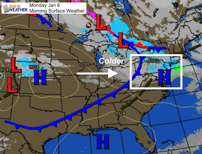
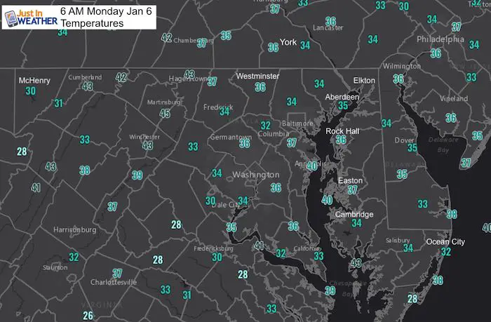
This morning: A cold front will send in gusty winds at times and set the state for the next system.
Monday January 6, 2020 in Baltimore
Average High: 41ºF
Record High: 72ºF in 1950
Average Low: 25ºF
Record Low: 5ºF in 1904
*Record Snow 3.4″ in 1989
Sunrise: 7:26 AM
Sunset 4:8 PM
*Daylight = 0:56 longer than yesterday
*Bay Water Temperature = 43ºF at Thomas Pt. Light House
*We have almost caught back to balance out the excessive warmth*
Get Forecasts By Email
Just in case you don’t get all posts on your social media feed, stay up to date with the latest info…
Click here to sign up for email alerts…. Be the first to hear any new weather
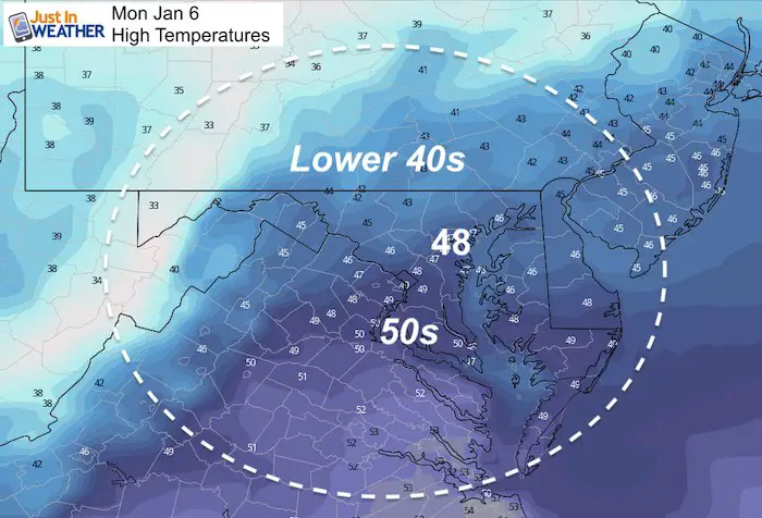
This Afternoon:
Tuesday
Morning
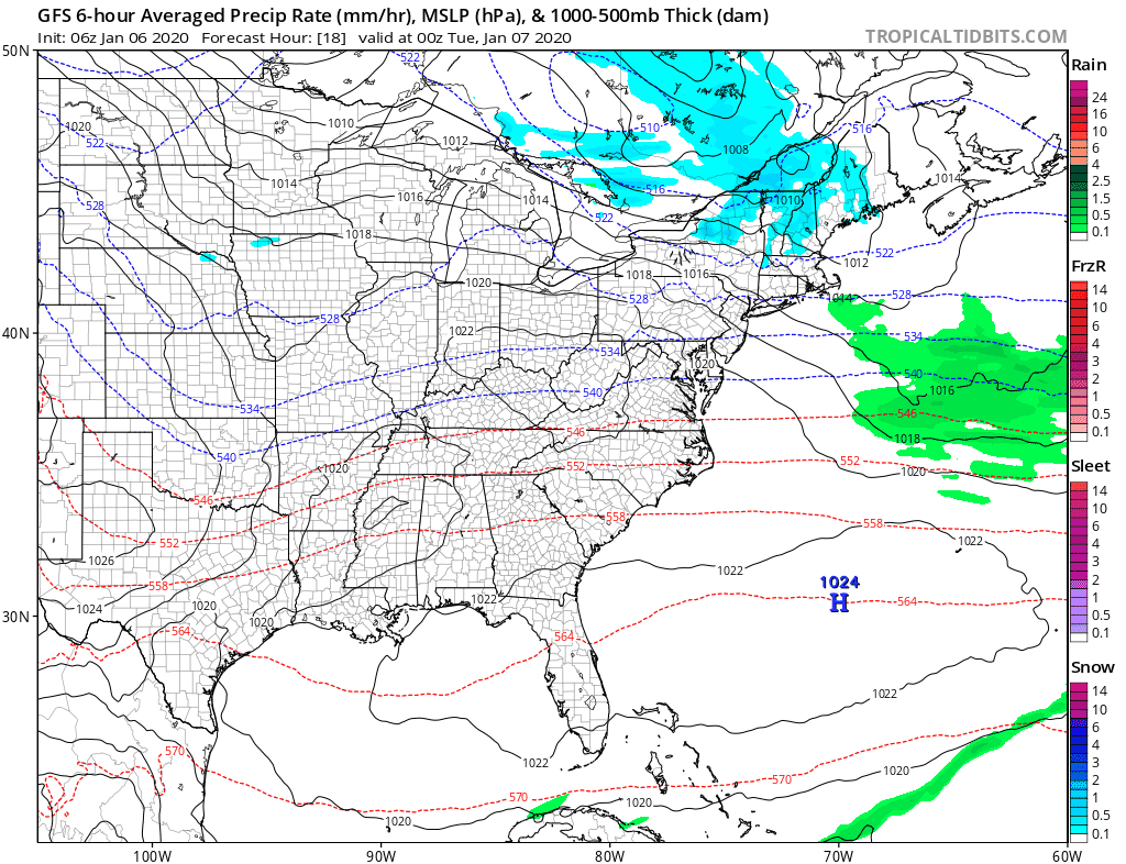
Snow Timeline 1 PM to 7 PM
Compare the GFS Model and European ECWMF Model
I will have a closer map with potential accumulation in my next update. Where the snow sticks, the coldest areas could get a dusting to 2 inches.
GFS Model —> slider


ECMWF Model —> slider
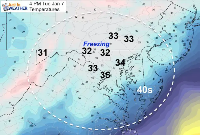
Afternoon Temperatures
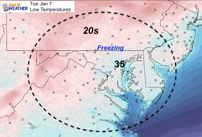
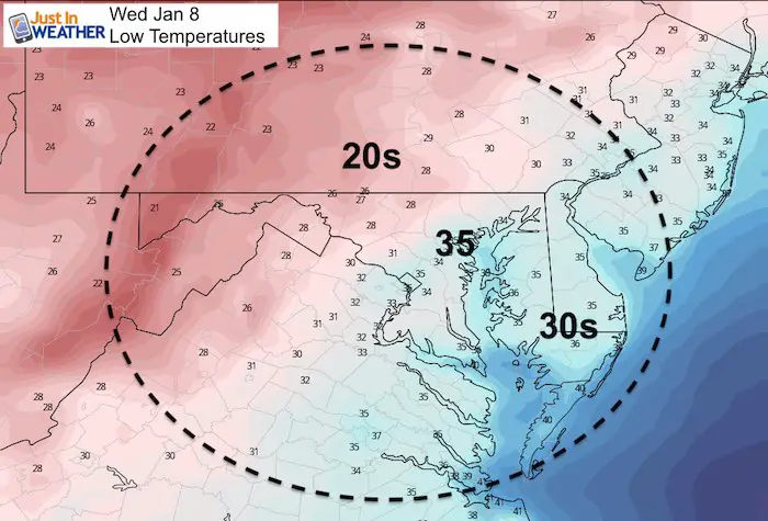
Wednesday Morning
There will be some risk of the melted snow on pavement to freeze overnight west and north of Baltimore.
Looking Ahead:
After the little snow event, the next weather feature will be a larger storm spread over the weekend.
I must state again that I do NOT trust modeling beyond days. The snow event tomorrow is one I suggested last week when models had us staying all rain. I am not suggesting this will be snow for us, but the track and timing could bring the heavy rain closer, sooner.
This product animation ends Saturday evening with the heaviest rain to our west. The impact on the Ravens game Saturday night is still subject to be more wet than shown here.
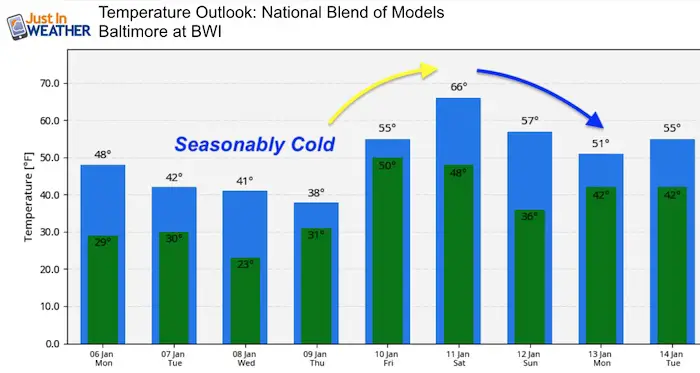
Temperature Outlook
It does look like we will have to wait until the last two weeks of the month for any signal of winter returning.
Please share your thoughts, best weather pics/video, or just keep in touch via social media
-
Facebook: Justin Berk, Meteorologist
-
Twitter: @JustinWeather
-
Instagram: justinweather

WEATHER WIFE COLLECTION
- Thanks to Shannon (weather wife) for hand picking items ‘she’ wants to wear
- The Yoga Pants have side leg pocket for your phone
- The Hoodie is extra soft and has the important ‘thumb holes’


Part 1: More Snow This Winter Supported By Stats

Part 2: Solar Minimum- Low Sunspots May Mean High Snow Totals This Winter

Part 3: Tropical Systems In East Asia and Atlantic Basin Hint At Winter Storm Tracks


Snowy Winters Following A Hot and Dry September

NOAA Winter Outlook Leaves Room For More Snow With Mild ‘Seasonal Average’ Temperatures


Baltimore Weather At BWI May Not Be As Hot As Reported
Construction at the airport close to the weather station may be added artificial heat. Click here or the image for the details.

Atmospheric Memory Shaped The US East Coast
Atmospheric Memory Of Hurricanes Over Thousands Of Years Shaped The Coast

Was Your County Not Included?
Click this map for more on the regional forecast zones

Maryland Trek Cycle Jerseys From Hill Killer
All proceeds will go to the Maryland Trek 6 total and Just In Power Kids programs

Thank you to our Title Sponsor for Maryland Trek 6
Shining on with Smyth and their contribution, our team has raised over $95,000 for Just In Power Kids to provide free programs for kids in and post cancer treatment.

Just In Power Kids:
Proceeds go to our programs Providing FREE holistic care for kids in cancer treatment and up to 5 years post treatment and caregivers.
![]()
Shine On
Proceeds from all sales go to Just In Power Kids. Click the image to shop and show your support.
