Monday Evening Update: December 16 2019
The Winter Weather Advisory has been expanded back into part so of central Maryland. If you read my prior report, this fit with the same area I suggested could get icing in northern Harford, Baltimore, and Carroll Counties.
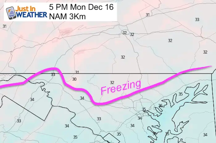
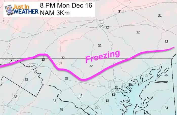
The irony is that where there was less snow farther north this morning, will be the more likely areas to get icy this evening. Below are updated conditions as of 5 PM.
The added counties of northern Harford, Baltimore, Carroll- through midnight. Ice mainly on sidewalks and elevated surfaces. Total accumulation up to 0.10 inch ice.
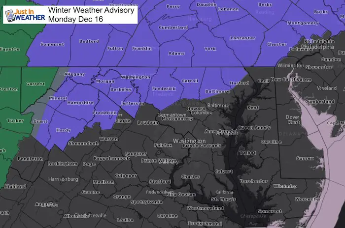
Temperatures at 5 PM
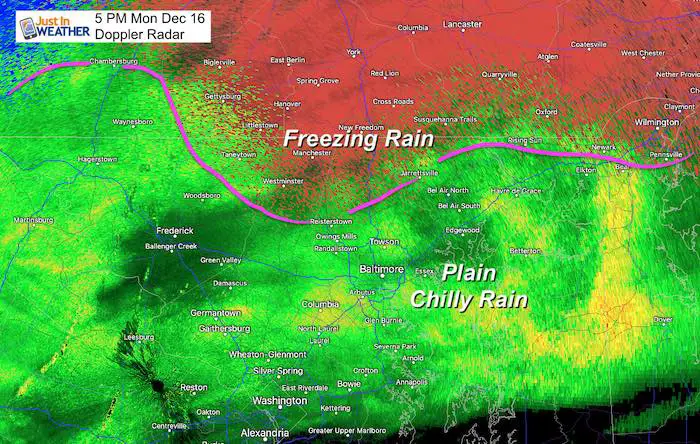
Here is the latest look at temperatures and the radar simulation. Freezing rain is fickle and can lead to icing in patchy areas between some regional weather stations that might show slightly warmer temps.
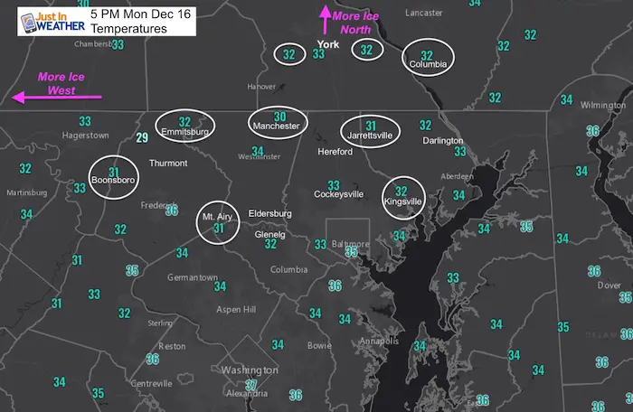
- These reports are form the regional weather stations.
- It is possible have colder pockets in between as just one or two degrees can make the difference for ice.
Doppler Radar (Winter Mode) at 5 PM
Winds are from the colder Northeast which will hold the cold through the evening.
Signs To Look For Develop Ice
- Touch the door on your car, or a car that has been parked for a few hours. The metal will freeze first. Then check the windows. If these feel like droplets are freezing, then next could be the pavement.
- Check metal rails or your mailbox for icing.
- Car Thermometers are not totally accurate, but when it is wet outside it displays more realistic numbers. You should be driving for a few minutes to make sure the heat from your engine is not falsely warming the display number.
- Caution: When ice is ‘patchy’ the places that are more likely to freeze are
In the shade:
- North side of hills or buildings
- Elevated surfaces like ramps or bridges
- Concrete sidewalks before dark road pavement
Radar Simulation —> slider
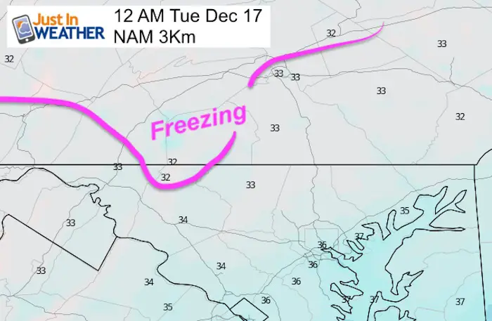
Temperatures: The Slow Thaw
Tuesday Morning
Most of the region should be above freezing with just a chilly rain. More info to follow. Keep checking back for updates.
Get Forecasts By Email
Just in case you don’t get all posts on your social media feed, stay up to date with the latest info…
Click here to sign up for email alerts…. Be the first to hear any new weather
Please share your thoughts, best weather pics/video, or just keep in touch via social media
-
Facebook: Justin Berk, Meteorologist
-
Twitter: @JustinWeather
-
Instagram: justinweather
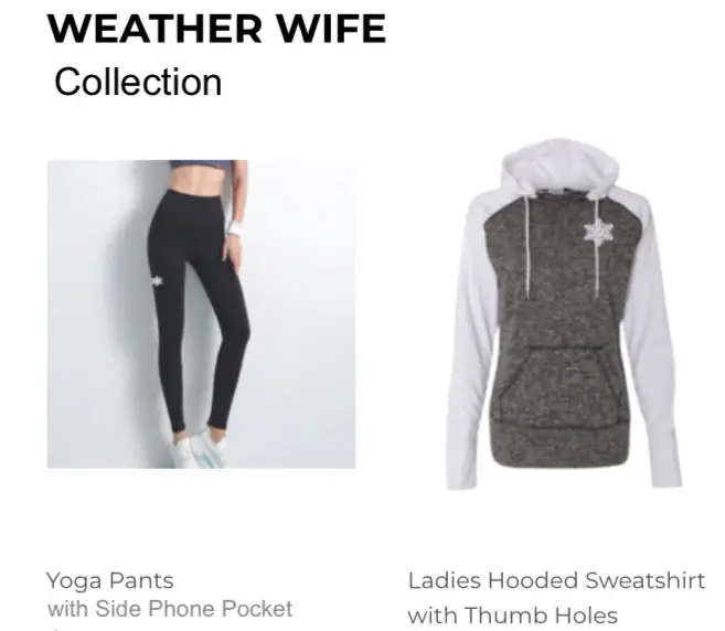
WEATHER WIFE COLLECTION
- Thanks to Shannon (weather wife) for hand picking items ‘she’ wants to wear
- The Yoga Pants have side leg pocket for your phone
- The Hoodie is extra soft and has the important ‘thumb holes’
Part 1: More Snow This Winter Supported By Stats
Part 2: Solar Minimum- Low Sunspots May Mean High Snow Totals This Winter
Part 3: Tropical Systems In East Asia and Atlantic Basin Hint At Winter Storm Tracks
Snowy Winters Following A Hot and Dry September
NOAA Winter Outlook Leaves Room For More Snow With Mild ‘Seasonal Average’ Temperatures
Baltimore Weather At BWI May Not Be As Hot As Reported
Construction at the airport close to the weather station may be added artificial heat. Click here or the image for the details.
Atmospheric Memory Shaped The US East Coast
Atmospheric Memory Of Hurricanes Over Thousands Of Years Shaped The Coast
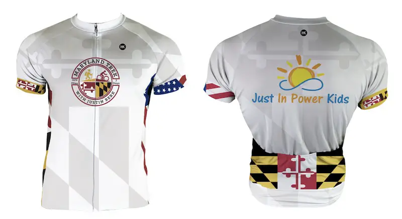
Maryland Trek Cycle Jerseys From Hill Killer
All proceeds will go to the Maryland Trek 6 total and Just In Power Kids programs
Thank you to our Title Sponsor for Maryland Trek 6
Shining on with Smyth and their contribution, our team has raised over $95,000 for Just In Power Kids to provide free programs for kids in and post cancer treatment.
Just In Power Kids:
Proceeds go to our programs Providing FREE holistic care for kids in cancer treatment and up to 5 years post treatment and caregivers.

Shine On
Proceeds from all sales go to Just In Power Kids. Click the image to shop and show your support.


