Thursday December 12 2019
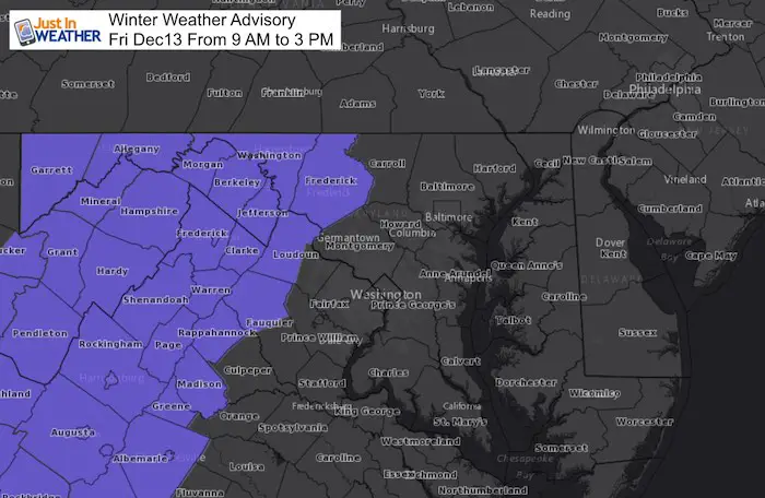
A Winter Weather Advisory has been issued for Friday morning in the mountains for some light icing. Technically this begins earlier farther south, but I have listed the 9 AM to 3 PM time for Maryland’s Frederick County and westward. According to NWS this should not be an issue for central Maryland. But at least one model does not agree…
How Much Ice?
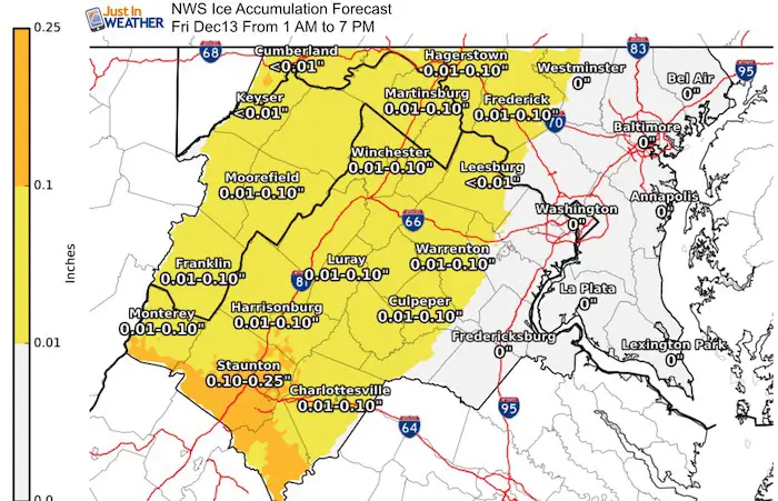
A light glaze under one tenth of an inch. The problem is that since roads will be cold enough, even a drizzle can lead to enough for impact in this area.
NAM 3 Km Model
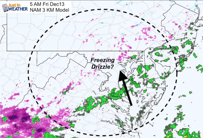
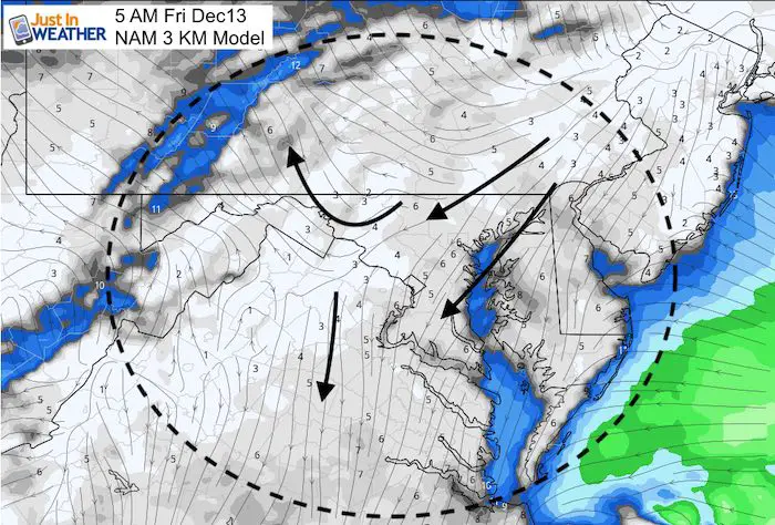
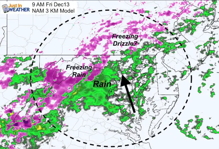
The NAM 3 Km is the most aggressive model that brings in some freezing drizzle as early as 5 AM. Normally that would not worth mentioning, but the timing is worth watching. I will NOT sound any alarms. Just to pay attention. If there is drizzle early in the morning, then it could lead to a light glaze.
5 AM NAM 3 Km Forecast
Radar Simulation
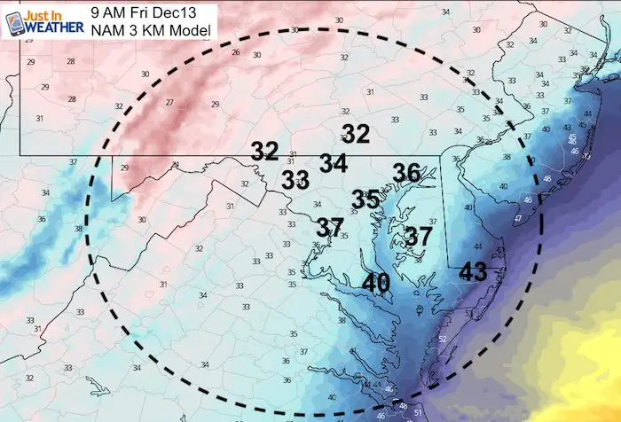
Temperatures
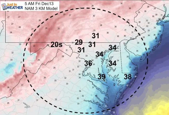
Baltimore and areas within 15 miles of the Bay should remain above freezing. It is farther inland where the freezing line is likely at this time. West and north of the City in northern Baltimore, Carroll, western Howard Counties and westward.
Surface Winds
The winds at ground level will be from the northeast. That can hold the cold longer, while the winds at cloud level will bring in the rain from the southeast.
9 AM Conditions
This most aggressive model does bring in the moisture early, but warms metro areas ups to Frederick city. It is up in the mountains and westward where the cold air is expected to allow for icing.
Temperatures
Notice Frederick at 33ºF but up past Boonsboro, Thurmont, and Hagerstown it will be around 32ºF with icing.
Noon Temperatures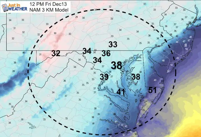
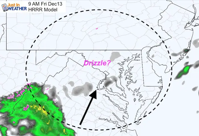
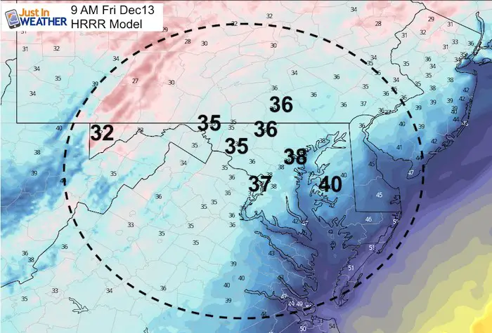
HRRR Model
This is slower with the moisture and warmer. So there is no clear agreement. According to this model, temps will be above freezing in the morning long before the rain arrives.
Storms Animation
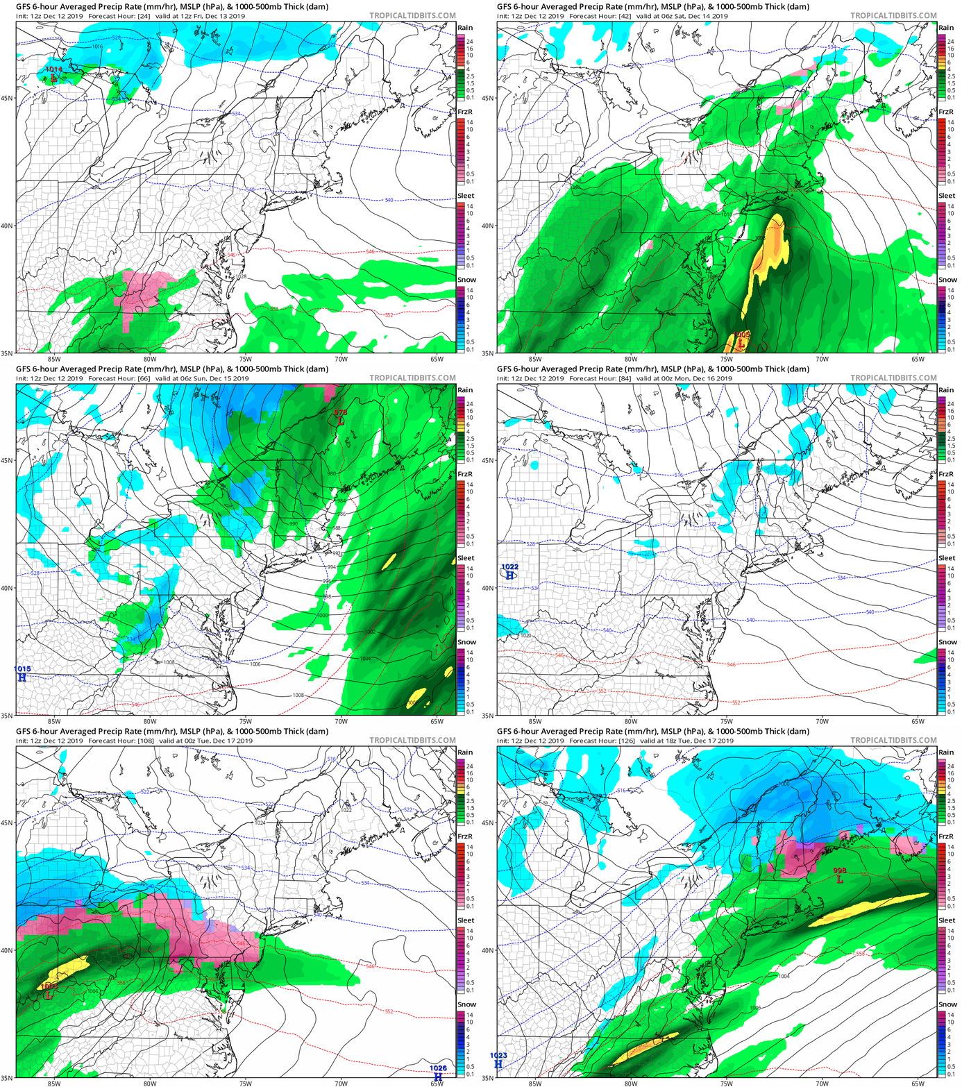
There will be two events. The main fiord for this round 1 will be the heavy rain Friday night into most of Saturday. It will be soggy bringing up to 1 inch of rain.
Round 2 will bring in the chance for snow and ice Monday morning, before the next round of rain
WEATHER WIFE COLLECTION
- Thanks to Shannon (weather wife) for hand picking items ‘she’ wants to wear
- The Yoga Pants have side leg pocket for your phone
- The Hoodie is extra soft and has the important ‘thumb holes’
Please share your thoughts, best weather pics/video, or just keep in touch via social media
-
Facebook: Justin Berk, Meteorologist
-
Twitter: @JustinWeather
-
Instagram: justinweather
Winter Outlook Series:
My Call For Snowfall Winter 2019-2020
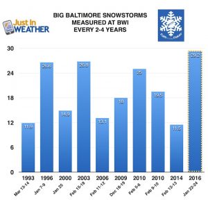
Part 1: More Snow This Winter Supported By Stats
Part 2: Solar Minimum- Low Sunspots May Mean High Snow Totals This Winter
Part 3: Tropical Systems In East Asia and Atlantic Basin Hint At Winter Storm Tracks
Snowy Winters Following A Hot and Dry September
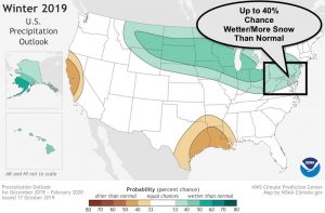
NOAA Winter Outlook Leaves Room For More Snow With Mild ‘Seasonal Average’ Temperatures
Baltimore Weather At BWI May Not Be As Hot As Reported
Construction at the airport close to the weather station may be added artificial heat. Click here or the image for the details.
Atmospheric Memory Shaped The US East Coast
Atmospheric Memory Of Hurricanes Over Thousands Of Years Shaped The Coast
Maryland Trek Cycle Jerseys From Hill Killer
All proceeds will go to the Maryland Trek 6 total and Just In Power Kids programs
Thank you to our Title Sponsor for Maryland Trek 6
Shining on with Smyth and their contribution, our team has raised over $95,000 for Just In Power Kids to provide free programs for kids in and post cancer treatment.
Just In Power Kids:
Proceeds go to our programs Providing FREE holistic care for kids in cancer treatment and up to 5 years post treatment and caregivers.

Shine On
Proceeds from all sales go to Just In Power Kids. Click the image to shop and show your support.

