Monday September 23 2019
Summer heat can hang on, or fall can race in. Earlier this morning, the Autumnal or Fall Equinox occurred. That means the sun’s direct rays are now south of the equator and our time in daylight will grow shorter than dark hours at night. Eventually we will get cooler air as a result, but not today. Well, at least for the start it feels like summer and urban areas will hit the 90s again. It will not be a record, however it might feel like it. Some relief will come with a cold front will pass through mid to late afternoon. If you are lucky, you might get a brief rain shower. It will not be enough to ease the growing drought conditions, but you will notice a difference in the weather tomorrow.

Extreme weather is common in stretches this time of year. We can get locked in a pattern for a few days that can be late summer heat or early fall chill. A heat wave in 1970 and a chilly stretch in 1983 stand out.
Record Heat Wave Stretch 1970
- 23rd: 98°F
- 24th: 95°F *Tied in 2010
- 25th: 97°F
- 26th: 95°F
Record Chilly Stretch 1983
- 23rd 40ºF
- 24th 39ºF
Morning Temperatures
Dress for the heat! It’s already warm.

Local Weather Stats:
Monday September 23, 2019 in Baltimore
Average High: 75ºF
Record High: 98ºF in 1970
Average Low: 55ºF
Record Low: 40ºF in 1983
Sunrise: 6:54 AM
Sunset 7:02 PM
*Daylight = 2:33 shorter than yesterday
*Bay Water Temperature = 75ºF at Thomas Pt. Light House
Keep In Touch Every Day
Just in case you don’t get all posts on your social media feed, stay up to date with the latest info…
Click here to sign up for email alerts…. Be the first to hear any new weather
Thank you to our Title Sponsor for Maryland Trek 6
Shining on with Smyth and their contribution, our team has raised over $95,000 for Just In Power Kids to provide free programs for kids in and post cancer treatment.

Forecast
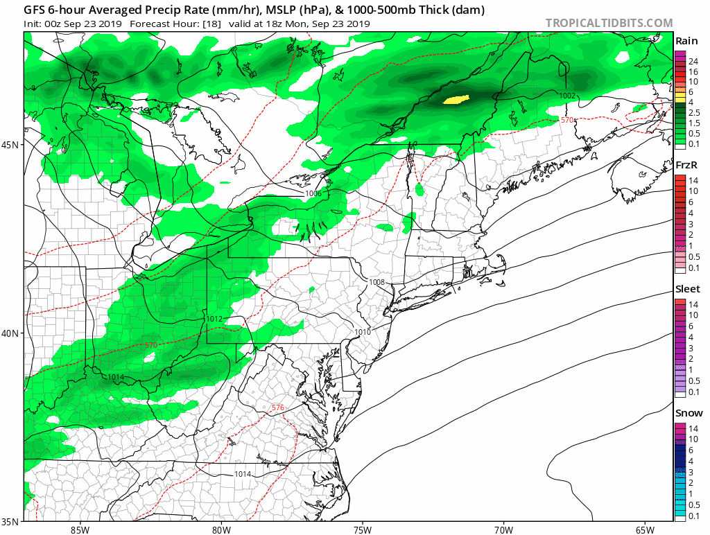
A cold front will arrive mid to late afternoon. We will see it more evident on the temperature map. Rain will be scattered along the front.
3 PM Temperatures Today

Rain Animation —> slider
Showers will break up east of the mountains, but there is a chance for brief rain. We will start to watch this between 3 PM and 6 PM to enter metro Baltimore. Then another round after sunset until midnight.
[metaslider id=80086]
Low Temperatures Tuesday

High Temperatures Tuesday

Lack of Rain- Animation
After today’s cold front, the next hope for some showers will be next weekend. At this point, we can only hope for showers, but not the organized rain event we will need to ease the growing drought conditions.
Temperature Outlook

Also See:

Please share your thoughts, best weather pics/video, or just keep in touch via social media
-
Facebook: Justin Berk, Meteorologist
-
Twitter: @JustinWeather
-
Instagram: justinweather
Maryland Trek Cycle Jerseys From Hill Killer
All proceeds will go to the Maryland Trek 6 total and Just In Power Kids programs

Just In Power Kids:
Proceeds go to our programs Providing FREE holistic care for kids in cancer treatment and up to 5 years post treatment and caregivers.
![]()
Shine On
Proceeds from all sales go to Just In Power Kids. Click the image to shop and show your support.

Love Maryland Shirts and Hoodies
This shirt was designed by my ‘bonus’ daughter Jaiden. The hoodie has been the biggest hit, so our promotion has been extended until the end of this week.
|
||
|
Show your love for Maryland and make this 14 year old artist and her mom extra proud
|


Related Links:
Baltimore Weather At BWI May Not Be As Hot As Reported
Construction at the airport close to the weather station may be added artificial heat. Click the image for the details.

Was Your County Not Included?
Click this map for more on the regional forecast zones

Also see: Atmospheric Memory Of Hurricanes Over Thousands Of Years Shaped The Coast