Thursday September 12 2019
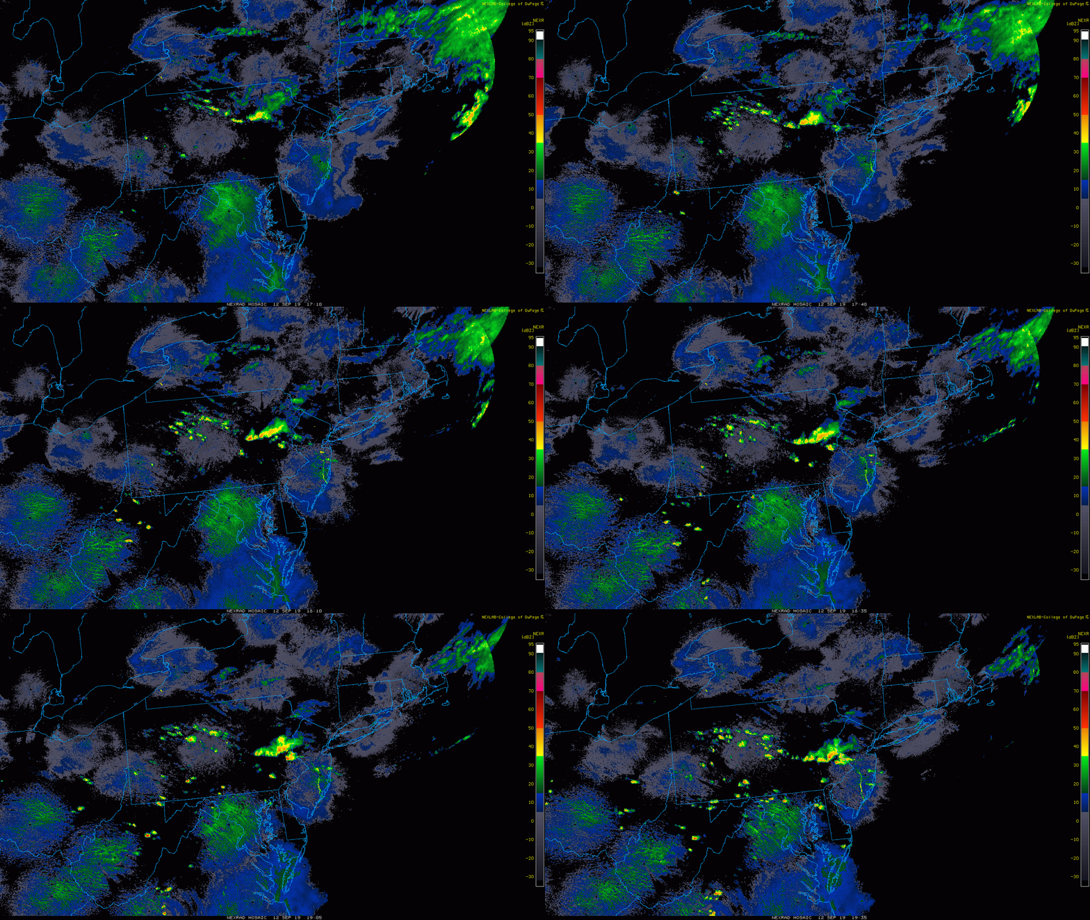
The heat jumped thermometers into the mid 90s in central Maryland this afternoon. The record for Baltimore of 96ºF was set back in 1931and just tied at BWI. This station has been running hot for a few months, but we have to go with it. Now it’s time for the heat to leave, and the colder air from the north will be bringing in some storms this evening. This time Friday most of the region will be in the mid 60s to barely 70ºF.
Record High At BWI
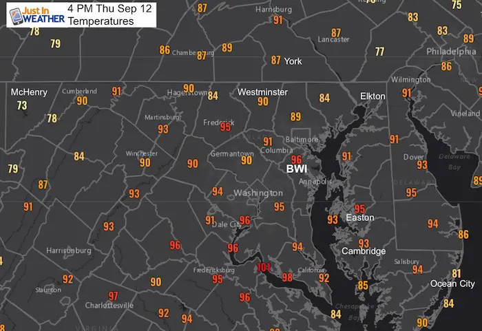
The cold front on the way will be bringing the showers and storms from north to south
Radar Loop
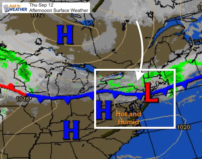
The main line in PA is where most of the evening activity for us will be coming from. But there have been some showers popping in Maryland in the last hour. These are all moving to the south-southeast.
Doppler Radar
The added complication today is an error with the Doppler Radar in Sterling, VA. There has been extra clutter or debris clogging the field at lower levels. So sorting through into the real storm cells is like Finding Waldo at times.
There has been some action north of Frederick and in Southern Carroll County near Eldersburg. These cells are dropping south. Frederick City and Howard County will be in on that action in the next hour.
Radar Simulation–> slider
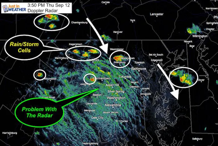
The Maryland activity on radar at 4 PM was not showing up on the model. Please use this just a potential showing the bulk of the action near the Bay from PA, but inland activity growing west of the Bay this evening. The main focus here is the the movement rather than the clustering. If you watch your local radar, look to your north and Northwest for what is heading hour way.
[metaslider id=79905]
Keep In Touch Every Day
Just in case you don’t get all posts on your social media feed, stay up to date with the latest info…
Click here to sign up for email alerts…. Be the first to hear any new weather
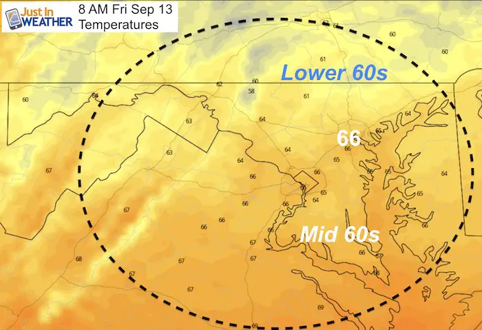
Temperature Change Friday
You may or may not fully notice the change in the morning. Temperatures will be down into the 60s, but during that morning that is still somewhat mild for mid September.
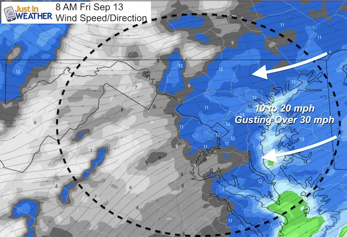
Winds
The wind will be picking up from the east and northeast. The steady wind will be 10 to 20 mph, but growing gusts over 30 mph.
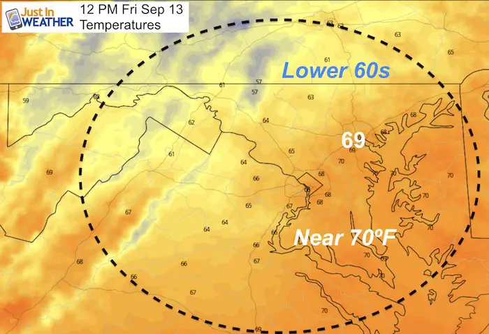
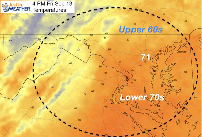
That is a cool flow from the Atlantic that will hold temps in place AND likely add to cloud cover. Some showers will linger during the day as well.
Midday and Afternoon high temperatures will not move much
Please share your thoughts, best weather pics/video, or just keep in touch via social media
-
Facebook: Justin Berk, Meteorologist
-
Twitter: @JustinWeather
-
Instagram: justinweather
Thank you to our Title Sponsor for Maryland Trek 6
Shining on with Smyth and their contribution, our team has raised over $95,000 for Just In Power Kids to provide free programs for kids in and post cancer treatment.
Maryland Trek Cycle Jerseys From Hill Killer
All proceeds will go to the Maryland Trek 6 total and Just In Power Kids programs
Just In Power Kids:
Proceeds go to our programs Providing FREE holistic care for kids in cancer treatment and up to 5 years post treatment and caregivers.

Shine On
Proceeds from all sales go to Just In Power Kids. Click the image to shop and show your support.
Love Maryland Shirts and Hoodies
This shirt was designed by my ‘bonus’ daughter Jaiden. The hoodie has been the biggest hit, so our promotion has been extended until the end of this week.
|
||
|
Show your love for Maryland and make this 14 year old artist and her mom extra proud
|
Related Links:

