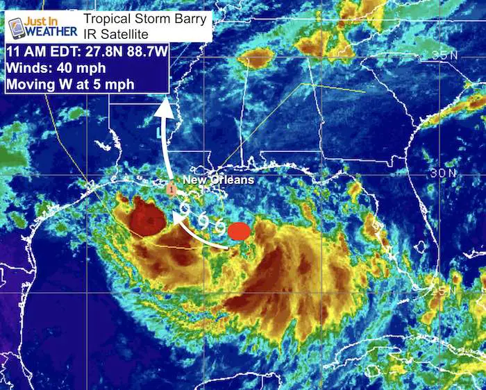
Thursday July 11 2019
Tropical Storm Barry has officially been named in the Gulf of Mexico. This is the second named storm of the season for the Atlantic basin but the first with potentially big impact on land. Louisiana appears to be the main target. After 10 inches of rain fell in New Orleans yesterday as a preview, a State of Emergency has been issued for Louisiana. Tropical Storm and Storm Surge Warnings have been issued. Hurricane Watch is also in place for expected strengthening before landfall on Saturday.
As of 11 AM, winds were only 40 mph and it still looked disorganized. But hurricane hunters have found a modest circulation at the surface.
Tropical Storm Barry Stats
Tropical Storm Barry Visible Satellite Loop
Flooding Potential
The slow movement and rapid development is why heavy rainfall is expected. The storm surge flooding is more pronounce because the city of New Orleans and much of southern LA is actually below sea level. So any additional rain or sloshing of water has a bigger impact here. The Flooding impact is highest for this region.
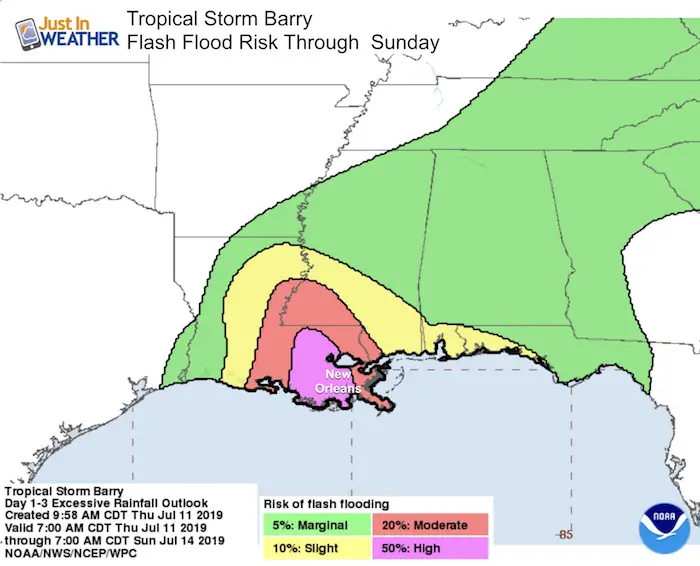
How Much Rain?
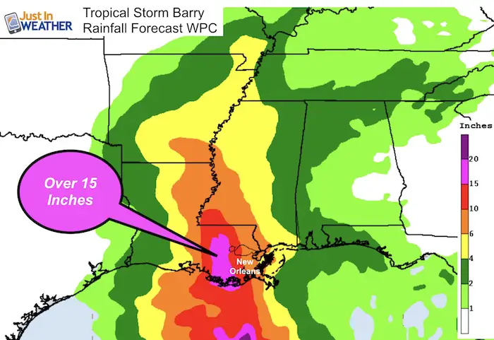
The National Hurricane Center WPC forecast shows New Orleans up to 10 inches of rain for New Orleans. But over 15 inches just west.
European Model Forecast
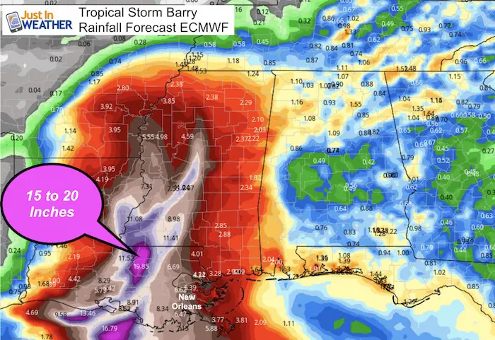
This shows New Orleans with between 6 and 7 inches of rain, but up to 20 inches just west.
Forecast Intensity
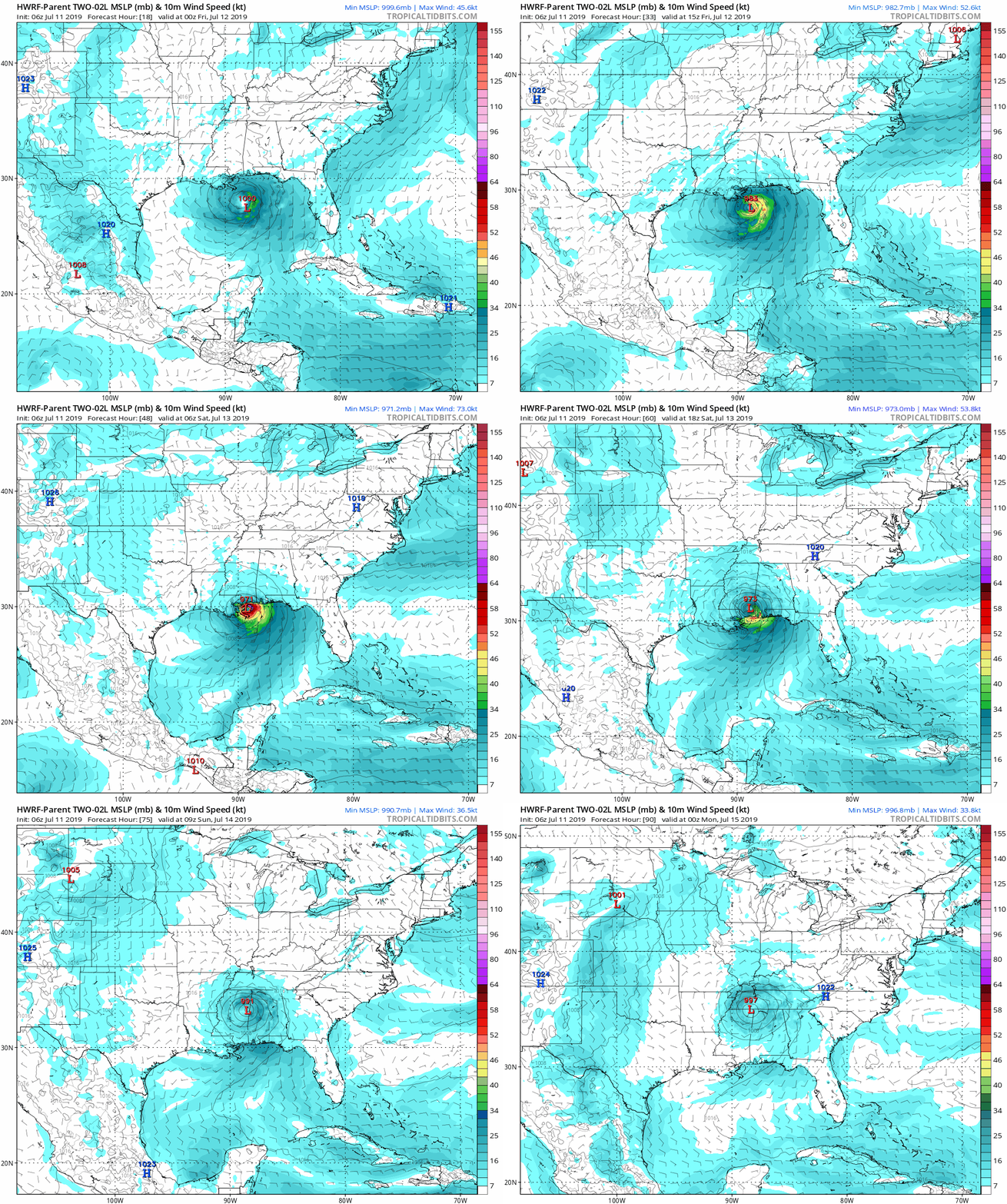
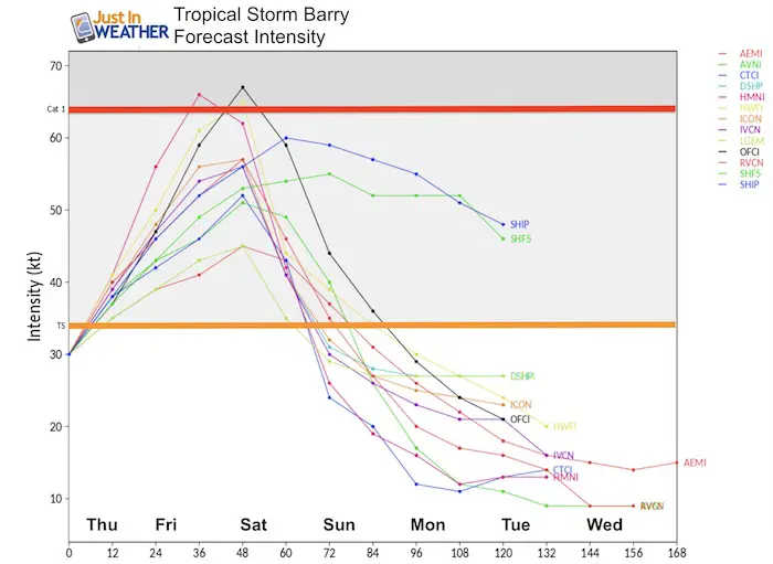
The majority of computer models still show this holding at tropical storm intensity. But NHC and the HWRF show the higher end of development to Category 1 status when landfall is expected Saturday morning.
Forecast Tracks
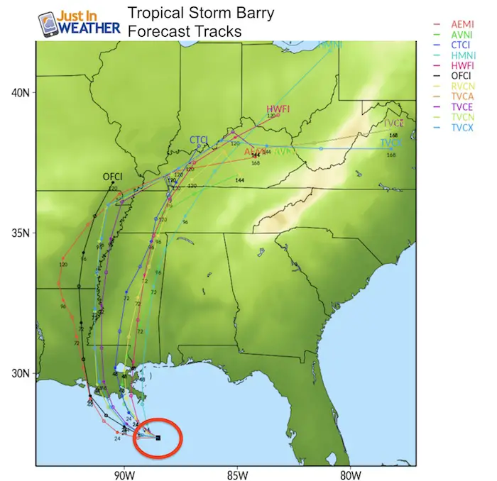
Consensus still locks in within 50 to 100 miles of New Orleans.
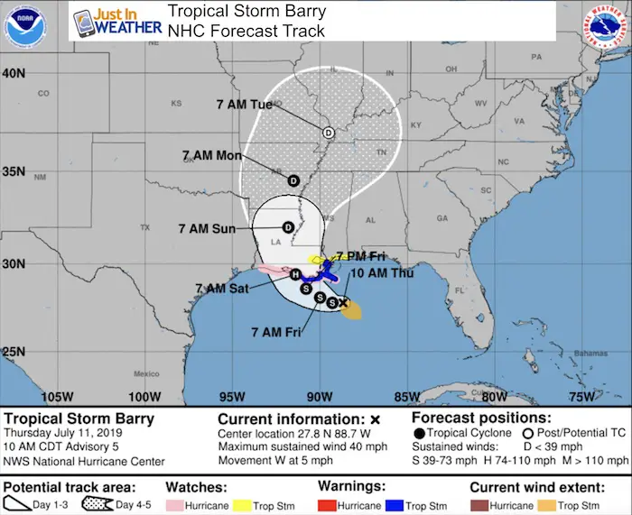
NHC Track and Warnings
The National Hurricane Center shows landfall as a Cat 1 hurricane Saturday morning. Then quick weakening to a depressing inland. As it pulls north, it should speed up. Current Tropical Storm Warnings on the map in blue. See the full list below.
SUMMARY OF WATCHES AND WARNINGS IN EFFECT...

A Tropical Storm Warning is in effect for...
* Mouth of the Pearl River to Morgan City

A Storm Surge Warning is in effect for...
* Mouth of the Atchafalaya River to Shell Beach

A Storm Surge Watch is in effect for...
* Shell Beach to the Mississippi/Alabama border
* Mouth of the Atchafalaya River to Intracoastal City

A Hurricane Watch is in effect for...
* Mouth of the Mississippi River to Cameron

A Tropical Storm Watch is in effect for...
* East of the Mouth of the Pearl River to the Mississippi/Alabama
border
* Lake Pontchartrain and Lake Maurepas including metropolitan New
Orleans

A Tropical Storm Warning means that tropical storm conditions are
expected somewhere within the warning area within 36 hours.
Animation Forecast
Please share your thoughts, best weather pics/video, or just keep in touch via social media
-
Facebook: Justin Berk, Meteorologist
-
Twitter: @JustinWeather
-
Instagram: justinweather
Join My Team: Maryland Trek 6
Our look got an upgrade, but we have the same purpose. Please click the logo take a look at our new page.
- Consider joining our team for the week, a single day, or even as a sponsor.
Kids Trek Too!
Bring Your Kids To Join My Team This Summer
Click the logo for more information
Support Our Nonprofit:
Proceeds go to our programs Providing FREE holistic care for kids in cancer treatment and up to 5 years post treatment and caregivers.

Shine On
Proceeds from all sales go to Just In Power Kids. Click the image to shop and show your support.
Love Maryland Shirts and Hoodies
This shirt was designed by my ‘bonus’ daughter Jaiden. The hoodie has been the biggest hit, so our promotion has been extended until the end of this week.
|
||
|
Show your love for Maryland and make this 14 year old artist and her mom extra proud
|
Related Links:

