Tuesday May 28 2019
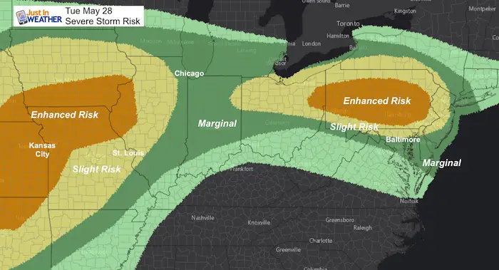
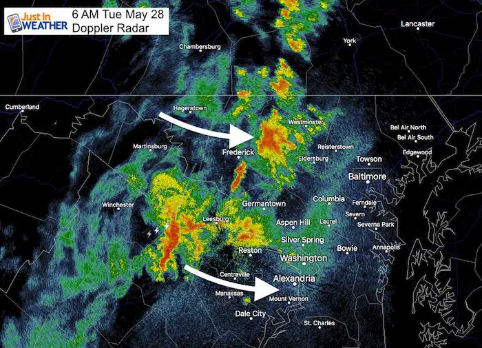
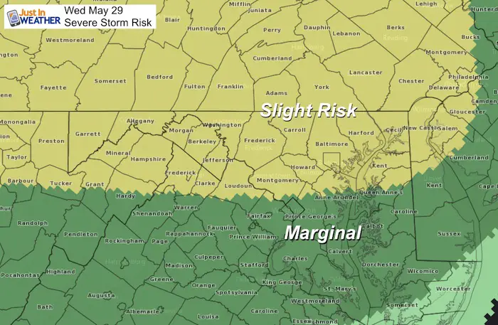
Some showers and a few lighting strikes this morning are moving through. This is what is left over from severe storms in the Mid West last night. At last check, nearly 5 million people in Ohio are without power this morning. The storms have weakened on the way here, we need to watch for a new round of storms later today and tomorrow. The Storm Prediction Center has posted Severe Storm Risk for our region today and tomorrow.
Severe Storm Risk Tuesday
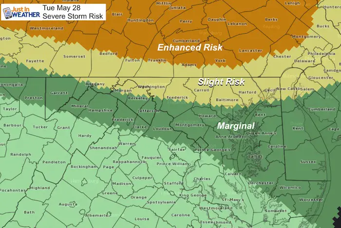
Today’s outlook shows two prime storm regions. Locally there is Enhanced Risk across Pennsylvania north of York and Lancaster, and Slight Risk into Baltimore. So lower threat father south. But that second region across Kansas, Missouri, and into Illinois is what will head our way tomorrow.
This means any thunderstorm has the potential for:
- Winds over 58 mph
- Hail over 1 inch diameter
- Tornados (isolated)
- Lightning will be frequent
- Flooding in local downpours
Forecast Maps Below
Local Weather Stats For May 28, 2019 in Baltimore
Average High: 77ºF
Record High: 97ºF in 1941
Average Low: 56ºF
Record Low: 41ºF in 1967
Sunrise: 5:44 AM
Sunset 8:25 PM
*Daylight = 1:20 longer than yesterday
*Bay Water Temperature = 70ºF at Thomas Pt. Light House
Keep In Touch Every Day
Just in case you don’t get all posts on your social media feed, stay up to date with the latest info…
Click here to sign up for email alerts…. Be the first to hear any new weather.
Morning Set Up
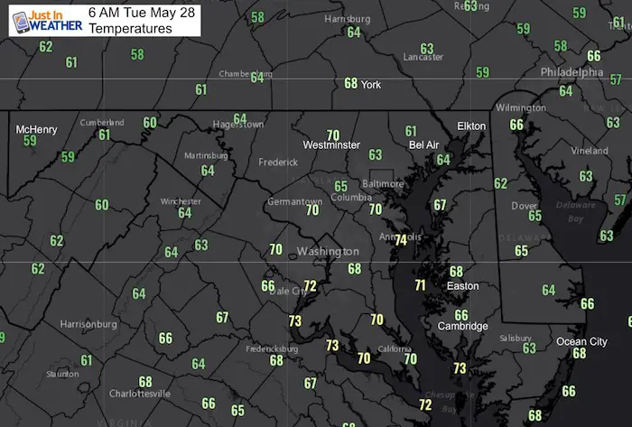
Temperatures
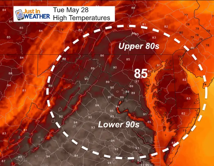
Note, after this rain passes, it will become more humid along with the building heat.
Doppler Radar
This snapshot is from 6 AM. Compare to the first slider image below. The modeling is NOT GOOD today! The impact has been more widespread already, and the timing is off by 1 to 2 hours.
Morning Radar Simulation —> slider
Compared to the 6 AM Doppler Radar snapshot above, we can see the modeling is NOT GOOD today! The impact has been more widespread already, and the timing is off by 1 to 2 hours.
So I do NOT trust the simulation for today. That is why we need to keep track of all development.
[metaslider id=76946]
Severe Storm Risk Today
Afternoon Development
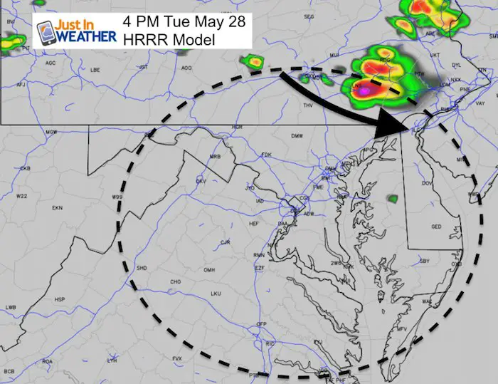
This HRRR Model is the highest resolution and most often updated. It has been wrong already this morning, so no reason to believe this is all we will see this afternoon. What is important to note is that storms are likely to form in PA, then drop south/southeast.
There is a 20% to 30% chance of storms later today. That is low, but any storm will have the potential to turn severe, but not guaranteed to do so.
Afternoon Heat
Wednesday Severe Storms
Temperature Outlook
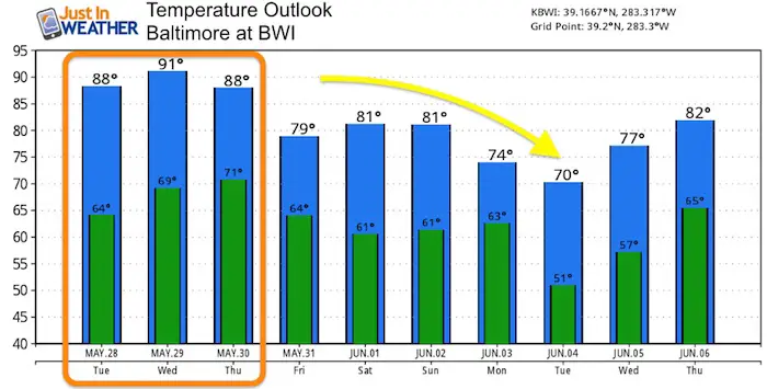
Once we shake off the heat, it will stay away for a while. The start of June appears to be well below average.
Maryland Trek 6
Our look got an upgrade, but we have the same purpose. Please click the logo take a look at our new page.
- Consider joining our team for the week, a single day, or even as a sponsor.
Support Our Nonprofit:
Proceeds go to our programs Providing FREE holistic care for kids in cancer treatment and up to 5 years post treatment and caregivers.

Shine On
Proceeds from all sales go to Just In Power Kids. Click the image to shop and show your support.
Love Maryland Shirts and Hoodies
This shirt was designed by my ‘bonus’ daughter Jaiden. The hoodie has been the biggest hit, so our promotion has been extended until the end of this week.
|
||
|
Show your love for Maryland and make this 14 year old artist and her mom extra proud
|
Please share your thoughts, best weather pics/video, or just keep in touch via social media
-
Facebook: Justin Berk, Meteorologist
-
Twitter: @JustinWeather
-
Instagram: justinweather
Related Links:

