Friday April 5 2019
Good morning! It’s going to be a wet day, but let’s make the most of it! There is actually good news about rain on this Friday. First, we just had a red flag warning for brushfires, so we can use it to dampen the ground for the sprig growth. It will also cut down on pollen. The other thing is that it won’t be too heavy… Then we set up a very nice weekend. It’s just this little storm we have to deal with today.
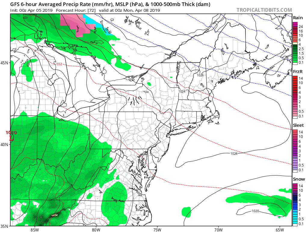
Saturday may start with some fog and drizzle, but we should see afternoon sun and temps between 65ºF and 70ºF. Sunday now looks to remain dry as we hold off the rain until Monday… but we may end that day with thunderstorms.

Big Announcement Later
I do have something important to share today, and you may be able to be part of it. But the weather is important to share first, so please check back around mid day. I’d really appreciate that.
Local Weather Stats For April 5, 2019 in Baltimore
Average High: 61ºF
Record High: 84ºF in 2010
Average Low: 40ºF
Record Low: 25ºF in 1881
*Record Snow: = 0.1″ in 1944
Sunrise: 6:44 AM
Sunset 7:33 PM
*Daylight = 2:32 longer than yesterday
*Bay Water Temperature = 48ºF at Thomas Pt. Light House
Keep In Touch Every Day
Just in case you don’t get all posts on your social media feed, stay up to date with the latest info…
Click here to sign up for email alerts…. Be the first to hear any new weather.

New Partner
Buchanan Kia of Westminster is a supporter of Just In Power Kids and Maryland Trek 6 in August 2019.
Morning Temperatures
This morning seems mild, but it is important to note that this is very close to the high temperatures for the day. We may actually drop a few degrees with the rain and spend most of the day in the upper 40s.

Rain Timelines
Morning Radar Simulation —> slider
[metaslider id=75372]
Afternoon/Evening Radar Simulation —> slider
[metaslider id=75381]
High Temperatures
Again, the afternoon is likely to be a few degrees cooler after the rain moves in

Looking Ahead:
After a warmer and dry weekend, the next systems arrives on Monday. We could get some thunderstorms Monday afternoon and evening.
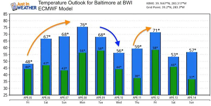
Temperature Outlook
Keep In Touch Every Day
Just in case you don’t get all posts on your social media feed, stay up to date with the latest info…
Click here to sign up for email alerts…. Be the first to hear any new weather.
Please share your thoughts, best weather pics/video, or just keep in touch via social media
- Facebook: Justin Berk, Meteorologist
- Twitter: @JustinWeather
- Instagram: justinweather
Related Links:
Was Your County Not Included?
Click this map for more on the regional forecast zones
