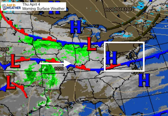
Thursday April 4 2019
Today is a local holiday and may be considered the other start of spring. The Orioles home opener agains the Yankees begins at 3:05 PM, but there will be festivites leading up to that. The weather will be a nice as we can expect in early April. The one question has been cloud cover ahead of our next storm. The latest model guidance shows hope that early clouds may break for a few hours of extra sunshine. But Friday is looking to turn wet again.
See the hourly simulation slider of cloud cover below. It’s important to note that in the sun this time of year you can easily get a sunburn. The solar rays are the same today as they are in early September. But in the shade or if there are more clouds, it can be chilly. I recommend a sweatshirt or light jacket with a T-shirt underneath that you may put on display.
Local Weather Stats For April 4, 2019 in Baltimore
Average High: 61ºF
Record High: 86ºF in 2011
Average Low: 39ºF
Record Low: 20ºF in 1965
*Record Snow: = 1.4″ in 1944
Sunrise: 6:46 AM
Sunset 7:32 PM
*Daylight = 2:32 longer than yesterday
*Bay Water Temperature = 47ºF at Thomas Pt. Light House
Keep In Touch Every Day
Just in case you don’t get all posts on your social media feed, stay up to date with the latest info…
Click here to sign up for email alerts…. Be the first to hear any new weather.

New Partner
Buchanan Kia of Westminster is a supporter of Just In Power Kids and Maryland Trek 6 in August 2019.
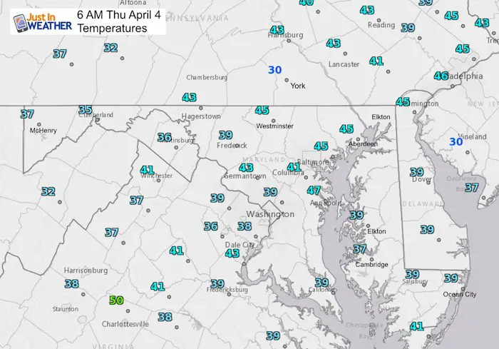
Morning Temperatures
Cloud Simulation —> slider
[metaslider id=75354]
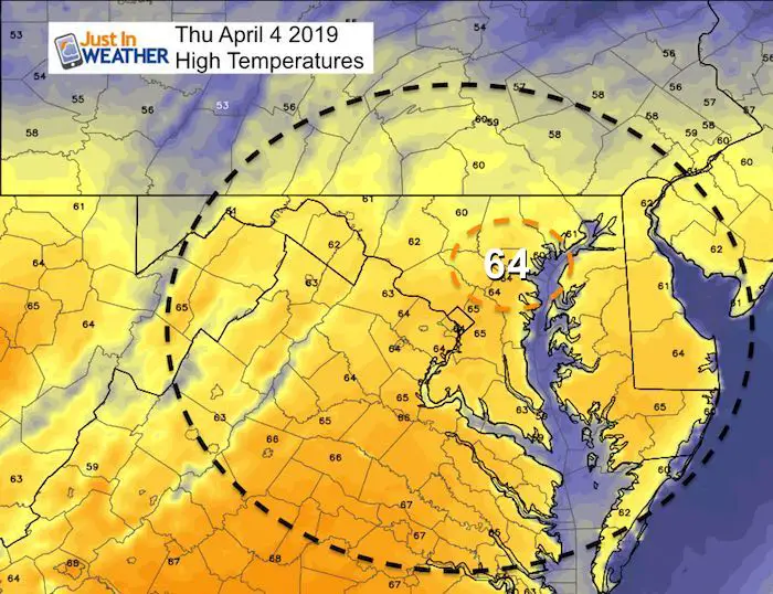
High Temperatures
It’s so nice the computer models brought out the orange pain for today’s warm afternoon temperatures.
It the sun and can feel hot. But in the shade or if it is more cloudy, it can feel chilly. Plan for a T-shirt you may want to show off, but a sweatshirt or light jacket over it. Also, please make sure to put on sunscreen. You can get a burn with the early April sunshine.
Rainy Friday
I was trying to be optimistic for Friday (for a few personal reasons), but it looks like we will get another push of rain. It’s likely to be showers in the morning, but steady and heavy later in the afternoon and evening. The good news is that it should be out of here for the weekend.
Animation: 6 AM Friday to Noon Saturday

Temperature Outlook
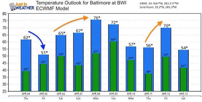
Rain Next Week:
Animation Sunday Evening to Tuesday Morning

Keep In Touch Every Day
Just in case you don’t get all posts on your social media feed, stay up to date with the latest info…
Click here to sign up for email alerts…. Be the first to hear any new weather.
Please share your thoughts, best weather pics/video, or just keep in touch via social media
-
Facebook: Justin Berk, Meteorologist
-
Twitter: @JustinWeather
-
Instagram: justinweather
Related Links:
Was Your County Not Included?
Click this map for more on the regional forecast zones
