Tuesday February 26 2019
The wind storm is over and cold air is left behind. There will be a breeze today average 10 mph, which will seem more calm and quiet. But cold air has settled back in and there will be slight wind chills to remind us it is still winter.
We are far from done with the snow. In fact the weather map today looks split with snow to the north and rain to the south, but the pattern will link up and line up for us to get snow by Friday morning. It looks like there may be a few more chances of snow through next week.

Local Weather Stats For February 26, 2019 in Baltimore
Average High: 48ºF
Record High: 74ºF in 1932
Average Low: 22ºF
Record Low: 2ºF in 1904
*Record Snow: = 3.0″ in 1993
Sunrise: 6:43 AM
Sunset 5:55 PM
*Daylight = 2:30 longer than yesterday
*Bay Water Temperature = 38ºF at Thomas Pt. Light House
Keep In Touch Every Day
Just in case you don’t get all posts on your social media feed, stay up to date with the latest info…
Click here to sign up for email alerts…. Be the first to hear any new weather.

New Partner
Buchanan Kia of Westminster is a supporter of Just In Power Kids and Maryland Trek 6 in August 2019.
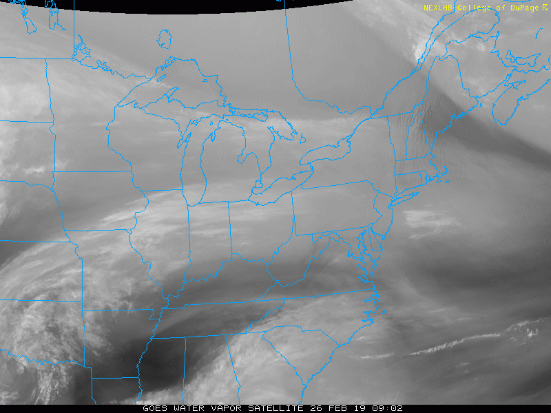
Morning Set Up
Water Vapor Satellite Loop
We can expect a mix of clouds and sun today. The split slow keeps snow across the Great Lakes and some rain in the south. These two tracks will link up for us at the end of the week.
Temperatures at 6 AM

Afternoon Temperatures


Active Weather Pattern
The American GFS Model shows snow Friday morning, rain Saturday, then snow again Tuesday next week. Just for argument sake, the European Model actually shows the second rounds of snow on Saturday closer and multiple snow chances next week.
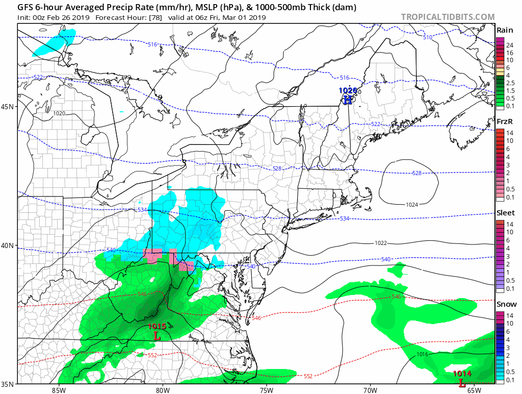
Friday Morning Snapshots
GFS Model
Light Snow: Less than 1 inch

European Model
Steady Snow: Total up to 2 inches

Canadian Model
Freezing Line North of Baltimore: Total snow between 1 and 3 inches.

Notes:
The Friday morning event will be a minor one, but timing might be enough for some school impact with delays.
Next week: I have seen multiple solutions with one or a few more hits of snow. It is to early to lock down, but a very high chance that the first two weeks of March will be much colder than average. I will have more on this in my afternoon update.
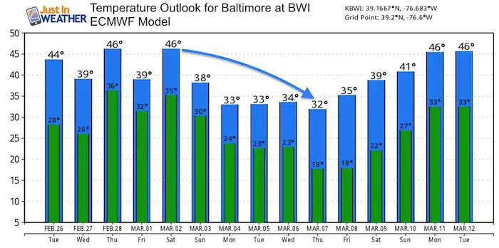
Temperature Outlook

ALL FITF Apparel

Please share your thoughts, best weather pics/video, or just keep in touch via social media
-
Facebook: Justin Berk, Meteorologist
-
Twitter: @JustinWeather
-
Instagram: justinweather

New Colors
We are giving 10% of each sale to Just In Power Kids: Providing FREE holistic care for pediatric oncology patients.

Related Links:
Winter Outlook
My Winter Outlook 2018-19: Multiple Nor’Easters and more snow

Was Your County Not Included?
Click this map for more on the regional forecast zones

Interactive Snow Report
November 15 Snow Reports- Interactive Map Compared To My Forecast

Winter Snow And Top 5 Wet Years
Snowfall Seasons at Beginning and End of Top 5 Wet Years In Baltimore

Related Winter Outlooks
Solar Cycle: When Sun Spots Are Low We Get More Snow
El Nino Modoki May Enhance Snow Chances
Sweet Spot: Hitting 70ºF on Halloween is followed by more winter snow
Will A Wet Summer Bring A Snowy Winter?
NOAA Winter 2018-2019 Outlook Explained: This Actually Supports Snow
Winter Outlook From Two Different Farmers Almanacs
Maryland Winters: Snowfall Maps and Baltimore Snow History
