Tuesday February 19 2019 6:30 AM
The Winter Storm Warning upgrade for much of central Maryland and Virginia for Wednesday include both moderate snow and heaving icing. A Winter Weather Advisory in southern Maryland is for impact snow and ice in the morning, but a faster change over to rain during the day. If you notice the old Winter Storm Watch in PA and northern Delmarva, this is another example of the regional NWS Offices not coordinating. Your area should see the new alert this morning.
Once again, just plan for limited or no travel Wednesday morning. I think it is safe to say that most area schools will adjust their schedules. Even on the Eastern Shore. There will be a ‘thump’ of snow that could fall at rates of 1 to 2 inches per hour at times.
The afternoon might get some road clearing with high sun angle and road crews, plus the mix over to sleet and snow. I do expect an ice storm situation west and north of Baltimore/Washington through Wednesday night. It will take some time even after the thaw for ice to melt or fall off of trees/power lines. Perhaps the largest super moon of the year now will enhance this storm (a theory we have discussed many times).
This post includes a timeline of the changeover plus new snow totals from various computer models and NWS Offices. My snow total was updated and increased last night. It is included below.
Winter Storm Warning (pink)
- Winter Weather Advisory (purple)
- Winter Storm Watch (blue: needs local NWS Offices to update)

Is Your County Not Included?
Either you may be too warm or your NWS Office has not posted yet. Click this map for more on the regional forecast zones

Storm Notes:
- Wednesday morning most of the area will see snow. This includes Southern MD and Delmarva.
- A burst of moderate to heavy snow could bring 1″/Hr at times.
- Wednesday Afternoon: Snow will change to sleet and freezing rain from south to north. That change over will be around lunchtime between Washington and Baltimore.
- Wednesday afternoon and evening: There will be icing across central Maryland
- Wednesday night: The normally colder zones will have heavy icing
- Thursday morning: It is possible that leftover ice has not fully melted or fallen off of trees in some areas even with warming and rain.
Weather Today
I know most of you will scroll down, but I wanted to address this first
Local Weather Stats For February 19, 2019 in Baltimore
Average High: 46ºF
Record High: 72ºF in 1997
Average Low: 27ºF
Record Low: 18ºF in 2015
*Record Snow: 16.4″ in 1979
Sunrise: 6:53 AM
Sunset 5:47 PM
*Daylight = 2:26 longer than yesterday
*Bay Water Temperature = 37ºF at Thomas Pt. Light House
This Morning

Keep In Touch Every Day
Just in case you don’t get all posts on your social media feed, stay up to date with the latest info…
Click here to sign up for email alerts…. Be the first to hear any new weather.

New Partner
Buchanan Kia of Westminster is a supporter of Just In Power Kids and Maryland Trek 6 in August 2019.
Afternoon
Increasing clouds and temps remaining in the 30s. So the ground will not get sufficient warming to counter stickage tomorrow.

More Below
My call for snowfall has increased a little to allow for more snow. Once we change to sleet and freezing rain, that will be an additional problem to content with.
Two sliders below are for you to compare the models and NWS Office snow forecasts
I am still staying lower that possible due to the sleet. The bust potential would lean towards overachieving. Note that the initial snow intensity can reach rates over 1 inch per hour.

Zone A:
- 5″ to 8″ of snow. The white circled region can get up to 12″.
- The highest snow may be where it begins earlier allowing for more stickage before late morning.
- This Zone will have the most snow and heaviest icing Wednesday night
Zone B:
- 3″ to 6″ of snow. It will fall heavy at times in the morning.
- Change over will be around lunchtime (between 11 AM and 3 PM).
- I expanded this zone to include Kent, Queen Annes, and Caroline Countes.
- Moderate icing in sleet and freeing rain
- Should change to rain from south to north between 3 PM and 8 PM Wednesday.
Zone C
- 1″ to 3″ of snow.
- Faster change over to icing and then rain during the day.
Start Of The Storm
Temperatures
It will be cold enough for snow and stickage. There will be a ‘thump’ of snow that could fall at rates of 1 to 2 inches per hour at times.

Radar Simulation Wednesday MORNING —> slider
There will be a ‘thump’ of snow that could fall at rates of 1 to 2 inches per hour at times in the morning to mid day.
[metaslider id=73555]
Radar Simulation Wednesday AFTERNOON/EVENING —> slider
[metaslider id=73568]
Thursday Morning Conditions
- The is a chance some cold air lingers in pockets northwest of Baltimore.
- Ice will be slow to thaw and also could be falling off of trees and power lines for a few hours after the change to all rain. This is what happened during last week’s storm.

How Much Snow?
Use the two sliders below to compare various models and NWS Zone Forecast Maps
Computer Models — > slider
- The ECMWF an NAM 3 Km seem most reasonable.
- The Canadian is low and the GFS is VERY HIGH. I think this is overblown and not accounting for the icing properly.
[metaslider id=73546]
Snow From NWS Offices For Their Zones —> slider
- Notice northern Maryland is higher than adjacent PA Counties. That shows NWS Sterling VA and State College did not coordinate and have different views on the storm.
- I think NWS Sterling VA put a lot of emphasis on the GFS Model above and is among the highest totals.
[metaslider id=73537]
Notes:
The potential to beat here might be on the higher side of snow. This all depends on the timing of the change over from snow to sleet, and freeing rain. Just plan for an icy mess. Morning snow rates will be high and able to stick on the pavement. The sets the stage for stickage for the middle of the day and afternoon.
Also remembering the ice storm last week. It is possible to change to plain rain, but have the effects of ice linger. This is due to longer time for it to melt and also fall off of trees and power lines. There is potential for 0.1″ to 0.25″ of icing on top of whatever snow falls.
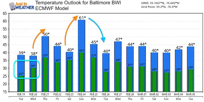
Temperature Outlook
ALL FITF Apparel

Please share your thoughts, best weather pics/video, or just keep in touch via social media
-
Facebook: Justin Berk, Meteorologist
-
Twitter: @JustinWeather
-
Instagram: justinweather
Keep In Touch Every Day
Just in case you don’t get all posts on your social media feed, stay up to date with the latest info…
Click here to sign up for email alerts…. Be the first to hear any new weather.

New Colors
We are giving 10% of each sale to Just In Power Kids: Providing FREE holistic care for pediatric oncology patients.

Related Links:
Winter Outlook
My Winter Outlook 2018-19: Multiple Nor’Easters and more snow

Interactive Snow Report
November 15 Snow Reports- Interactive Map Compared To My Forecast

Winter Snow And Top 5 Wet Years
Snowfall Seasons at Beginning and End of Top 5 Wet Years In Baltimore

Related Winter Outlooks
Solar Cycle: When Sun Spots Are Low We Get More Snow
El Nino Modoki May Enhance Snow Chances
Sweet Spot: Hitting 70ºF on Halloween is followed by more winter snow
Will A Wet Summer Bring A Snowy Winter?
NOAA Winter 2018-2019 Outlook Explained: This Actually Supports Snow
Winter Outlook From Two Different Farmers Almanacs
Maryland Winters: Snowfall Maps and Baltimore Snow History
