Thursday December 27 2018
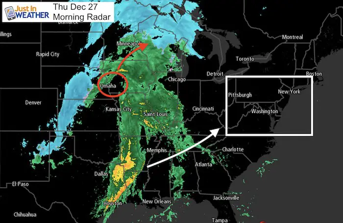
Once again we have a chilly start and thick frost, but the next storm will arrive with warmer air. This pattern continues along with the trend of getting heavy rain on a Friday. This next event may be responsible for severe storms in the south and that energy will head our way. Showers will begin tonight but some downpours are expected on Friday. Meanwhile the snow part of this system is locked well to the north.
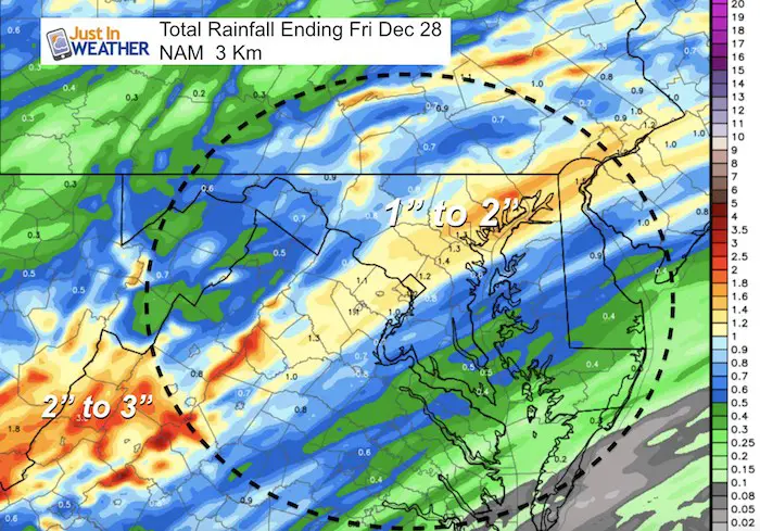
Heavy rain is likely to add up between 1 and 3 inches across our region. The ground is still soggy and streams are swollen, so more flooding is likely Friday.
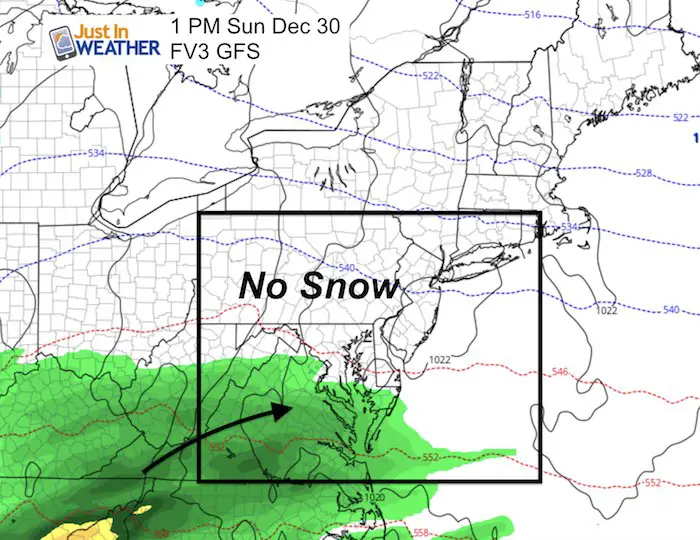
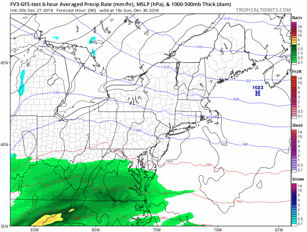
The good news is that we should clear out for the weekend. At this point the two models that showed some snow or mix on Sunday have lost that event and the Ravens game may go off without any weather factor.
Local Weather Stats For December 27 in Baltimore
Average High: 43ºF
Record High: 69ºF in 2015
Average Low: 26ºF
Record Low: 5ºF in 1914
*Record Snow: 5.0″ in 1939
Sunrise: 7:25 AM
Sunset 4:50 PM
*Daylight = 0:20 longer than yesterday
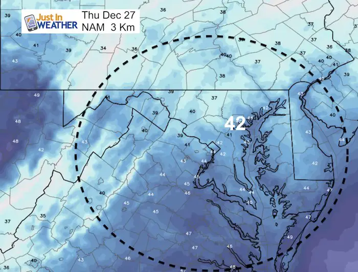
*Bay Water Temperature = 42ºF at Thomas Pt. Light House
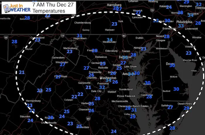
Morning Set Up
Temperatures
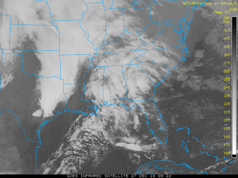
Satellite Loop
Afternoon
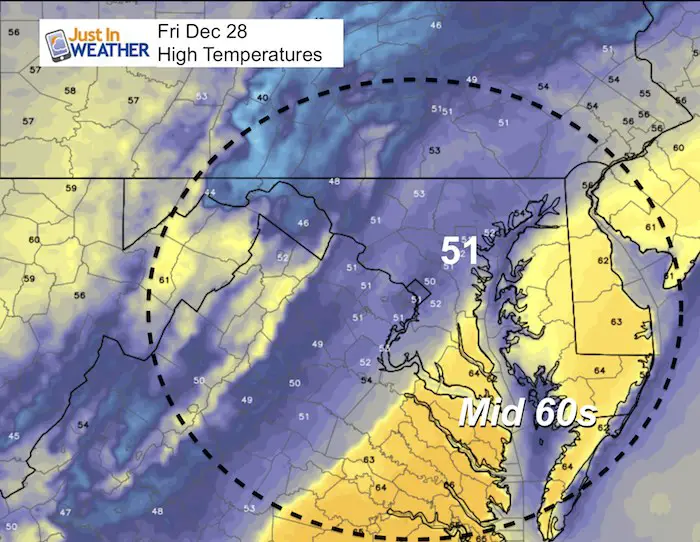
It will be more cloudy, so these temperatures will feel chillier than yesterday.
Rain Showers Tonight
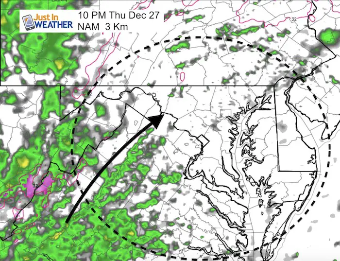
Friday Rain Timeline —> slider
[metaslider id=70075]
Rainfall Potential Total
Temperatures Friday Afternoon
A sharp boundary from lower 50s to mid 60s. The band of heavier rain may be just north of the warmer air. But a slight shift could get the mid 60s farther north.
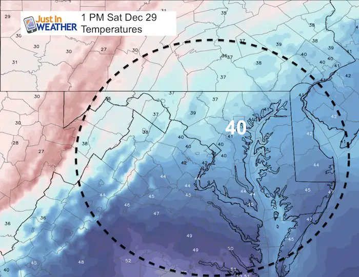
Temperatures Saturday Afternoon
Cooling back down after the storm
Looking Ahead
This is the same model that stood along trying to bring us steady snow Sunday. It appears that it will not arrive in time, so when it does, we will get rain later Sunday. However, I think we could get one sleet mixed in at the start.
Storm Animation
Depending on the timing, some sleet could be mixed in at the start Sunday evening and night. Notice, another rain event right around the New Year night/morning.
Snow Day Kit
Our ritual the night before a storm is finally in one kit. Maybe if more Maryland kids had this, the storm would reach us 🙂
- This includes a very soft raglan Tee printed inside out with #FITF AND the check list, #FITF spoon for under your pillow, ice cube tray with snowflake shapes, chalk, a #FITF wrist-band, a mini SnowStix, and a bag to carry it all in.
- New Orders are likely to be delivered after the holiday.
- This will also help us give a free Snow Day Kit to each of the Just In Power Kids.

FITF and SnowStix Stores are now OPEN

Keep In Touch Every Day
Click here to sign up for email alerts…. Be the first to hear the big news over the weekend
Also- Just in case you don’t get the post on your social media feed
Please share your thoughts, best weather pics/video, or just keep in touch via social media
-
Facebook: Justin Berk, Meteorologist
-
Twitter: @JustinWeather
-
Instagram: justinweather
Keep In Touch Every Day
Click here to sign up for email alerts…. Just in case you don’t get the post on your social media feed
Related Links:
Winter Outlook
My Winter Outlook 2018-19: Multiple Nor’Easters and more snow

Interactive Snow Report
November 15 Snow Reports- Interactive Map Compared To My Forecast

Winter Snow And Top 5 Wet Years
Snowfall Seasons at Beginning and End of Top 5 Wet Years In Baltimore

Related Winter Outlooks
Solar Cycle: When Sun Spots Are Low We Get More Snow
El Nino Modoki May Enhance Snow Chances
Sweet Spot: Hitting 70ºF on Halloween is followed by more winter snow
Will A Wet Summer Bring A Snowy Winter?
NOAA Winter 2018-2019 Outlook Explained: This Actually Supports Snow
Winter Outlook From Two Different Farmers Almanacs
Maryland Winters: Snowfall Maps and Baltimore Snow History

Snowstix- We Need You To Measure Snow Too
We are giving 10% of each sale to Just In Power Kids: Providing FREE holistic care for pediatric oncology patients.
