Friday December 28 2018
Having heavy rain has been the theme of the year, but a Flood Watch on a Friday is bordering on cliche. Here we go again as rain overnight has already dampened the roads. We will have a few bands of heavy rain to watch today that may add up to a total of 2 inches or more in central Maryland. Less to the north in PA. The timing appears to hit this morning and again this afternoon as shown in the timeline below.
Flood Watch
The focus of the heavier rain will b right along I-95 in central Maryland. This includes Baltimore up to Harford and Cecil Counties and north to Philadelphia. Southward to Anne Arundel, Howard, Montgomery and across Washington DC into central Virginia. This means we have the potential for flooding in these areas, but it is not happening yet.

The weekend will bring in colder winds and dry weather, but another storm will bring rain Monday evening, which may be the most fitting way to end the year. But New Years Eve plans might be affected. See the maps below.
Local Weather Stats For December 28 in Baltimore
The record low was tied on this date last year
Average High: 42ºF
Record High: 74ºF in 1946
Average Low: 26ºF
Record Low: 10ºF in 2017
*Record Snow: 2.0″ in 19933
Sunrise: 7:25 AM
Sunset 4:50 PM
*Daylight = 0:24 longer than yesterday
*Bay Water Temperature = 42ºF at Thomas Pt. Light House
Morning Set Up
Temperatures

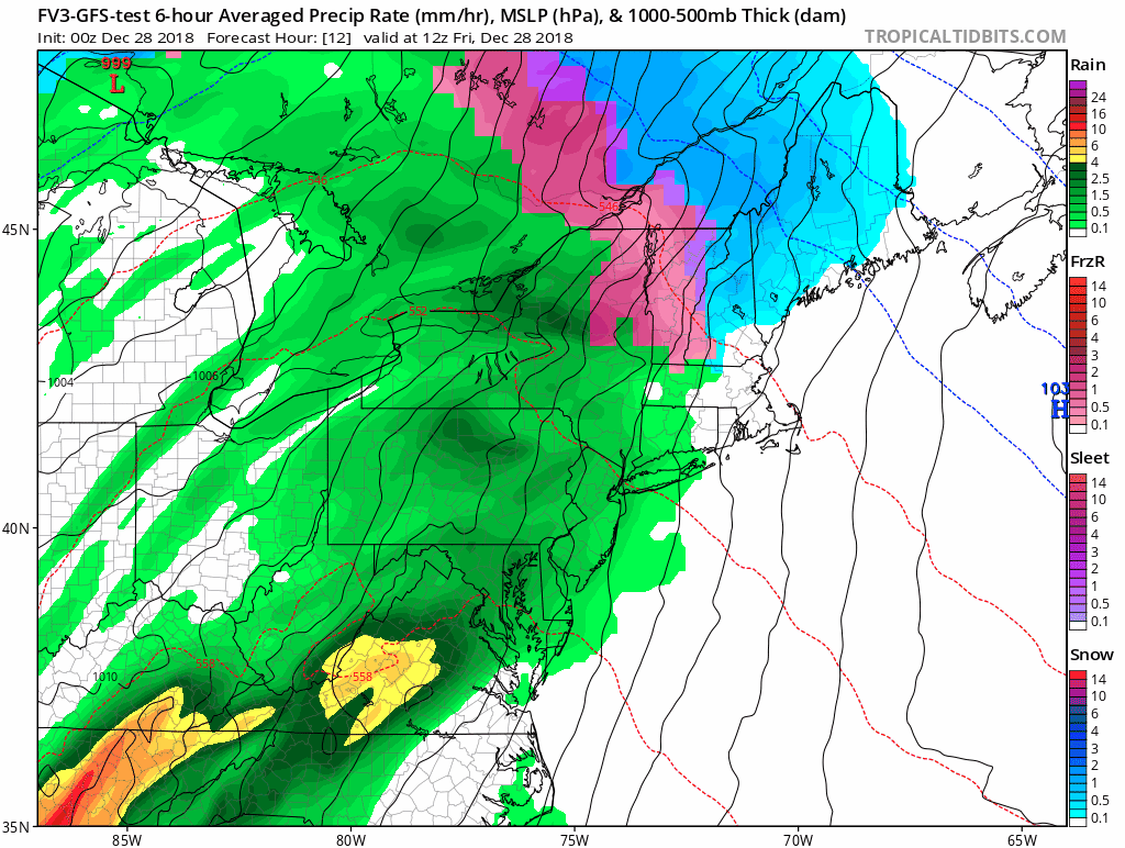
The Storm

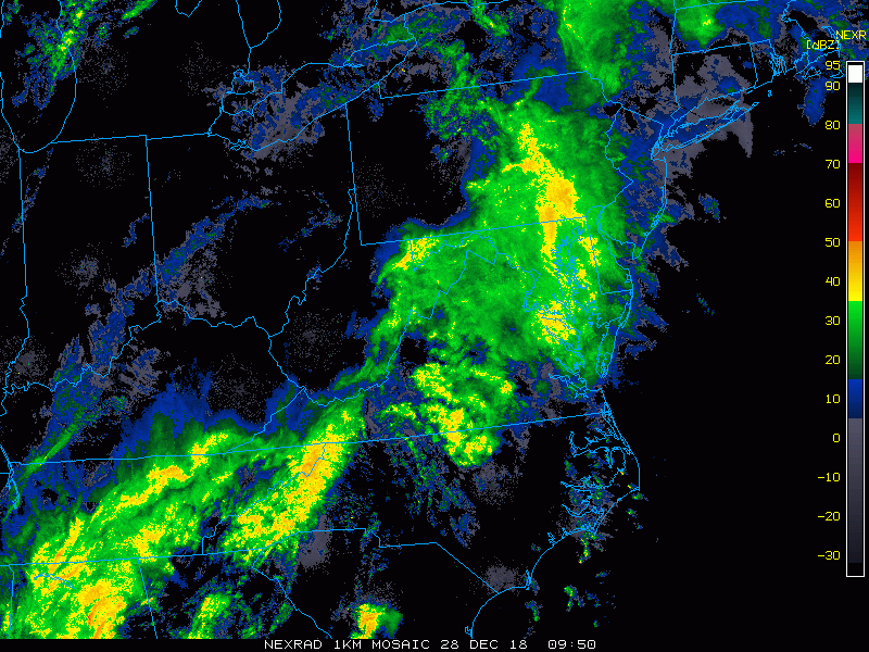
Radar Loop: 2 Hours 4:45 to 6:45 AM
More heavy rain will spread in mid morning
Radar Simulation -> slider
[metaslider id=70128]
Rainfall Total Forecast

Adding to the Record Yearly Total

Temperatures

Rainy Outlook Animation
This storm then New Year’s Eve rain ending Tuesday morning. The last event in this focus will be Thursday Jan 3 stalled front to our south may have snow with it.
New Year’s Eve Rain
This may be a game changer for some First Night or other celebration plans. I will continue to focus on this event for the time frame around midnight 2019.

Snow Day Kit
Our ritual the night before a storm is finally in one kit. Maybe if more Maryland kids had this, the storm would reach us 🙂
- This includes a very soft raglan Tee printed inside out with #FITF AND the check list, #FITF spoon for under your pillow, ice cube tray with snowflake shapes, chalk, a #FITF wrist-band, a mini SnowStix, and a bag to carry it all in.
- New Orders are likely to be delivered after the holiday.
- This will also help us give a free Snow Day Kit to each of the Just In Power Kids.

FITF and SnowStix Stores are now OPEN

Keep In Touch Every Day
Click here to sign up for email alerts…. Be the first to hear the big news over the weekend
Also- Just in case you don’t get the post on your social media feed
Please share your thoughts, best weather pics/video, or just keep in touch via social media
-
Facebook: Justin Berk, Meteorologist
-
Twitter: @JustinWeather
-
Instagram: justinweather
Keep In Touch Every Day
Click here to sign up for email alerts…. Just in case you don’t get the post on your social media feed
Related Links:
Winter Outlook
My Winter Outlook 2018-19: Multiple Nor’Easters and more snow

Interactive Snow Report
November 15 Snow Reports- Interactive Map Compared To My Forecast

Winter Snow And Top 5 Wet Years
Snowfall Seasons at Beginning and End of Top 5 Wet Years In Baltimore

Related Winter Outlooks
Solar Cycle: When Sun Spots Are Low We Get More Snow
El Nino Modoki May Enhance Snow Chances
Sweet Spot: Hitting 70ºF on Halloween is followed by more winter snow
Will A Wet Summer Bring A Snowy Winter?
NOAA Winter 2018-2019 Outlook Explained: This Actually Supports Snow
Winter Outlook From Two Different Farmers Almanacs
Maryland Winters: Snowfall Maps and Baltimore Snow History

Snowstix- We Need You To Measure Snow Too
We are giving 10% of each sale to Just In Power Kids: Providing FREE holistic care for pediatric oncology patients.
