Sunday December 16 2018
A new Flood Warning has been issued until 3:15 PM due to high stream gauges and additional rain. Up to an addition 1 inch has fallen today and these bands looks more intense that expected. This has been on overachieving event and the recent radar shows the heaviest rain just east of this warning area… So it may be expanded. The warning now includes Ellicott City and there may be heightened anxiety there since the summer flood. But the heavier rain appears to be just to their east over Baltimore and into AACo. See the radar loop below.

Flood Statement
* At 1211 PM EST, stream gauges indicated minor flooding across the
area. The Howard County 911 Center also reported two roads closed
due to high water. Water levels will continue to recede this
afternoon since the heaviest rainfall has ended.
* Some locations that may experience flooding include…
Columbia, Elkridge, Ellicott City, Catonsville, Laurel, Arbutus,
Savage-guilford, Scaggsville, Ilchester, Linthicum, Lansdowne,
Jessup, Savage, Fulton, Highland, Clarksville, West Friendship,
Dayton, Roxbury Mills and Glenelg.

Estimated Rain
Over 1.5″ around Baltimore with an area over 3″ west and north of Washington across Montgomery and western Howard Counties in Maryland.

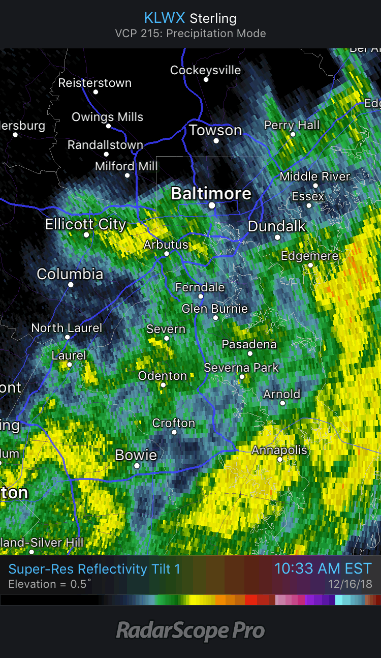
Doppler Radar Loops
The heaviest rain was falling just east of the warning area… Yellow and orange shading appears to be circulation across metro Baltimore and I-95 dropping into Anne Arundel County.
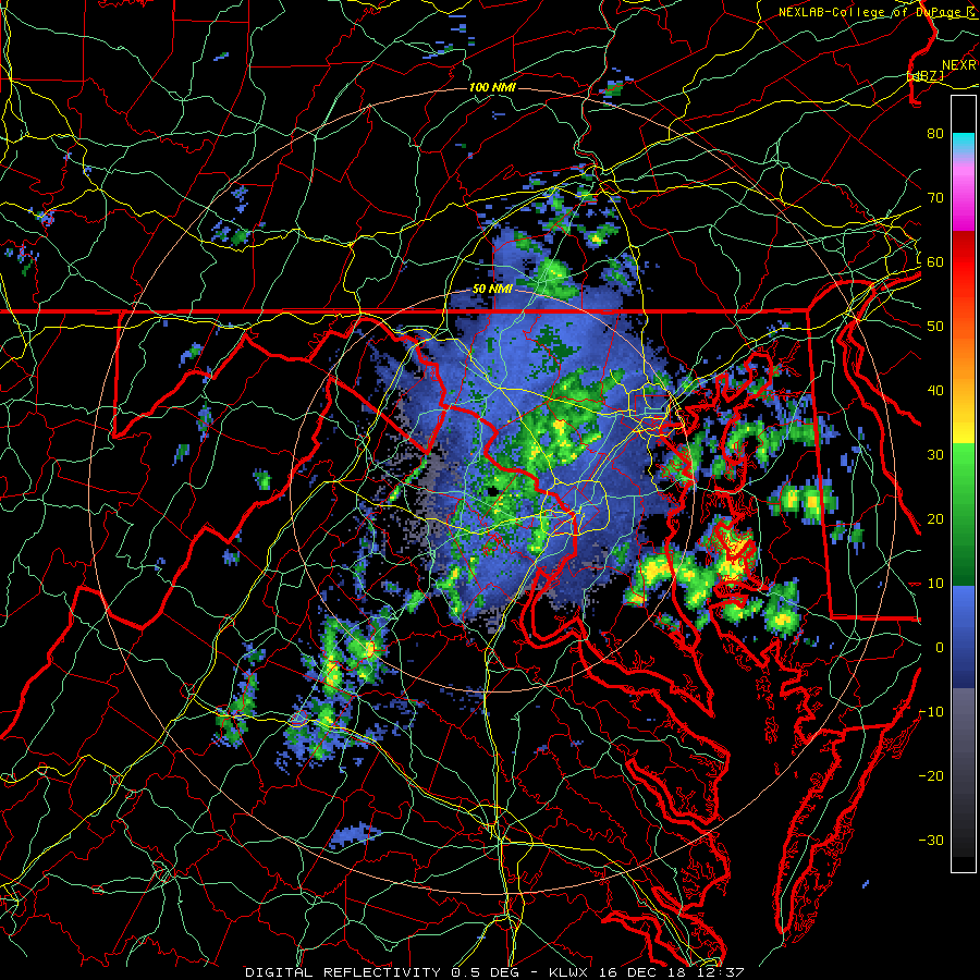
Regional Radar
Watch the rain expand and wrap around the upper level Low that is passing through Southern Maryland…
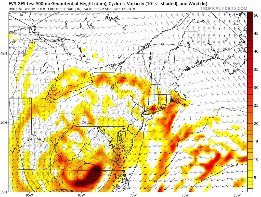
Jet Stream
Here is the upper level Low that we were tracking today. This was expected to increase the rain but it definitely over achieved.
Wintry Mix?
The High Resolution Modeling supports color air aloft to mix in some snow or sleet across the higher terrain north of Baltimore. This are likely across the line into southern PA. Ground temps short remain above freezing during the time, but some ‘stuff’ might mix down. Tonight is when we need to watch the falling temps with the wet ground….

Monday Morning Low Temperatures

Snow Day Kit
Our ritual the night before a storm is finally in one kit. Maybe if more Maryland kids had this, the storm would reach us 🙂
- This includes a very soft raglan Tee printed inside out with #FITF AND the check list, #FITF spoon for under your pillow, ice cube tray with snowflake shapes, chalk, a #FITF wrist-band, a mini SnowStix, and a bag to carry it all in.
- Order by December 14 and it should arrive for the holiday.
- This will also help us give a free Snow Day Kit to each of the Just In Power Kids.

FITF and SnowStix Stores are now OPEN

Keep In Touch Every Day
Click here to sign up for email alerts…. Be the first to hear the big news over the weekend
Also- Just in case you don’t get the post on your social media feed
Please share your thoughts, best weather pics/video, or just keep in touch via social media
-
Facebook: Justin Berk, Meteorologist
-
Twitter: @JustinWeather
-
Instagram: justinweather
Keep In Touch Every Day
Click here to sign up for email alerts…. Just in case you don’t get the post on your social media feed
Related Links:
Winter Outlook
My Winter Outlook 2018-19: Multiple Nor’Easters and more snow

Interactive Snow Report
November 15 Snow Reports- Interactive Map Compared To My Forecast

Winter Snow And Top 5 Wet Years
Snowfall Seasons at Beginning and End of Top 5 Wet Years In Baltimore

Related Winter Outlooks
Solar Cycle: When Sun Spots Are Low We Get More Snow
El Nino Modoki May Enhance Snow Chances
Sweet Spot: Hitting 70ºF on Halloween is followed by more winter snow
Will A Wet Summer Bring A Snowy Winter?
NOAA Winter 2018-2019 Outlook Explained: This Actually Supports Snow
Winter Outlook From Two Different Farmers Almanacs
Maryland Winters: Snowfall Maps and Baltimore Snow History

Snowstix- We Need You To Measure Snow Too
We are giving 10% of each sale to Just In Power Kids: Providing FREE holistic care for pediatric oncology patients.
