Tuesday December 11 2018
This may seem like a tease, but the cold air in place has one chance to produce snow this week. Thursday morning will bring some light snow across the northern part of our area. This may skim metro Baltimore, but northern areas into southern PA could have a minor impact. Then a shift of the upper air pattern will bring in the next system with warmer air and rain on Friday. Despite this, I still see us back to the cold and a chance for snow before Christmas.
Local Weather Stats For December 11 in Baltimore
Average High: 46ºF
Record High: 69ºF in 1979
Average Low: 29ºF
Record Low: 9ºF in 1968
*Record Snow: 9.3″ in 1960
Sunrise: 7:16 AM
Sunset 4:43 PM
*Daylight = 0:40 shorter than yesterday
*Bay Water Temperature = 42ºF at Thomas Pt. Light House
Snow Day Kit
Our ritual the night before a storm is finally in one kit. Maybe if more Maryland kids had this, the storm would reach us 🙂
- This includes a very soft raglan Tee printed inside out with #FITF AND the check list, #FITF spoon for under your pillow, ice cube tray with snowflake shapes, chalk, a #FITF wrist-band, a mini SnowStix, and a bag to carry it all in.
- Order by December 14 and it should arrive for the holiday.
- This will also help us give a free Snow Day Kit to each of the Just In Power Kids.

Morning Snapshot
Bitterly cold and thick frost for most this morning.

Afternoon Highs
Slow thaw, but there will be plenty of sunshine to help.

Thursday Morning Light Snow — > slider
- This looks like a minor impact northwest of Baltimore that may include parts of Howard, Frederick, Carroll, northern Baltimore, and Harford Counties. Better chance for some impact on the roads before school in southern PA.
- Watch the Freezing Line for where there may be stickage.
- This needs a closer look and I will post that this afternoon.
[metaslider id=69487]
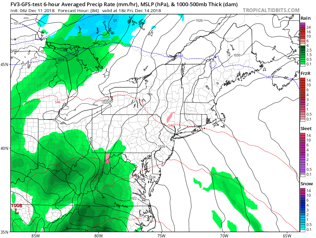
Rain Arrives Later Friday
Temperature Outlook

FITF and SnowStix Stores are now OPEN

Keep In Touch Every Day
Click here to sign up for email alerts…. Be the first to hear the big news over the weekend
Also- Just in case you don’t get the post on your social media feed
Please share your thoughts, best weather pics/video, or just keep in touch via social media
-
Facebook: Justin Berk, Meteorologist
-
Twitter: @JustinWeather
-
Instagram: justinweather
Keep In Touch Every Day
Click here to sign up for email alerts…. Just in case you don’t get the post on your social media feed
Related Links:
Winter Outlook
My Winter Outlook 2018-19: Multiple Nor’Easters and more snow

Interactive Snow Report
November 15 Snow Reports- Interactive Map Compared To My Forecast

Winter Snow And Top 5 Wet Years
Snowfall Seasons at Beginning and End of Top 5 Wet Years In Baltimore

Related Winter Outlooks
Solar Cycle: When Sun Spots Are Low We Get More Snow
El Nino Modoki May Enhance Snow Chances
Sweet Spot: Hitting 70ºF on Halloween is followed by more winter snow
Will A Wet Summer Bring A Snowy Winter?
NOAA Winter 2018-2019 Outlook Explained: This Actually Supports Snow
Winter Outlook From Two Different Farmers Almanacs
Maryland Winters: Snowfall Maps and Baltimore Snow History

Snowstix- We Need You To Measure Snow Too
We are giving 10% of each sale to Just In Power Kids: Providing FREE holistic care for pediatric oncology patients.
