Sunday November 25 2018
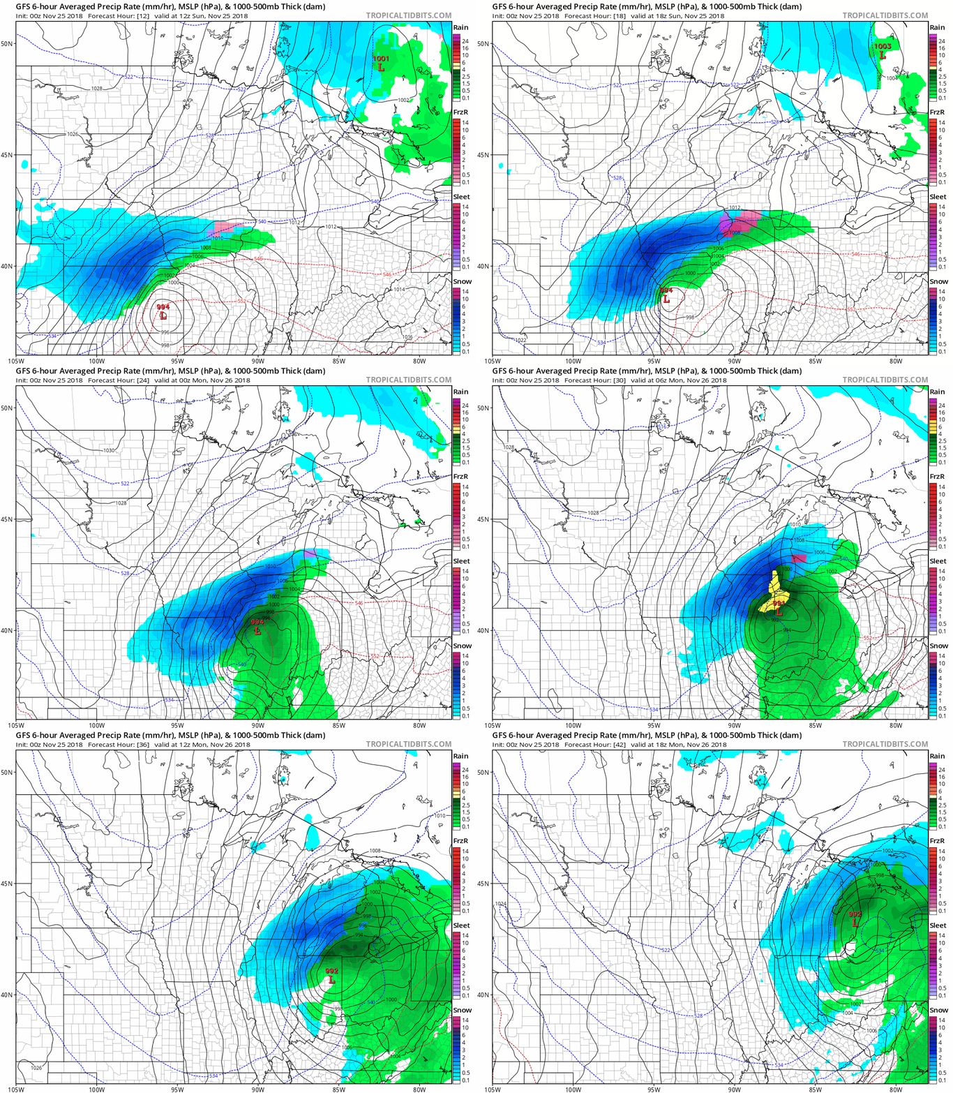
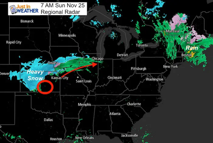
Today is the big travel day to return home and it will be a problem for the central US. A Blizzard Warning is in place for a large area including Kansas City. This storm will extend to Chicago where a winter storm warning is in place along with flooding before this turns to snow. This large airport hub will start as rain, but the snow problem will begin mid afternoon and last overnight. All of these area have the potential for 6 to 12 inches of snow.

High winds will impact areas south of the storm, meanwhile fog has been a problem this morning across much of the east. Basically, there will be flight and driving delays traveling away or heading back home.
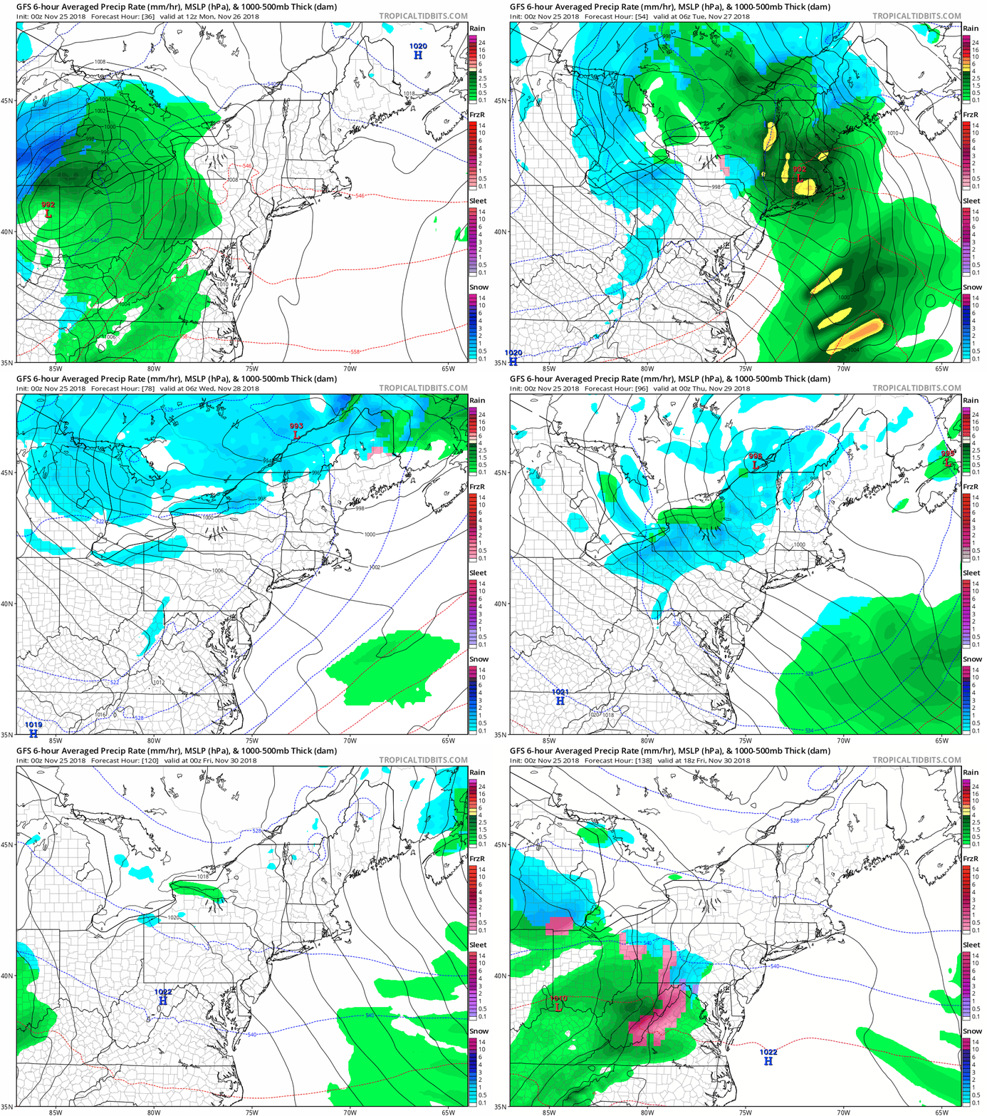
This is an impressive storm, but for us locally it will be a rain event Monday. This will be followed by the cold air which will bring heavy snow to western Maryland, but only dry winds to metro areas. We may have to watch the next system at the end of the week to start with some ice.
Local Weather Stats For November 25 in Baltimore
Average High: 53ºF
Record High: 75ºF in 1973
Average Low: 34ºF
Record Low: 18ºF in 1956
*Record Snow: 3.5″ in 1938 (2 day storm totals 8.5″)
Sunrise: 7:00 AM
Sunset 4:45 PM
*Daylight = 1:30 shorter than yesterday
*Bay Water Temperature = 47ºF at Thomas Pt. Light House
Record Rain Year Update:
The rainfall on Friday Nov 24 at BWI was 1.68″, NOT A RECORD. The top spot was 2.82″ way back in 1877. But we added to our wettest year total now sitting at 64.86″ (rain and melted snow combined)

The FITF Store Is Open With Gear And SnowStix
Get the most popular (and my favorite) item Right Now
#FITF Hats
Morning SnapShot
Traveling to Boston or northern New England, moderate rain wil be the issue. Kansas City gets their snow much of the day starting before lunchtime. Chicago will start as rain and turn to snow by 5 PM.
Mid West Storm Animation
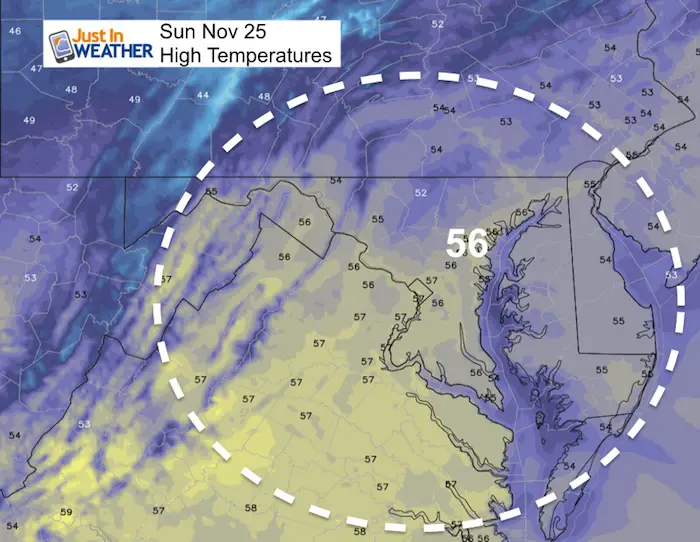
High Temperatures
Today will be mild and dry with most of the region reaching the 50s
Our Rain Monday —> slider
[metaslider id=68846]
Local Storm Animation
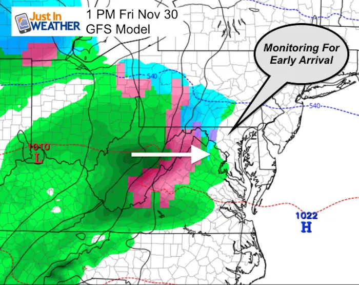
The cold air we get will arrive AFTER the rain departs. Mid week will be dry, but may set up a problem with the arrival of the next system on Friday.
Friday Morning
We have had a trend of systems arriving earlier than first suggested. If this happens later this week, it could repeat some of the issues we just had over the weekend. That means cold ground might lead to icy problems… If this storm shows up around sunrise, 6 hours earlier than shown here.
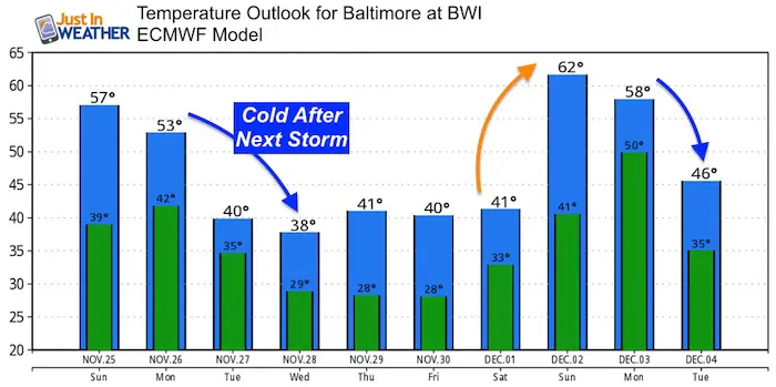
Temperature Outlook
The cold air arrives AFTER the rain. Then we warm up next weekend briefly. The long range outlook still supports the shift back to winter for us- including cold air and storms starting December 5-8.
Keep In Touch Every Day
Click here to sign up for email alerts…. Be the first to hear the big news over the weekend
Also- Just in case you don’t get the post on your social media feed
Please share your thoughts, best weather pics/video, or just keep in touch via social media
-
Facebook: Justin Berk, Meteorologist
-
Twitter: @JustinWeather
-
Instagram: justinweather
Keep In Touch Every Day
Click here to sign up for email alerts…. Just in case you don’t get the post on your social media feed
Related Links:
Winter Outlook
My Winter Outlook 2018-19: Multiple Nor’Easters and more snow
Interactive Snow Report
November 15 Snow Reports- Interactive Map Compared To My Forecast
Winter Snow And Top 5 Wet Years
Snowfall Seasons at Beginning and End of Top 5 Wet Years In Baltimore
Related Winter Outlooks
Solar Cycle: When Sun Spots Are Low We Get More Snow
El Nino Modoki May Enhance Snow Chances
Sweet Spot: Hitting 70ºF on Halloween is followed by more winter snow
Will A Wet Summer Bring A Snowy Winter?
NOAA Winter 2018-2019 Outlook Explained: This Actually Supports Snow
Winter Outlook From Two Different Farmers Almanacs
Maryland Winters: Snowfall Maps and Baltimore Snow History
FITF and SnowStix Stores are now OPEN
Snowstix- We Need You To Measure Snow Too
We are giving 10% of each sale to Just In Power Kids: Providing FREE holistic care for pediatric oncology patients.


