 November 15 2018
We are not completely done with the storm yet, but most of the snow has done its thing. There still may be an additional inch or so overnight west and north of Baltimore. Yes, this was an overachiever! But if you saw all of my reports, then hopefully you saw my upgraded snow maps. Here is a look at the local snow reports plotted against my final call for snowfall map. The list of snow spotter reports is below.
I want to than Jared Scott for helping to put this together as we are working on a much larger project. Please let me know if you like the layout and interactivity. We hope to be able to allow for public uploading of snow totals and conditions in real time to help in future events.
Record Snow for November 15
BWI = 1.7″ of snow
That was the report from Baltimore as of 1 PM.
The breaks the record of 1.2″ set on the date in 1908. That was 110 years years ago!!! That was part of a larger two day storm that brought 4.8″ between Nov 14-15, 1908.
If you saw my new FITF hat, now is the time to get yours. We had a lot of interest today and I know you will love it.

Snow Reports and Interactive Map
Use the controls to zoom in and see the reports by your place. Please scroll below for the full snow spotter report list.
Note: These are from NWS Baltimore/Washington. The reports from PA and Delmarva are from other regional offices. We will work to include them.
Please share your thoughts, best weather pics/video, or just keep in touch via social media
-
Facebook: Justin Berk, Meteorologist
-
Twitter: @JustinWeather
-
Instagram: justinweather
Keep In Touch Every Day
Click here to sign up for email alerts…. Just in case you don’t get the post on your social media feed
The FITF Store Is Open With Gear And SnowStix
Snow Spotter Report List
LOCATION STORM TOTAL TIME/DATE COMMENTS
SNOWFALL OF
/INCHES/ MEASUREMENT
MARYLAND
...Allegany County...
Frostburg 2 ENE 9.0 315 PM 11/15 Trained Spotter
Cresaptown SSW 8.6 430 PM 11/15 Trained Spotter
Ridgeley 1 NW 8.0 438 PM 11/15 Trained Spotter
Frostburg 7.5 300 PM 11/15 Trained Spotter
Mount Savage 7.5 405 PM 11/15 Trained Spotter
Wolfe Mill 2 NNE 6.5 415 PM 11/15 Trained Spotter
Cumberland 5.0 113 PM 11/15 Co-Op Observer
...Anne Arundel County...
BWI Airport 1.7 100 PM 11/15 Airport
...Baltimore County...
Bentley Springs 1 E 5.5 445 PM 11/15 Trained Spotter
Parkton S 5.2 330 PM 11/15 Trained Spotter
Parkton 1 W 4.7 120 PM 11/15 Trained Spotter
Long Green 2 NW 4.0 300 PM 11/15 Trained Spotter
Glyndon 1 SW 4.0 456 PM 11/15 Trained Spotter
Kingsville 1 NE 3.1 100 PM 11/15 Trained Spotter
Perry Hall 2 E 2.5 130 PM 11/15 Trained Spotter
Middle River 1 N 2.3 250 PM 11/15 Trained Spotter
...Baltimore City...
Pimlico SE 2.3 1250 PM 11/15 Trained Spotter
...Carroll County...
Taneytown 7 NE 7.0 443 PM 11/15 Trained Spotter
Lineboro 3 WSW 6.8 307 PM 11/15 Trained Spotter
Millers 4 NE 6.1 300 PM 11/15 Co-Op Observer
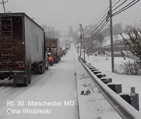
Manchester 1 SSW 5.8 330 PM 11/15 Trained Spotter
Westminster 2 SE 5.8 405 PM 11/15 Trained Spotter
Uniontown 2 S 5.5 356 PM 11/15 Trained Spotter
Westminster 1 W 5.0 200 PM 11/15 CoCoRaHS
Winfield 1 N 4.9 245 PM 11/15 Trained Spotter
Watersville 1 NW 4.5 245 PM 11/15 Trained Spotter
Eldersburg 1 SE 4.3 249 PM 11/15 Trained Spotter
...Frederick County...
Sabillasville 2 SSE 9.0 330 PM 11/15 Trained Spotter
Walkersville 1 E 8.1 340 PM 11/15 Trained Spotter
Thurmont 3 N 8.0 300 PM 11/15 NWS Employee
Ballenger Creek 1 W 6.8 344 PM 11/15 Trained Spotter
Bloomfield 2 WSW 6.5 115 PM 11/15 NWS Employee
New Market N 5.3 315 PM 11/15 Trained Spotter
New Market 2 NW 5.3 100 PM 11/15 Trained Spotter
Frederick 1 ESE 5.0 1250 PM 11/15 Trained Spotter
Brunswick 2 WNW 4.6 130 PM 11/15 Trained Spotter
Park Mills 3 ESE 4.2 1257 PM 11/15 Trained Spotter
Frederick 1 SSE 4.1 150 PM 11/15 Trained Spotter
...Harford County...
Whiteford 5.0 500 PM 11/15 Trained Spotter
Norrisville 3 W 4.5 100 PM 11/15 Trained Spotter
Norrisville 1 WSW 4.5 145 PM 11/15 CoCoRaHS
Street 1 ESE 4.5 245 PM 11/15 Trained Spotter
Scarboro 2 E 4.0 435 PM 11/15 Trained Spotter
Bel Air 2.8 120 PM 11/15 County Official
...Howard County...
Columbia 2 N 2.2 300 PM 11/15 Trained Spotter
Columbia 2.0 400 PM 11/15 NWS Employee
Oella 1 SW 1.5 135 PM 11/15 Trained Spotter
...Montgomery County...
Clarksburg 2 ENE 5.2 140 PM 11/15 CoCoRaHS
Damascus 3 SSW 4.4 333 PM 11/15 Co-Op Observer
...Washington County...
Pecktonville 3 NNW 7.1 416 PM 11/15 NWS Employee
Boonsboro 3 NNE 6.5 300 PM 11/15 Trained Spotter
Hancock 6.0 231 PM 11/15 NWS Employee
Long Meadow 1 SSE 4.0 130 PM 11/15 Trained Spotter
VIRGINIA
...Arlington County...
Reagan National Apt 1.4 100 PM 11/15 Airport
...City of Harrisonburg...
Harrisonburg 1.0 215 PM 11/15 Broadcast Media
...Fairfax County...
Wolf Trap 1 ENE 2.7 100 PM 11/15 CoCoRaHS
Chantilly 3 N 2.1 1239 PM 11/15 NWS Employee
Fairfax Station 1 NN 2.0 100 PM 11/15 Trained Spotter
Centreville W 1.7 1255 PM 11/15 Trained Spotter
Rose Hill ENE 1.5 400 PM 11/15 Trained Spotter
...Fauquier County...
Opal 1.0 300 PM 11/15 NWS Employee
...Frederick County...
Whitacre 1 ESE 6.0 200 PM 11/15 Trained Spotter
Gainesboro 2 W 6.0 300 PM 11/15 CoCoRaHS
Winchester 2 S 5.0 446 PM 11/15 Trained Spotter
Stephens City 2 E 4.0 220 PM 11/15 Trained Spotter
...Loudoun County...
Lovettsville 2 ENE 7.2 500 PM 11/15 Trained Spotter
Hillsboro 3 NW 6.0 1235 PM 11/15 Trained Spotter
Leesburg 2 E 5.0 345 PM 11/15 Trained Spotter
Purcellville 4.8 142 PM 11/15 NWS Employee
Ashburn 1 ENE 4.0 211 PM 11/15 NWS Employee
Leesburg 2 WNW 4.0 200 PM 11/15 NWS Employee
Leesburg 1 ESE 3.5 220 PM 11/15 NWS Office
Dulles International 3.0 100 PM 11/15 Airport
...Page County...
Ida 1 SW 2.0 500 PM 11/15 Trained Spotter
Honeyville 1 ESE 0.8 410 PM 11/15 Trained Spotter
...Warren County...
Buckton 1 NNE 1.8 1245 PM 11/15 Trained Spotter
WEST VIRGINIA
...Berkeley County...
Falling Waters 2 NW 7.3 243 PM 11/15 Trained Spotter
Martinsburg 2 E 7.0 100 PM 11/15 NWS Employee
Vanville 1 SSW 6.8 100 PM 11/15 Trained Spotter
Bunker Hill SE 6.4 245 PM 11/15 Trained Spotter
...Hardy County...
Wardensville 3 E 4.0 230 PM 11/15 Trained Spotter
...Jefferson County...
Harpers Ferry 5.8 1255 PM 11/15 Park Srvc
...Mineral County...
New Creek 3 NW 10.1 437 PM 11/15 Trained Spotter
Keyser 8.5 329 PM 11/15 Trained Spotter
Ridgeley 1 W 7.5 200 PM 11/15 Trained Spotter
Ridgeville 4 ENE 7.3 325 PM 11/15 Trained Spotter
Burlington E 5.2 400 PM 11/15 Trained Spotter
...Morgan County...
Berkeley Spgs 1 E 7.0 353 PM 11/15 CoCoRaHS
Winter Outlook
My Winter Outlook 2018-19: Multiple Nor’Easters and more snow

Related Winter Outlooks
Solar Cycle: When Sun Spots Are Low We Get More Snow
El Nino Modoki May Enhance Snow Chances
Sweet Spot: Hitting 70ºF on Halloween is followed by more winter snow
Will A Wet Summer Bring A Snowy Winter?
NOAA Winter 2018-2019 Outlook Explained: This Actually Supports Snow
Winter Outlook From Two Different Farmers Almanacs
Maryland Winters: Snowfall Maps and Baltimore Snow History

Snowstix- We Need You To Measure Snow Too
We are giving 10% of each sale to Just In Power Kids: Providing FREE holistic care for pediatric oncology patients.
