 Thursday November 8 2018
This will be a quick weather post with graphics to describe what seems like a repeat of so many other recent forecasts. We have a storm on the way for yet another Friday, followed by a chilly weekend. This time it will feel like winter with highs in the upper 30s to lower 40s and a wind chill. Another storm will hit us with more rain early next week and at the end we will either have the 2nd or number 1 wettest year on record.
The two storms will generate Low Pressure off of the coast in similar locations to recent storms, reinforcing the pattern and atmospheric memory. Rain will be heavy on Friday afternoon and evening. The second event will be followed by colder air and could end with snow showers. At this time it does not look like we will have local stickage but there is something to look for. If you missed my last post, My Winter Outlook 2018-19 is out. I will link that below.
Local Weather Stats For November 8 in Baltimore
Average High: 59ºF
Record High: 80ºF in 1975
Average Low: 39ºF
Record Low: 24ºF in 1960
Sunrise: 6:42 AM
Sunset 4:57 PM
*Daylight = 2:06 shorter than yesterday
*Bay Water Temperature = 57ºF at Thomas Pt. Light House
Rainfall 2018 Total: Rank 3rd Wettest Year
We could get the 2nd spot by next week

Morning Snapshot

Today
We should have sunshine this afternoon with highs in the mid 50s. Clouds return tonight.
Friday: Developing morning showers. Steady rain after noon. Heavy by evening.
Saturday: Breezy, colder, and dry.
Rain Timeline Friday —> slider
[metaslider id=67993]
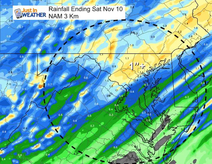
Rainfall Potential
1 inch or more near and on the north/west side of Baltimore. Less rain will fall to the south.
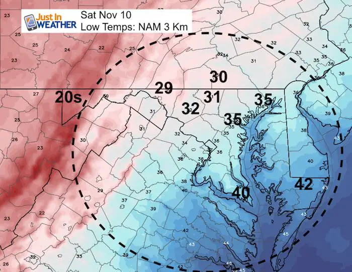
Low Temperatures Saturday
This will set up a chilly day. Afternoon temps will be in the upper 30s to lower 40s. Winch Chills stay in the 30s into the afternoon.
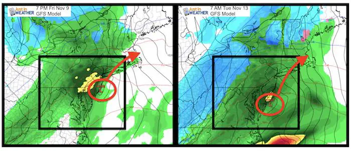
Storm Animation
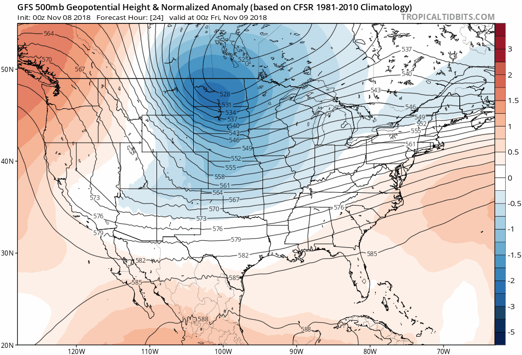
The next event will be on Tuesday. It will display a Low Pressure in a similar location… Colder air will spill in with the chance of snow showers Tuesday.
Jet Stream Outlook
The pattern is looking a bit more like winter through Thanksgiving Week
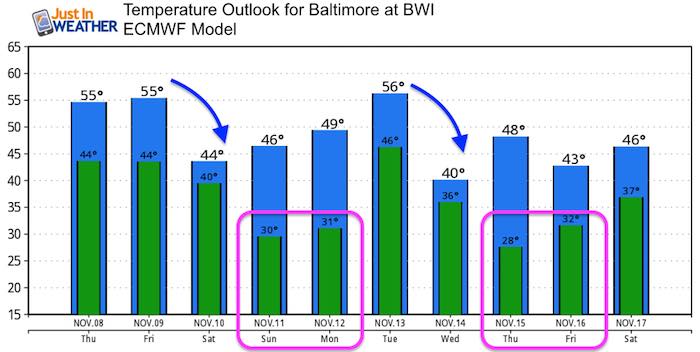
Temperature Outlook
Winter Outlook
My Winter Outlook 2018-19: Multiple Nor’Easters and more snow

Related Winter Outlooks
Solar Cycle: When Sun Spots Are Low We Get More Snow
El Nino Modoki May Enhance Snow Chances
Sweet Spot: Hitting 70ºF on Halloween is followed by more winter snow
Will A Wet Summer Bring A Snowy Winter?
NOAA Winter 2018-2019 Outlook Explained: This Actually Supports Snow
Winter Outlook From Two Different Farmers Almanacs
Cold Stuff
Normal First Frost/Freeze Dates
FITF and SnowStix Stores are now OPEN

Snowstix- We Need You To Measure Snow Too
We are giving 10% of each sale to Just In Power Kids: Providing FREE holistic care for pediatric oncology patients.

Keep In Touch Every Day
Click here to sign up for email alerts…. Just in case you don’t get the post on your social media feed
Please share your thoughts, best weather pics/video, or just keep in touch via social media
-
Facebook: Justin Berk, Meteorologist
-
Twitter: @JustinWeather
-
Instagram: justinweather