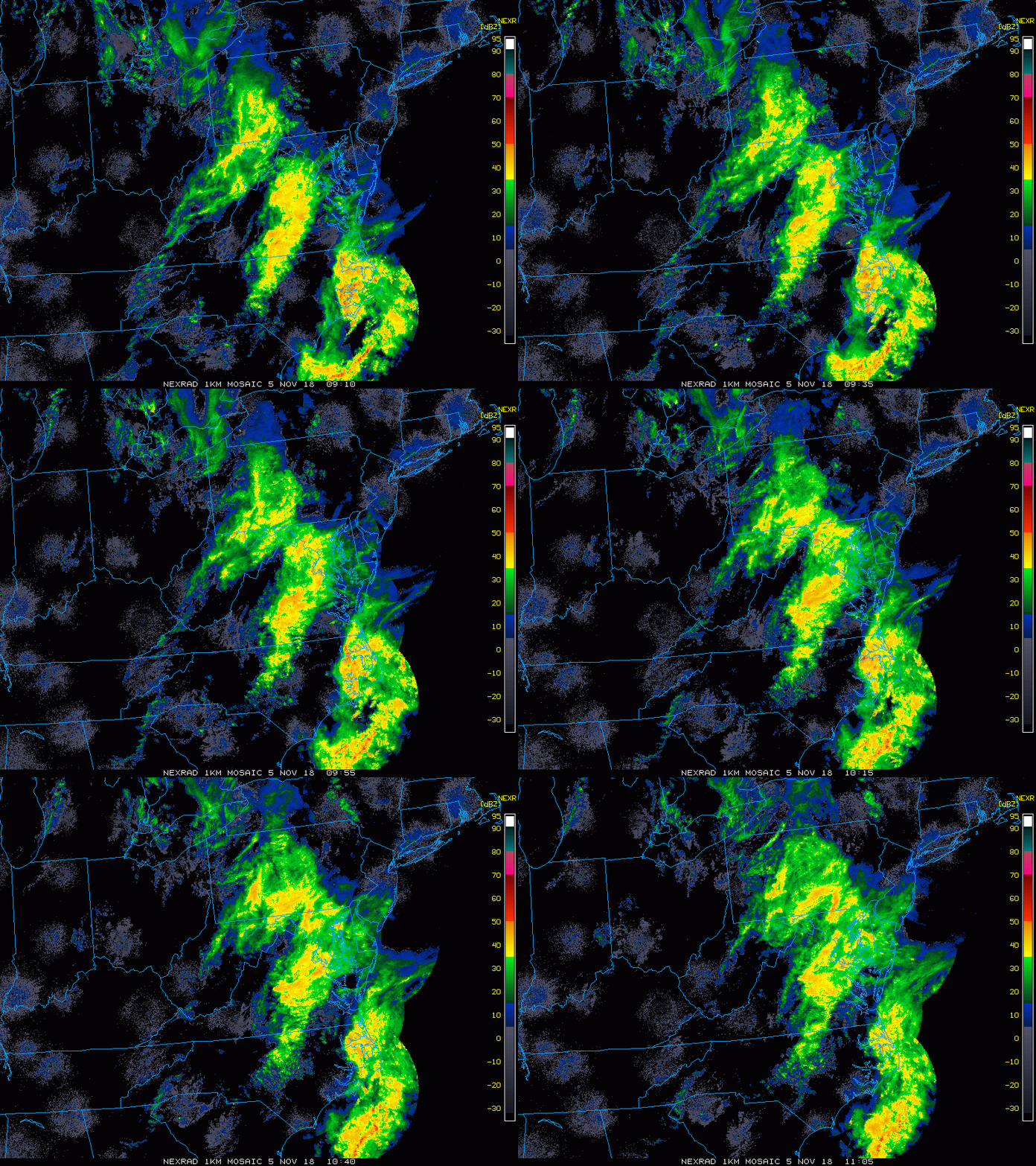
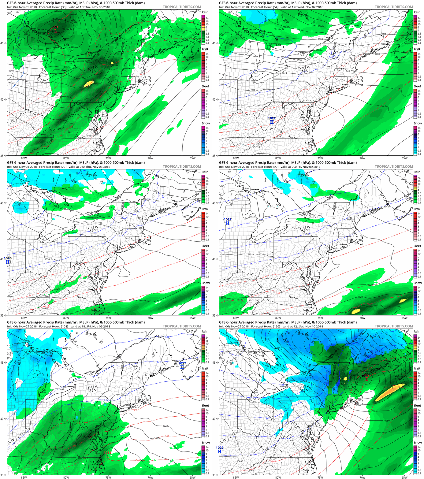
 November 5 2018
This Monday starts off with rain and yet another storm following the path of Hurricane Micheal. I just needed to point out the reinforcement of the atmospheric memory and storm track. It’s a pattern we are in and likely to carry over into winter when things can get fun. For now it is just another rainy day and it will be heavy this morning. There is a chance for local flooding in heavy downpours
Not to this Monday any ore profoundly, but this is the last day of the year with sunset at 5 PM.
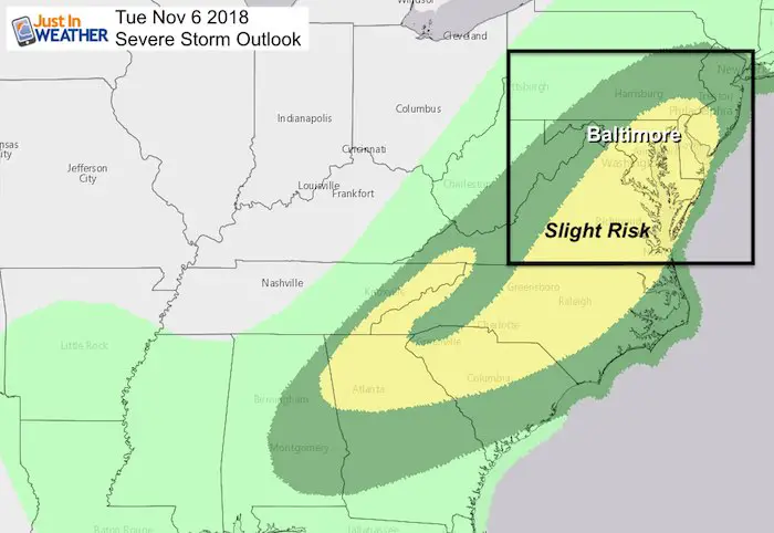
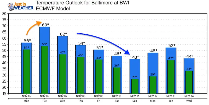
Another system, will follow with a strong cold front and potential for severe storms in the middle of Election Day. That will be the warmest day of the week as very cold air wil be moving in and truly setting in this weekend. Here is the latest rain timeline.
Local Weather Stats For November 5 in Baltimore
Average High: 61ºF
Record High: 83ºF in 1961
Average Low: 39ºF
Record Low: 24ºF in 1998
Sunrise: 6:38 AM
Sunset 5:00 PM
*Daylight = 2:15 shorter than yesterday
*Bay Water Temperature = 60ºF at Thomas Pt. Light House
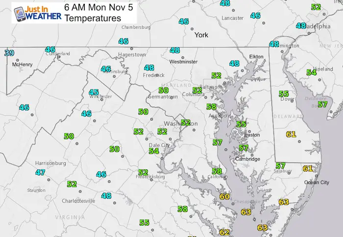
Morning Snapshot
Temperatures
Radar Loop- 2 Hours ending at 6:05 AM
Radar Simulation Monday—> slider
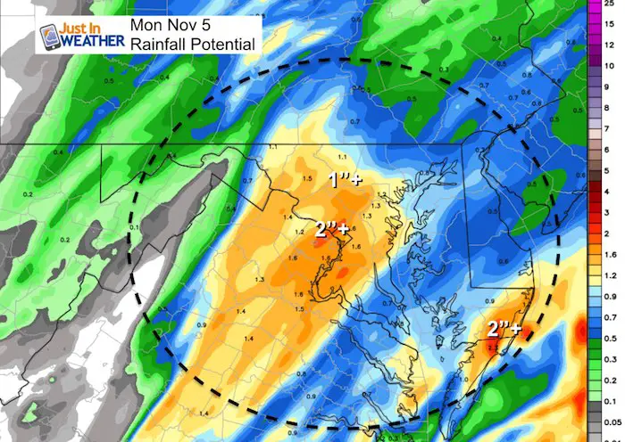
There is a chance for local flooding in heavy downpours
[metaslider id=67863]
Rainfall Potential Today
There is a chance for local flooding in heavy downpours
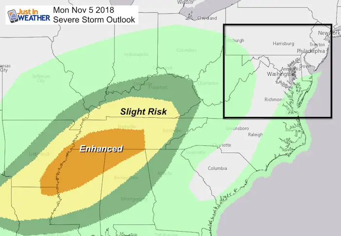
Severe Storm Potential
Storms today will be in the lower Mississippi River Valley… That is what will spread our way tomorrow.
Tuesday Severe Storm Potential
Radar Simulation Tuesday—> slider
[metaslider id=67843]
Storm Animation
The next event will be Friday but then clear out for a much colder weekend. The chance of snow appears to be limited to the mountains and well north. But it will turn very chilly.
Temperature Outlook
Also See:
Two Tornadoes Confirmed in central Maryland from Fri Nov 2 Storms
Winter Outlooks
Sweet Spot: Hitting 70ºF on Halloween is followed by more winter snow
Solar Cycle: When Sun Spots Are Low We Get More Snow
Will A Wet Summer Bring A Snowy Winter?
El Nino Modoki May Enhance Snow Chances
Winter Outlook From Two Different Farmers Almanacs
NOAA Winter 2018-2019 Outlook Explained: This Actually Supports Snow
Cold Stuff
Normal First Frost/Freeze Dates
Maryland Winters: Snowfall by region and records
FITF and SnowStix Stores are now OPEN
Snowstix- We Need You To Measure Snow Too
We are giving 10% of each sale to Just In Power Kids: Providing FREE holistic care for pediatric oncology patients.
Keep In Touch Every Day
Click here to sign up for email alerts…. Just in case you don’t get the post on your social media feed
Please share your thoughts, best weather pics/video, or just keep in touch via social media
-
Facebook: Justin Berk, Meteorologist
-
Twitter: @JustinWeather
-
Instagram: justinweather

