 November 4 2018
Today will be a sunny Sunday and a nice break between the severe storms that passed and another round on the way. Nice weather timed out great for the Bay Bridge 10K and the Ravens game against the Steelers. The benefit of sunshine today may also highlight the return to Standard Time with sunset just after 5 PM. Then we have an abrupt change back to rain Monday morning and a risk for severe storms on Tuesday Election Day.
Local Weather Stats For November 4 in Baltimore
Average High: 61ºF
Record High: 83ºF in 1997
Average Low: 40ºF
Record Low: 22ºF in 1951
Sunrise: 6:37 AM
Sunset 5:01 PM
*Daylight = 2:12 shorter than yesterday
*Bay Water Temperature = 57ºF at Thomas Pt. Light House
Keep In Touch Every Day
Click here to sign up for email alerts…. Just in case you don’t get the post on your social media feed
Morning Snapshot
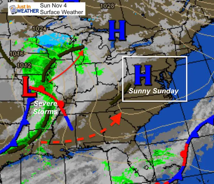
High Pressure will provide us with a Sunny Sunday. But the complex storm to our west will bring strong and severe storms across the central US and into the Ohio Valley. A second piece of energy on the south side will ride a path similar to Hurricane Michael and our last Nor’easter to reaffirm the atmospheric memory. This is something to watch for how it behaves here and potential future winter storm tracks.
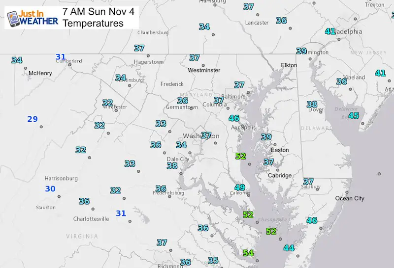
Morning Temperatures
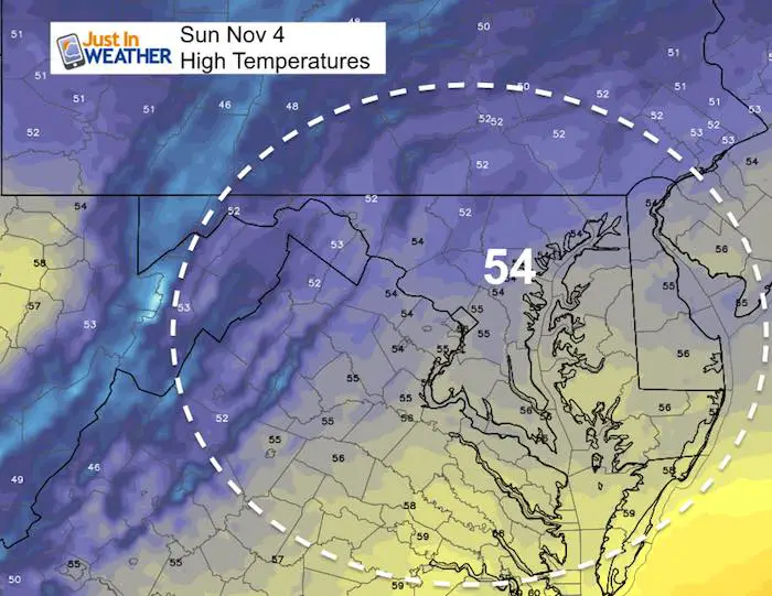
High Temperatures Today
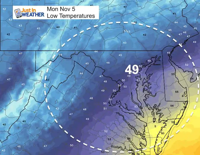
Low Temperatures Monday
Radar Simulation Monday —> slider
Heavy rain and storms are possible during the morning across southern and central Maryland to the Eastern Shore.
[metaslider id=67773]
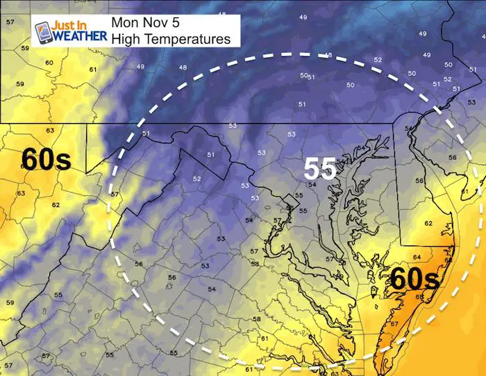
High Temperatures Monday
Notice the push of warm air on the Lower Eastern Shore AND in the mountains. We will get into that as the severe weather approaches Tuesday
Radar Simulation Tuesday —> slider
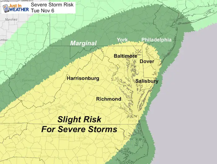
Heavy rain and storms may arrive in the morning just west of Baltimore. The risk for severe storms in central Maryland wil be just after this time frame… Into the early to mid afternoon.
[metaslider id=67794]
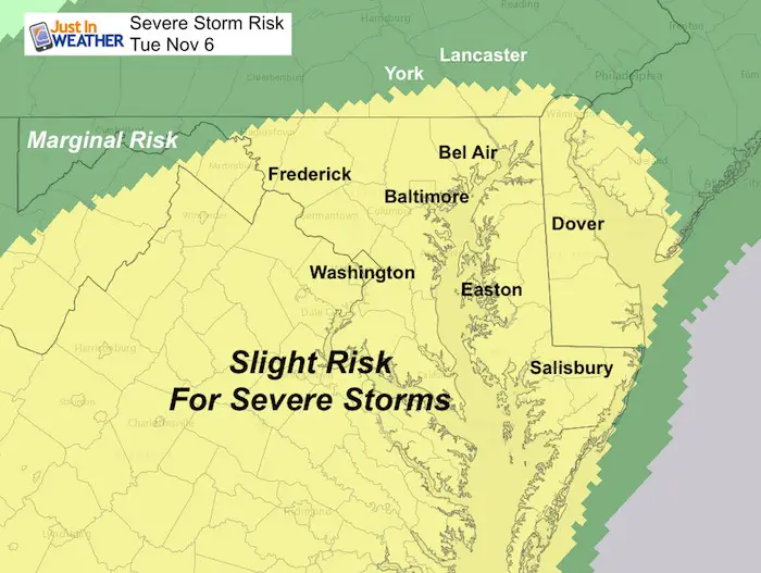
Severe Storm Potential
Storm Animation
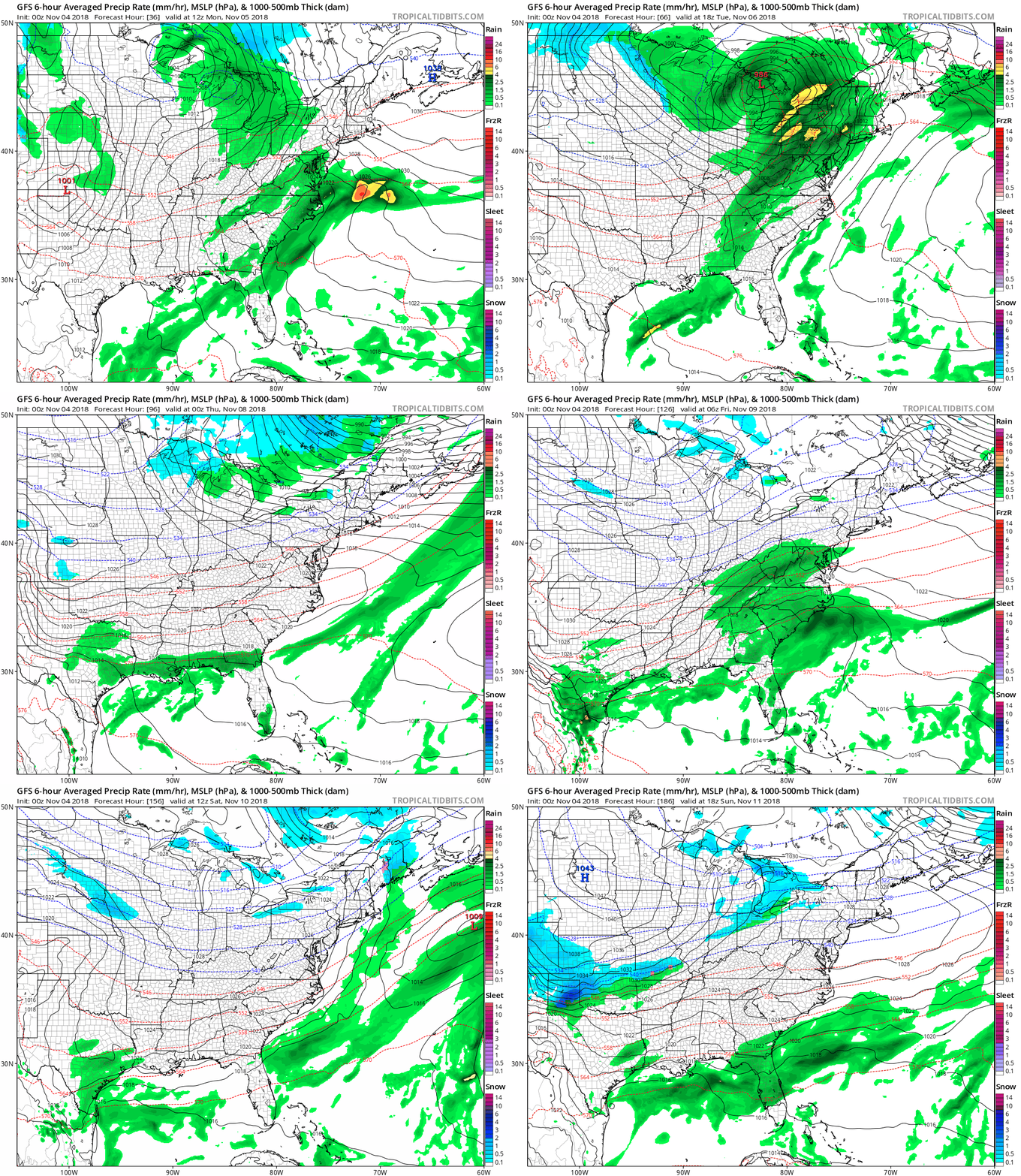
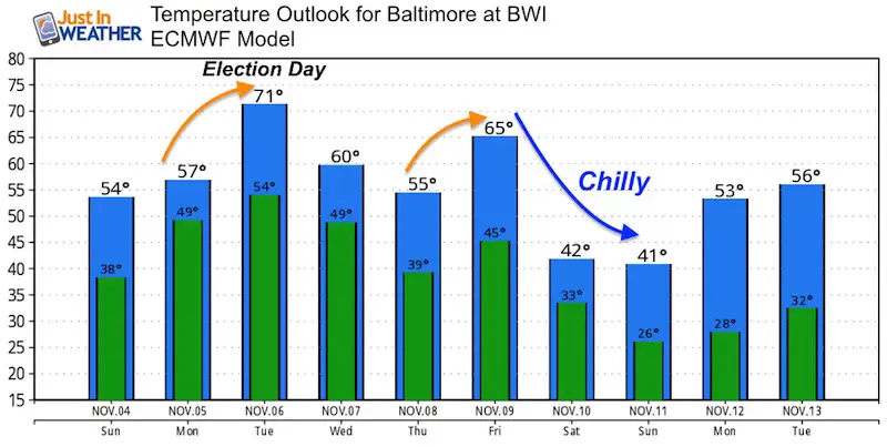
We continue with an active pattern. Rain Today, Storms Tuesday, more rain Friday. Next weekend looks dry, then we watch for a big pattern chance and possibly snow flurries next week.
Temperature Outlook
Also See:
Two Tornadoes Confirmed in central Maryland from Fri Nov 2 Storms
Winter Outlooks
Sweet Spot: Hitting 70ºF on Halloween is followed by more winter snow
Solar Cycle: When Sun Spots Are Low We Get More Snow
Will A Wet Summer Bring A Snowy Winter?
El Nino Modoki May Enhance Snow Chances
Winter Outlook From Two Different Farmers Almanacs
NOAA Winter 2018-2019 Outlook Explained: This Actually Supports Snow
Cold Stuff
Normal First Frost/Freeze Dates
Maryland Winters: Snowfall by region and records
FITF and SnowStix Stores are now OPEN
Snowstix- We Need You To Measure Snow Too
We are giving 10% of each sale to Just In Power Kids: Providing FREE holistic care for pediatric oncology patients.
Keep In Touch Every Day
Click here to sign up for email alerts…. Just in case you don’t get the post on your social media feed
Please share your thoughts, best weather pics/video, or just keep in touch via social media
-
Facebook: Justin Berk, Meteorologist
-
Twitter: @JustinWeather
-
Instagram: justinweather

