Monday September 24 2018
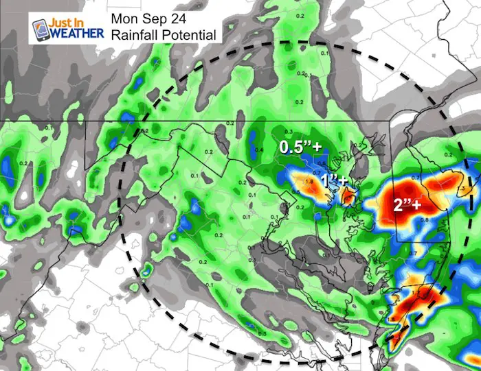
It’s just wet! This morning starts with drizzle and fog for many areas with a northeasterly wind that will increase today. While the pockets of rain are scattered early, we all get back into the steady rain during the day and afternoon. This may seem like nothing new, and you might be wondering about records. After the second most rainy summer (June through August), we may have a chance to challenge the wettest September… but it will be a stretch. As of this morning, Baltimore has had 7.27″ of rain this month. The record was set in 2011 with 13.32″. We need 6.05″ of rain to fall this week to hit that mark and have 7 days to get there.
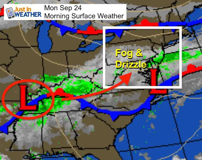
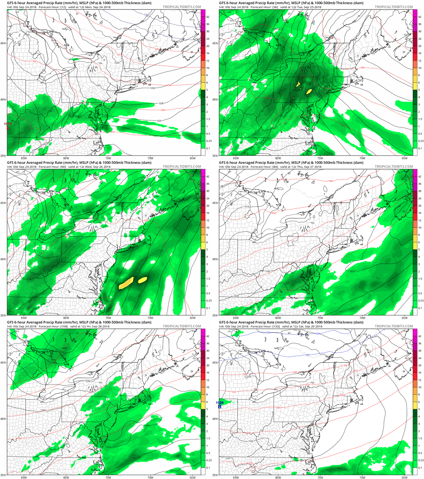
Another area of Low Pressure will move north and increase the steady rain mid day through this evening from south to north. We have more steady rain likely on Tuesday, then Wednesday we get a break in the morning to warm up, but a round of stronger storms in the afternoon. The pattern doesn’t seem to break until Friday afternoon and the weekend. Just hang on a little longer and we should see an improvement. At least October is looking to start dry.
Local Weather Stats For September 24 in Baltimore
*Today is the last day of the year with sunset in the 7 PM hour.
Average High: 75ºF
Record High: 95ºF in 2010
Average Low: 54ºF
Record Low: 40ºF in 1983
Sunrise: 6:55 AM
Sunset 7:00 PM
*Daylight = 2:33 shorter than yesterday
*Bay Water Temperature = 72ºF at Thomas Pt. Light House
*Notes: The ‘equinox’ does not mean equal daylight and darkness, but it is equal around the globe. Due to light bending around the edge of the atmosphere you will see we 12 hour and 6 minutes od daylight today.
We are losing sunlight at the rate of 2:32 each day.
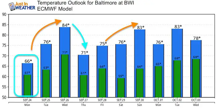
Temperatures are trending a loss of 1ºF every two to three days
Also see:
Winter Outlook From Two Different Farmers Almanacs
Now Scheduling School Assemblies
- Storm Smart – Severe Weather (September, October; March through May)
- FITF – Snow and ice (November through March)
Programs for K through Middle School
Choose flat fee or FREE along with a spirit wear shirt fundraiser that earns your school money.
Morning Set Up
Temperatures
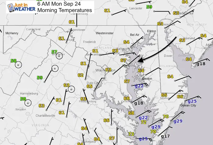
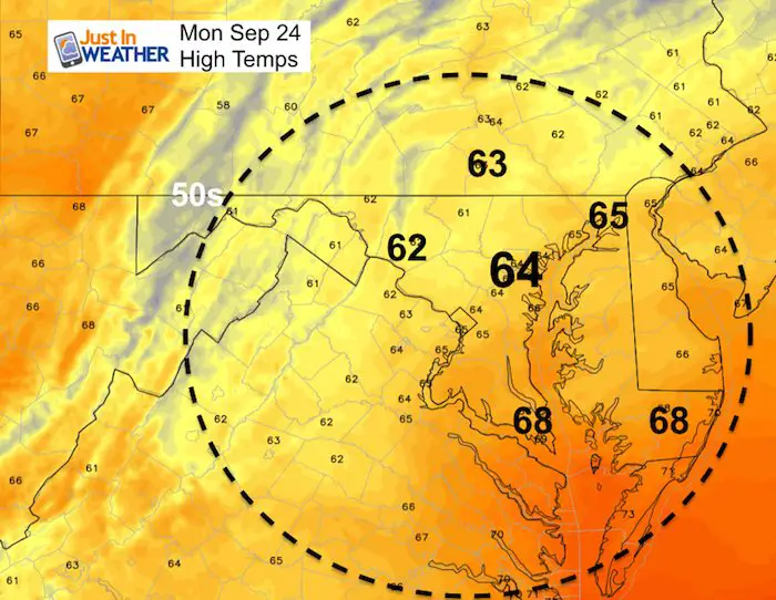
Note the wind direction and speed. The northeast flow is why we remain chilly and damp. The strongest winds are across the lower Chesapeake Bay. As the rain builds in from the south, the winds will increase this afternoon as well.
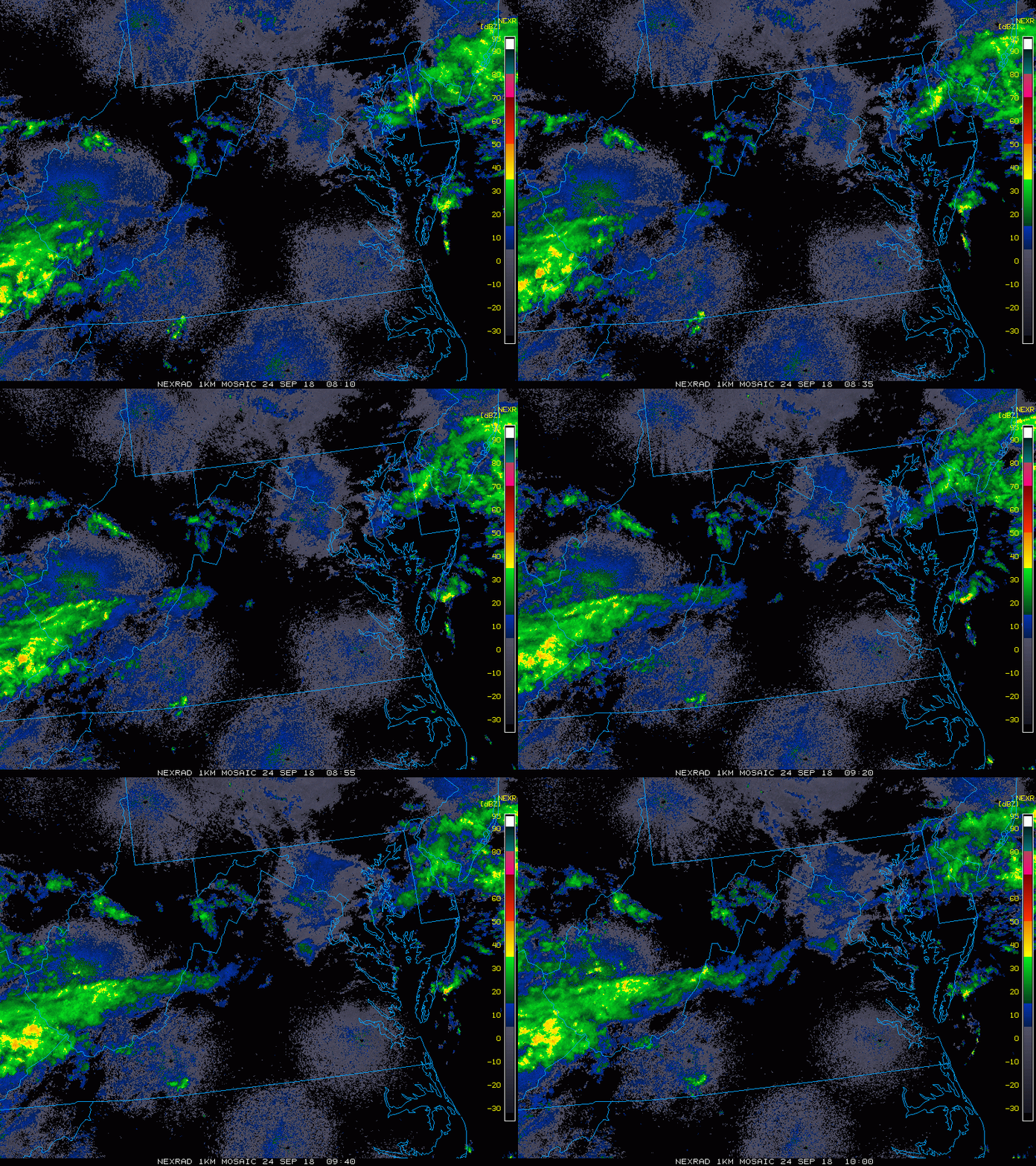
Radar Loop (2 Hours)
Many areas getting drizzle and fog that is not showing up on radar. This loop runs 4 AM to 6 AM.
Radar Simulation —> slider
[metaslider id=66085]
Note: Winds this afternoon will increase 15 to 20 mph with gusts to 25 mph. The may make for some restrictions on area bridges.
Rainfall Potential
High Temperatures
Rain Animation
- Today: Rain
- Tuesday: More Rain
- Wednesday: Dry morning, Strong Storms Afternoon/Evening
- Thursday: Showers return
- Friday: Morning showers, then clearing
- Weekend: Sunny
Temperature Outlook
Keep In Touch Every Day
Click here to sign up for email alerts…. Just in case you don’t get the post on your social media feed
Please share your thoughts, best weather pics/video, or just keep in touch via social media
-
Facebook: Justin Berk, Meteorologist
-
Twitter: @JustinWeather
-
Instagram: justinweather
Love Maryland Shirt Designed By Jaiden

 Get the award winning Kid Weather App I made with my oldest son and support our love for science, weather, and technology. Our 3 year anniversary of the release and our contribution to STEM education is this November. It has been downloaded in 60 countries, and works in both temperature scales. With your support we can expand on the fun introduction to science and real weather.

