Sunday September 23 2018
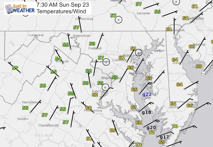
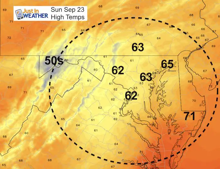
Lat night was the Autumnal Equinox and we are officially in the Fall Season now. It seems like the past few seasons began wet and this is just following the trend. We are on the cold side of a stationary front with a push of Low Pressure sending in rain today. The rain is arriving from the southwest, but the surface winds are from the northeast. This is why we are so chilly and may struggle to move out of the lower 60s.
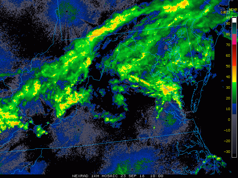
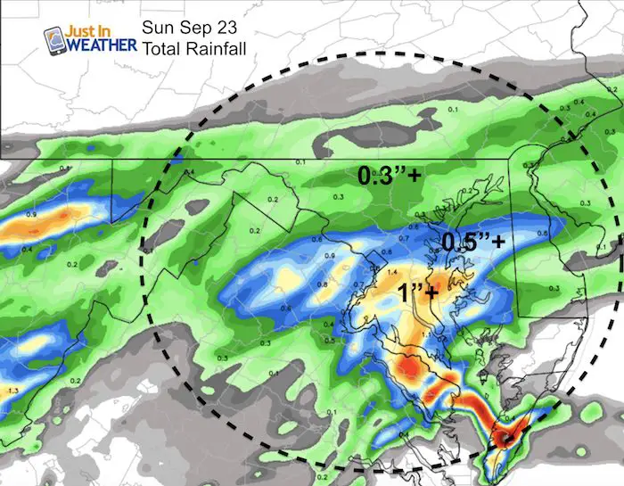
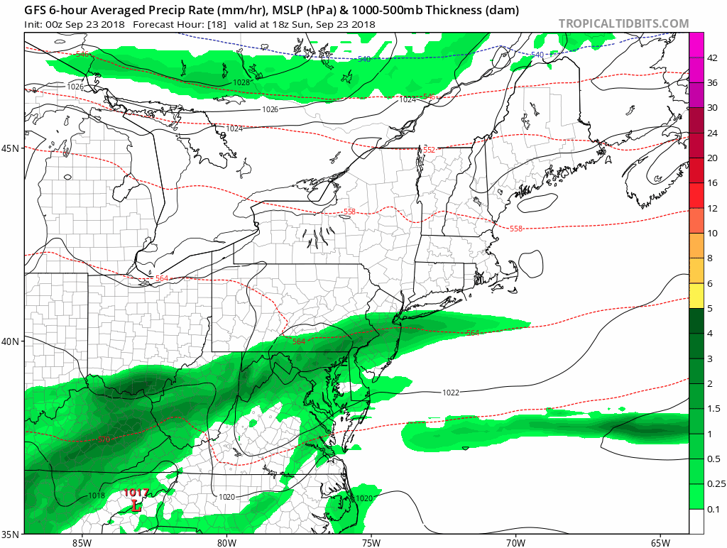
The rain today should be heavier south of Baltimore, but we all stay damp. Below is a look at the morning radar and simulation through the day. The forecast for the upcoming week shows more rain Monday and then a shift to showers mid week, meaning dry hours at time. The pattern should break for us late Friday and next weekend should be better.
Local Weather Stats For September 23 in Baltimore
Average High: 75ºF
Record High: 98ºF in 1970
Average Low: 55ºF
Record Low: 40ºF in 1983
Sunrise: 6:55 AM
Sunset 7:01 PM
*Daylight = 2:32 shorter than yesterday
*Bay Water Temperature = 73ºF at Thomas Pt. Light House
*Notes: The ‘equinox’ does not mean equal daylight and darkness, but it is equal around the globe. Due to light bending around the edge of the atmosphere you will see we 12 hour and 6 minutes od daylight today.
We are losing sunlight at the rate of 2:32 each day.
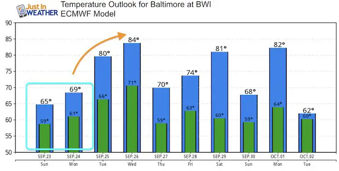
Temperatures are trending a loss of 1ºF every two to three days
Also see:
Winter Outlook From Two Different Farmers Almanacs
Now Scheduling School Assemblies
- Storm Smart – Severe Weather (September, October; March through May)
- FITF – Snow and ice (November through March)
Programs for K through Middle School
Choose flat fee or FREE along with a spirit wear shirt fundraiser that earns your school money.
This morning….
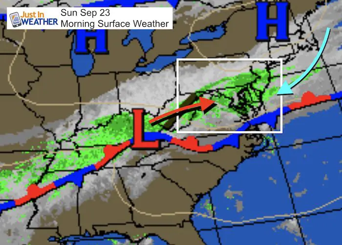
Surface Weather
This is the front staled just to our south. We are on the cooler side and the heavier rain will be closer to the front south of Baltimore.
Morning Radar Loop
Radar Simulation —> slider
[metaslider id=66057]
Rain Total (Suggestion)
High Temperatures
Looking Ahead….
The front will try to move north Monday with another batch of steady rain. As it moves north, we will get into warmer air and break the steady rain into showers Tuesday. The timing of the next front will determine if we can break this pattern Thursday or Friday… But next weekend is looking much better.
Animation
Temperature Outlook
Keep In Touch Every Day
Click here to sign up for email alerts…. Just in case you don’t get the post on your social media feed
Please share your thoughts, best weather pics/video, or just keep in touch via social media
-
Facebook: Justin Berk, Meteorologist
-
Twitter: @JustinWeather
-
Instagram: justinweather
Love Maryland Shirt Designed By Jaiden
 |
|
This shirt was designed by my ‘bonus’ daughter Jaiden. All proceeds will go to Just In Power Kids and free holistic therapy for kids in and post cancer treatment.
Show your love for Maryland and make this 14 year old artist extra proud
|
![]()
 Get the award winning Kid Weather App I made with my oldest son and support our love for science, weather, and technology. Our 3 year anniversary of the release and our contribution to STEM education is this November. It has been downloaded in 60 countries, and works in both temperature scales. With your support we can expand on the fun introduction to science and real weather.