Saturday September 15 2018
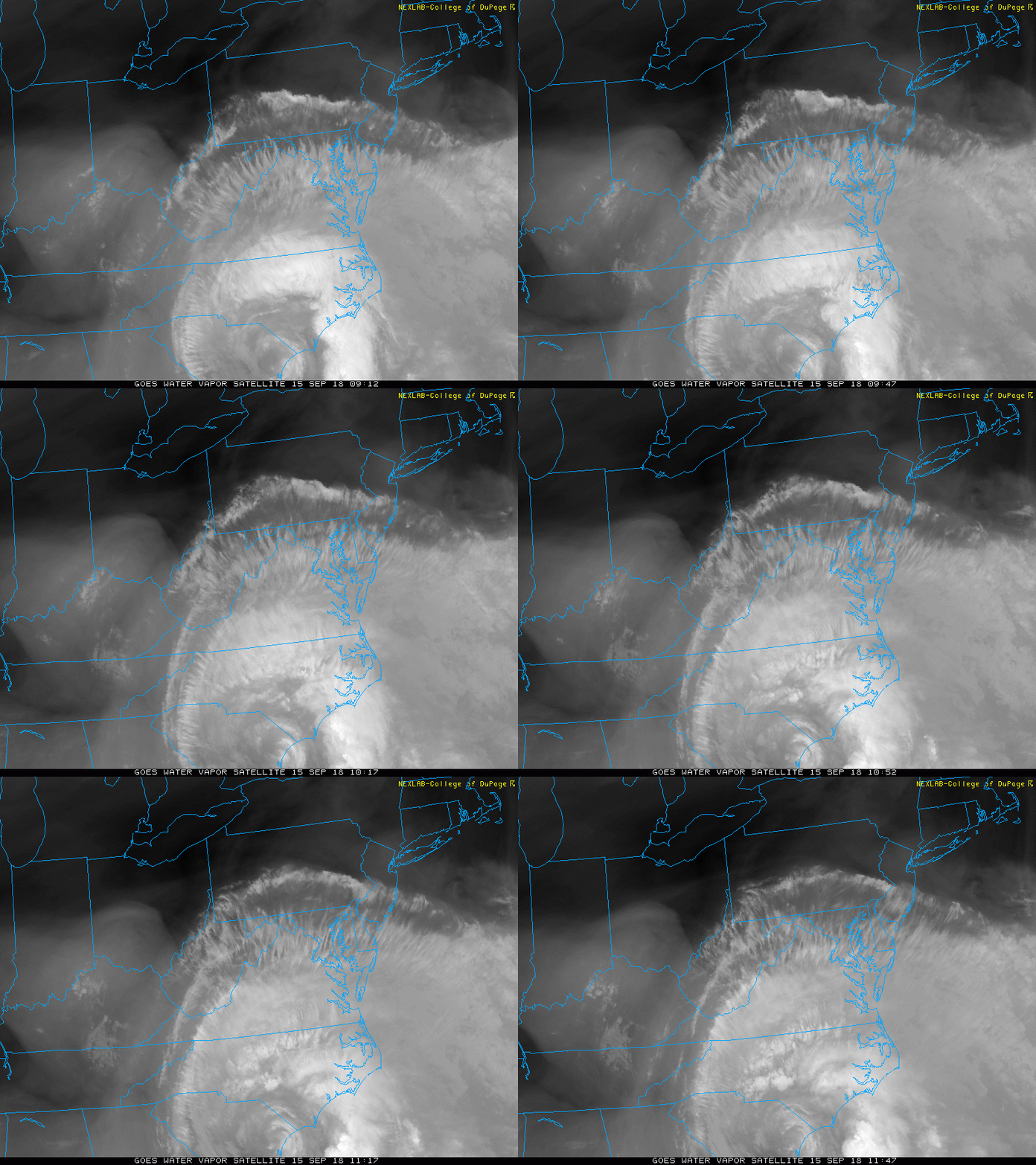
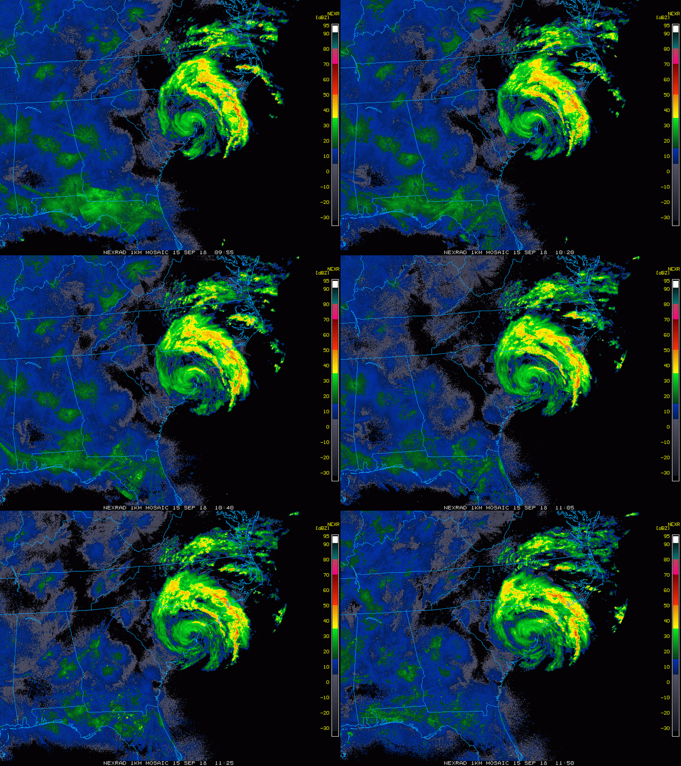
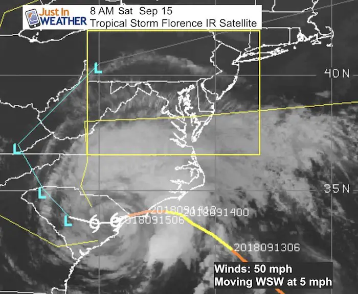
Tropical Storm Florence is located west of Myrtle Beach in South Carolina this morning but the wind flow continues to pump the heaviest rain and ocean water into North Carolina. As the storm crawls and hits the same areas today, we are watching some dry air try to erode away the clouds on the north side. Yes, some parts of our area will get sun today making for the nicer weather I suggested this weekend.
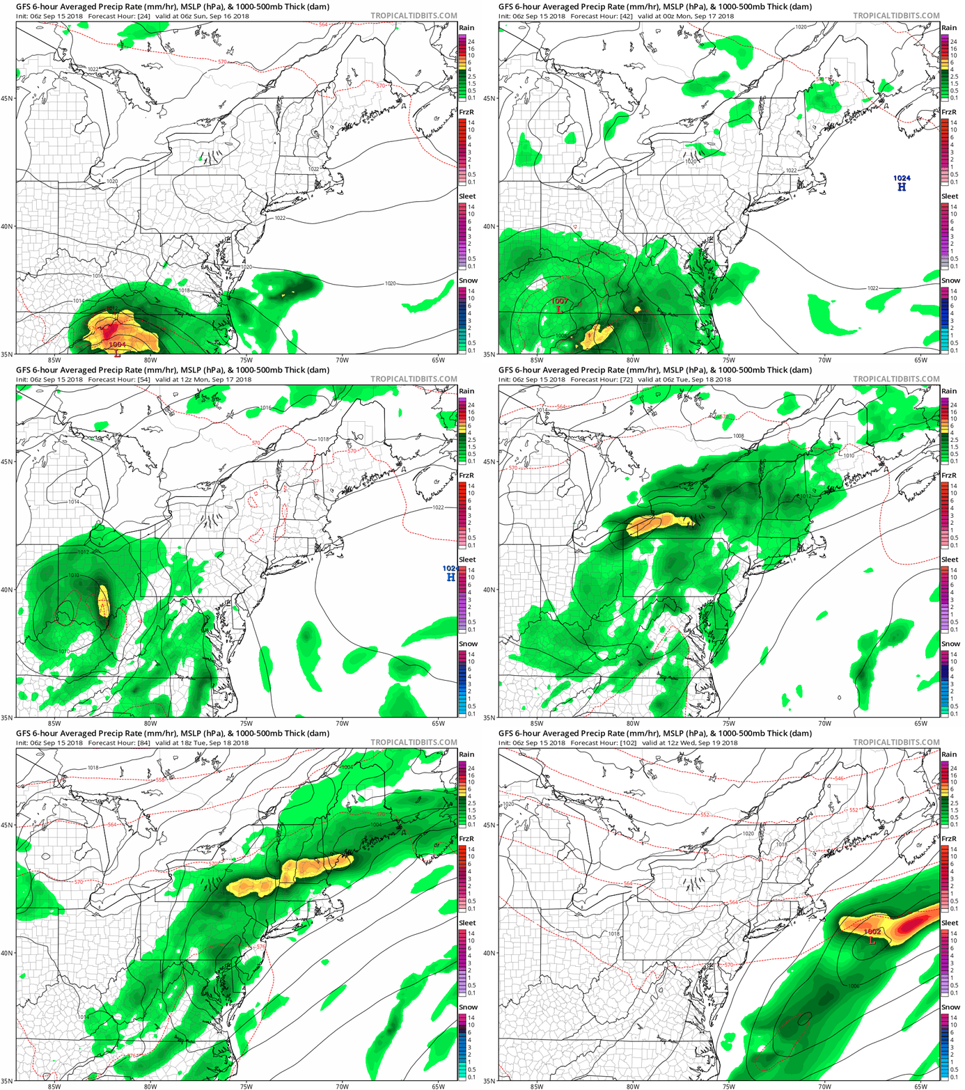
We are still watching the forecast curve Florence back around to bring us rain Monday and Tuesday. The long rang outlook shows a cool down and pattern change with a hint of autumn coming our way.
Local Weather Stats For September 15 in Baltimore
Average High: 78ºF
Record High: 97ºF in 1927
Average Low: 58ºF
Record Low: 40ºF in 1873
Sunrise: 6:47 AM
Sunset 7:14 PM
*Daylight = 2:32 shorter than yesterday
*Bay Water Temperature = 75ºF at Thomas Pt. Light House
Also see:
Winter Outlook From Two Different Farmers Almanacs
Video of Hurricane Hunter flying into the Eye and first call for track shifting
Wind and Storm Surge Expectations
Hurricane Florence Satellite Loop
Local Cloud Forecast –> slider
This is a product from the HRRR Mode showing the dry air trying to filter in from the north. The sky should turn partly to mostly sunny in southern PA and I expect sun to break between the clouds in central Maryland and northern Delaware.
[metaslider id=65748]
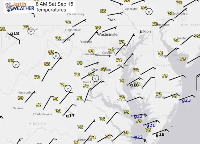
Local Winds
The dry air is filtering on NE winds, but they are relatively light. The strongest winds on in southern Maryland and Southeast VA with gusts over 20 mph.
Hurricane Florence Radar Loop
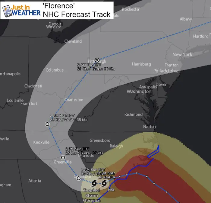
The National Hurricane Center forecast does continue to show the drift to the west and then curving up the Appalachians. This will bring rain our way Monday and Tuesday
Local Rain Expectation
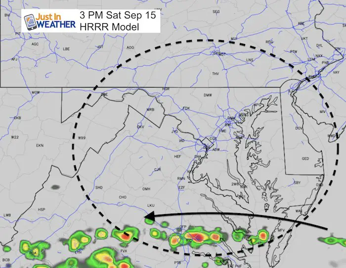
This afternoon
The Northern band of Florence is accepted to be in southern Virginia.
Sunday Evening
The rain begins to show a push to the north into the mountains of West Virginia and showers in western Maryland.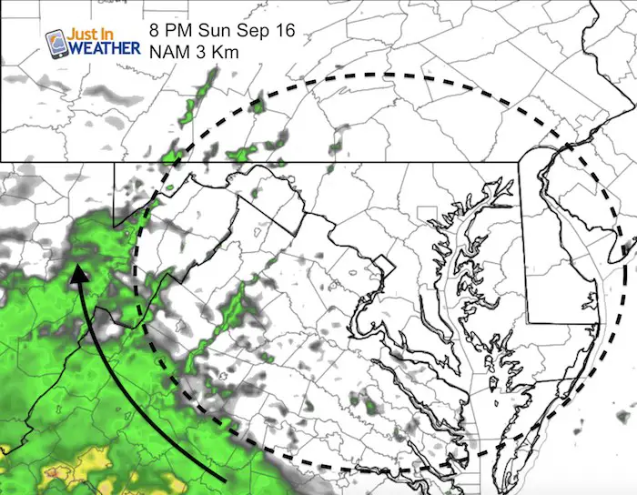
Monday Morning
Rainfall should be back onto central Maryland with more on the way. Our rain from Florence will last two days with the heaviest on Tuesday
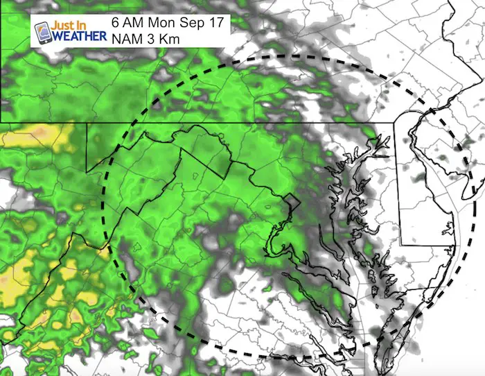
Rain Animation
The remnant Low of Florence will pass to our north. We will get some heavy downpours and a small chance of severe storms Tuesday evening.
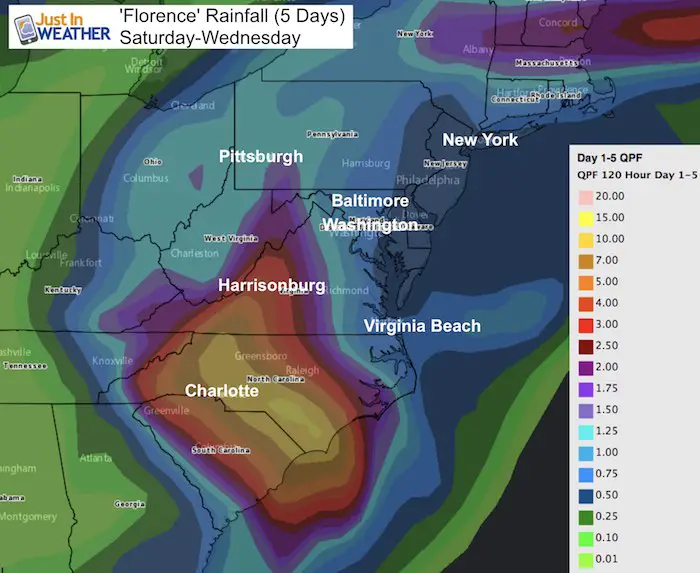
Rain Forecast (5 Days)
Much of our area is in for 0.50 to over 1 inch in the mountains. The bulk of this will be Monday and Tuesday in Maryland and PA
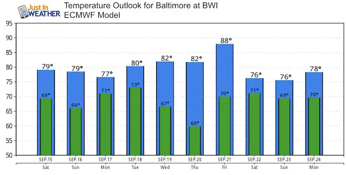
Temperature Outlook
The next sign of a pattern change will be next weekend. The longer range jet stream looks like we get into the cool stuff for the last week of September. But first we need Florence to depart.
Keep In Touch Every Day
Click here to sign up for email alerts…. Just in case you don’t get the post on your social media feed
Please share your thoughts, best weather pics/video, or just keep in touch via social media
-
Facebook: Justin Berk, Meteorologist
-
Twitter: @JustinWeather
-
Instagram: justinweather
Love Maryland Shirt Designed By Jaiden
Now Scheduling School Assemblies
- Storm Smart – Severe Weather (September, October; March through May)
- FITF – Snow and ice (November through March)
Programs for K through Middle School
Choose flat fee or FREE along with a spirit wear shirt fundraiser that earns your school money.

 Get the award winning Kid Weather App I made with my oldest son and support our love for science, weather, and technology. Our 3 year anniversary of the release and our contribution to STEM education is this November. It has been downloaded in 60 countries, and works in both temperature scales. With your support we can expand on the fun introduction to science and real weather.

