 Thursday September 13 2018
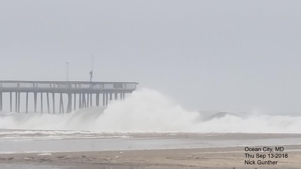
Hurricane Florence may be hundreds of miles away, but the steady east flow has piled up the water in Ocean City, Maryland today. Large waves scraped the fishing pier and the Inlet Parking Lot was flooded. The worst conditions are expected on Friday morning on the north end, and this post will highlight what can be expected in Maryland to start the day.
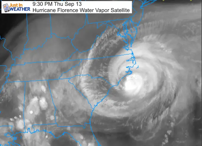
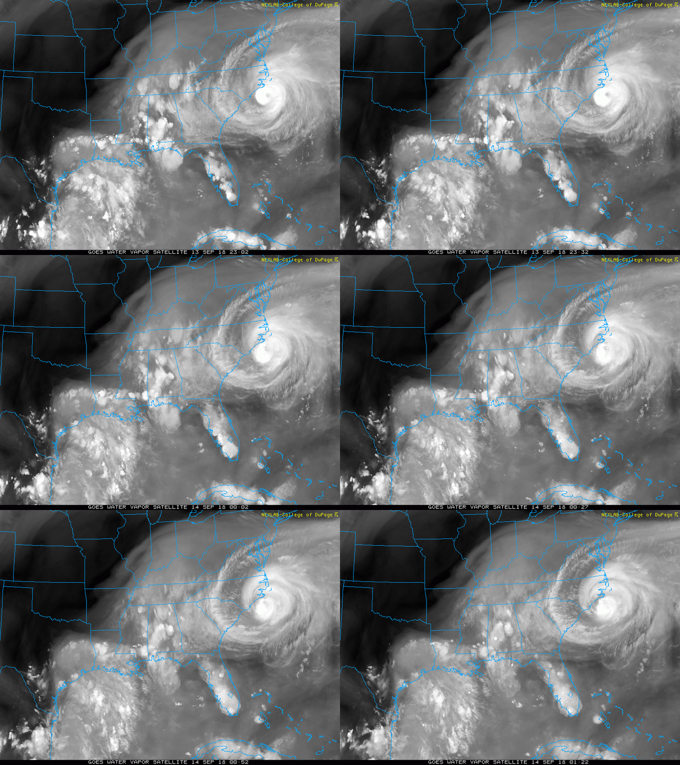
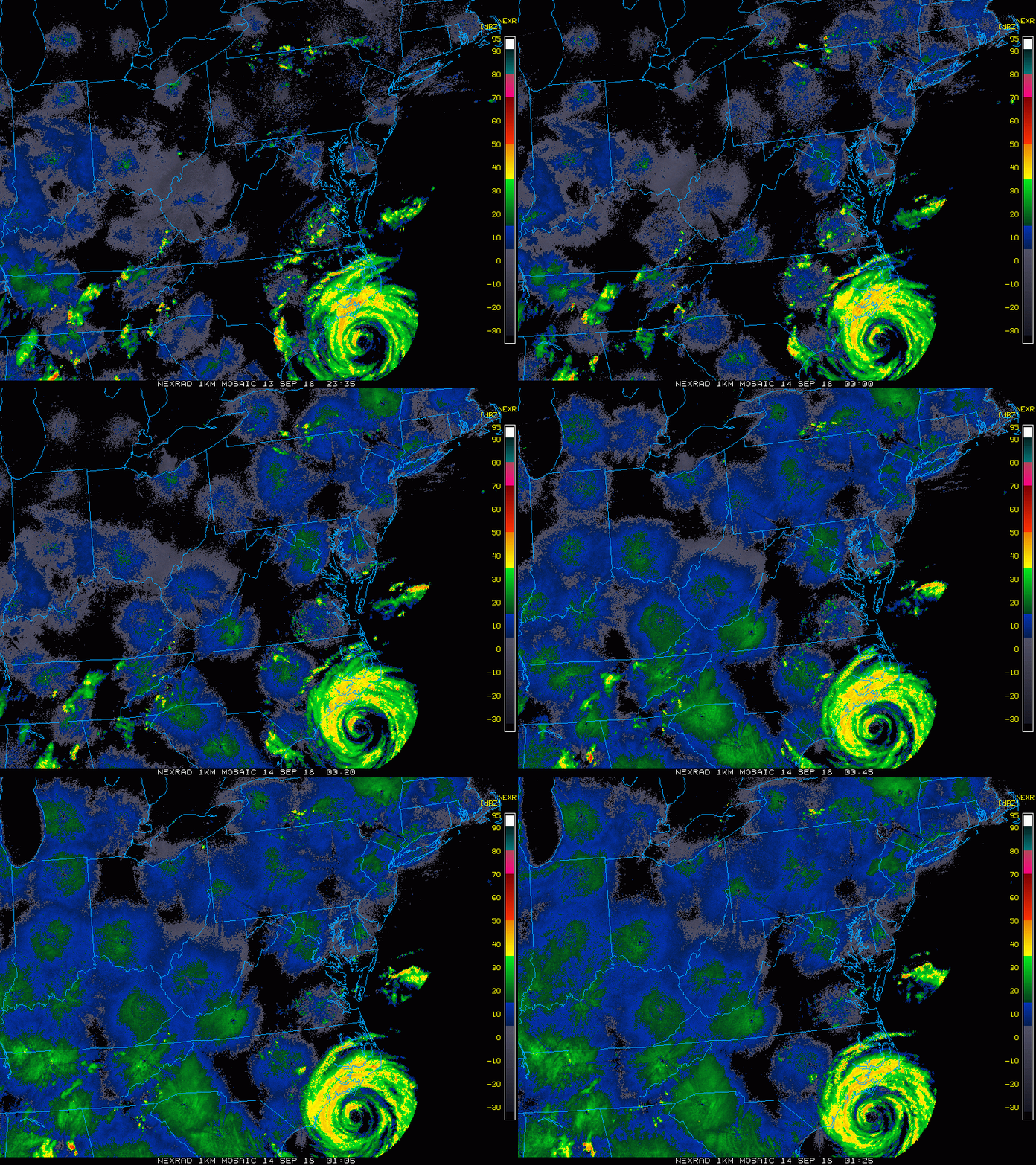
As of the 8 PM Advisory: Hurricane Florence had winds of 100 mph at the 8 PM advisory. That may seem weaker, but every bit of storm surge and flooding rainfall is still expected near landfall in North Carolina. Hurricane force winds still reach 80 miles from the center and tropical storm force winds extend 200 miles away. All of the latest data is being splattered online and on TV. I do have the past two hours of satellite and Doppler Radar looped here. Below, take a look at the latest high resolution models showing how far north the rain and wind reach Friday morning.
Satellite Loop: Florence Clouds Have reached Maryland
2 Hour loop ending 9:22 PM
Radar Loop
2 Hour loop ending 9:25 PM
The eye of Florence was 85 miles from Wilmington and the forward speed slowed to 5 mph. The northern fringe band offshore appears to be within reach of Ocean City. It should reach them before sunrise.
Radar Simulation —> slider For Friday 6 AM to 1 PM
[metaslider id=65668]
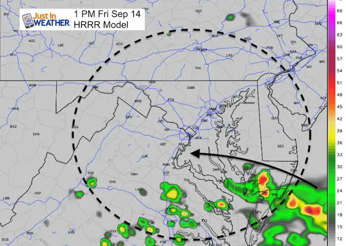
Close Up View At 1 PM
The northern fringe of rain bands should be trying to move across the Lower Eastern Shore.
Some showers may creep north towards the Bay Bridge during the afternoon and evening. I will have a full day outlook in my morning post.
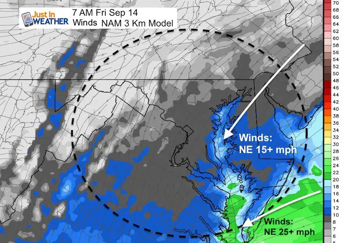
Winds Friday Morning
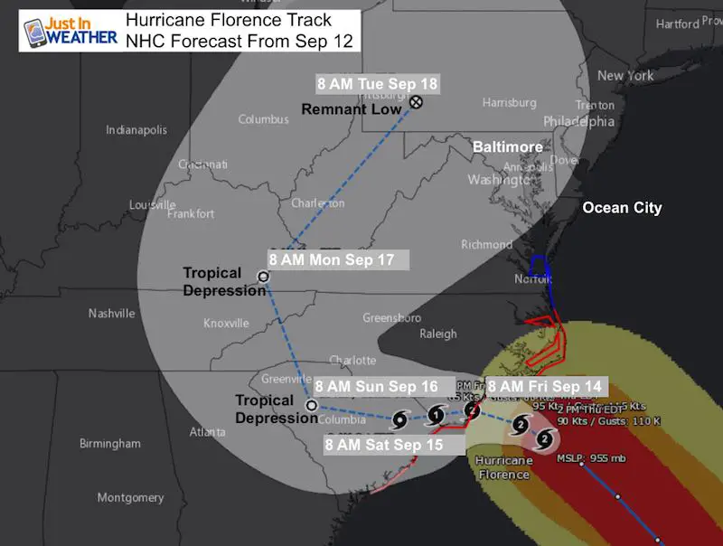
The closest approach of Florence will be around day break Friday. After that, the crawl or drift to the west and southwest will take the influence a little farther away.
Steady Winds:
15 to 25 mph. The direction from the Northeast is important to limit the water entering the Bay. However there will be high water sloshing on the Western Shore. Ocean City and even Delaware beaches will remain with high water from the onshore flow.
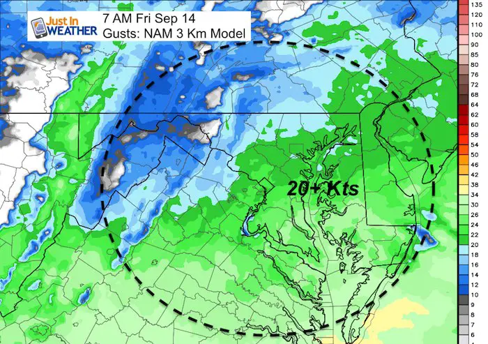
Wind Gusts
These are not expected to be much more than 20 knots. But we can be generous and suggest perhaps up to 30 mph. That may lead to some wind restrictions on the bridges, but not much different than what we would experience in a Nor’easter.
Local Storm Notes
Friday Afternoon and Evening: Best chance of showers will be near but especially south of Baltimore.
Saturday: Best chance of showers will be in the afternoon, mainly southern Maryland and west in the mountains. Nicer weather will reach Southern Pennsylvania and central Maryland much of the day. There could be some late afternoon showers.
Sunday through Tuesday- See my prior post for the chance of rain as the remains of Florence eventually get picked up to the north and provide some rain.
Keep In Touch Every Day
Click here to sign up for email alerts…. Just in case you don’t get the post on your social media feed
Please share your thoughts, best weather pics/video, or just keep in touch via social media
-
Facebook: Justin Berk, Meteorologist
-
Twitter: @JustinWeather
-
Instagram: justinweather
Love Maryland Shirt Designed By Jaiden
Now Scheduling School Assemblies
- Storm Smart – Severe Weather (September, October; March through May)
- FITF – Snow and ice (November through March)
Programs for K through Middle School
Choose flat fee or FREE along with a spirit wear shirt fundraiser that earns your school money.

 Get the award winning Kid Weather App I made with my oldest son and support our love for science, weather, and technology. Our 3 year anniversary of the release and our contribution to STEM education is this November. It has been downloaded in 60 countries, and works in both temperature scales. With your support we can expand on the fun introduction to science and real weather.

