Thursday September 6 2018
There are three main things to highlight this morning. Today will be the last Heat Advisory for our region in this stretch. The weekend will be much cooler with afternoon temperatures in the 60s to lower 70s along with some rain. Then we shift our focus to tracking Hurricane Florence across the Atlantic. I do not think we will have a landfall in the Mid Atlantic, but it is worth watching for coastline concerns.
There is a lot of info, but I have shortened the chatter to get to the important stuff here:
Local Weather Stats For September 6 in Baltimore
Average High: 81ºF
Record High: 98ºF in 1983
Average Low: 61ºF
Record Low: 46ºF in 1962
Sunrise: 6:39 AM
Sunset 7:29 PM
*Daylight = 2:30 shorter than yesterday
*Bay Water Temperature = 84ºF at Thomas Pt. Light House * This is the warmest the water has been all year!
Also see: Winter Outlook From Two Different Farmers Almanacs
Morning Snapshot
Cooler air is on the way with the next front…
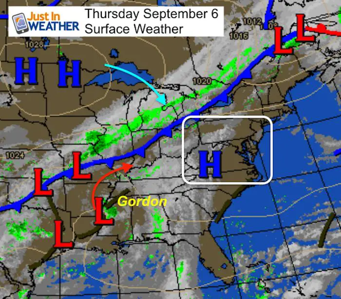
Pattern Change brings lots of rain through next week
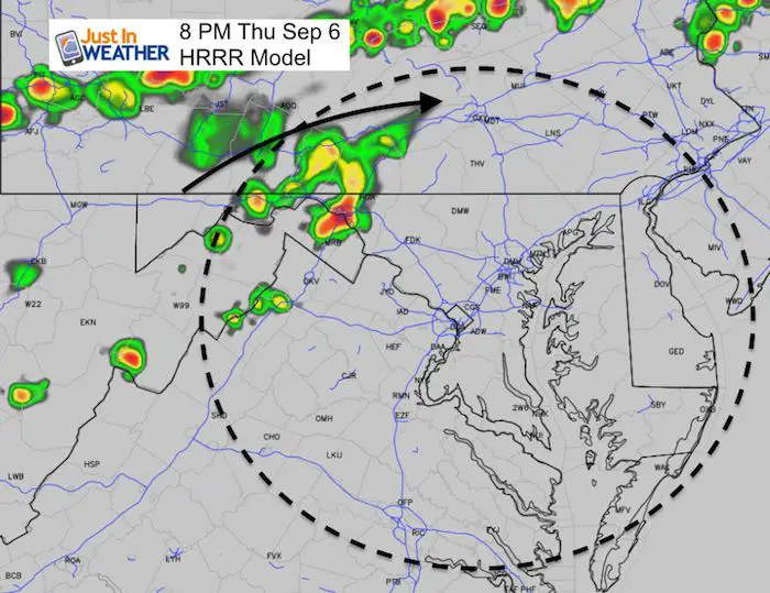
That front may spark some showers, mainly in the mountains by evening
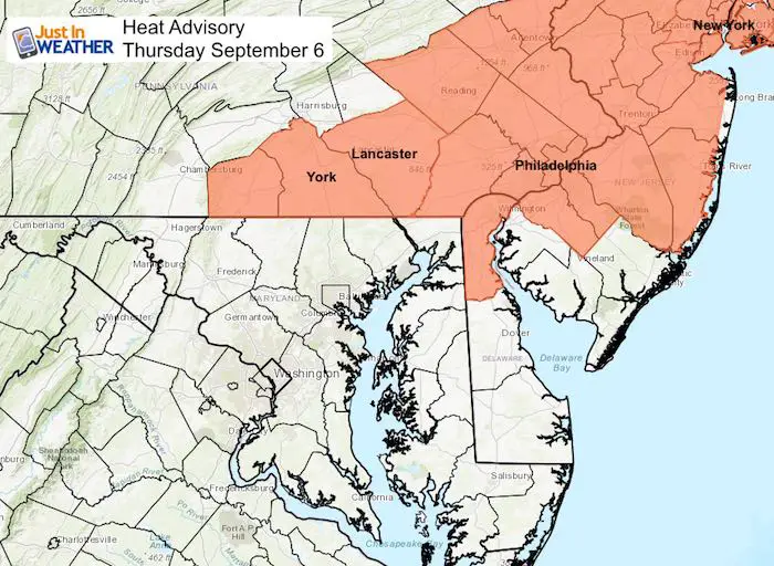
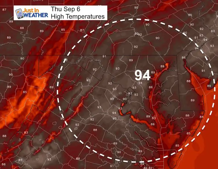
But, we have one last day of heat
Heat Advisory
Afternoon
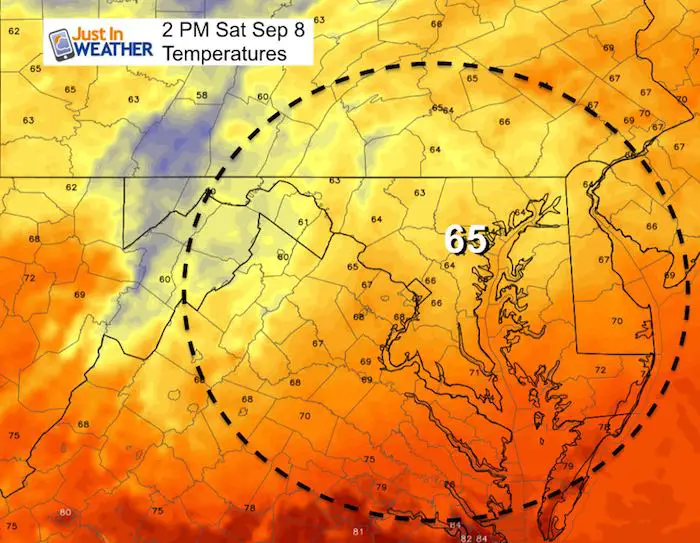
Saturday Temperatures
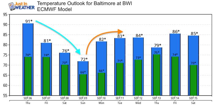
It will feel chilly over the weekend. If we get into the northeast wind AND some rain, we could drop into the 60s during the day
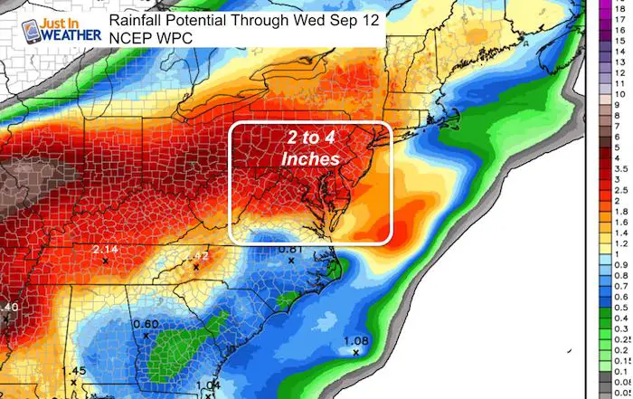
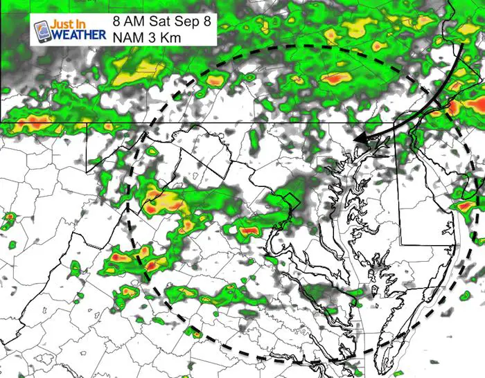
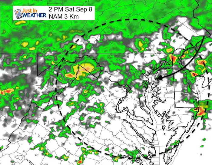
Rainfall Potential
The NAM Model shows rain building from the north in the morning to afternoon. The GFS has a different solution below…
GFS Model Animation
This model has more rain Saturday morning, clearing by evening… But more rain returning for Sunday.

Temperature Outlook
 Get the award winning Kid Weather App I made with my oldest son and support our love for science, weather, and technology. Our 3 year anniversary of the release and our contribution to STEM education is this November. It has been downloaded in 60 countries, and works in both temperature scales. With your support we can expand on the fun introduction to science and real weather.
Hurricane Florence
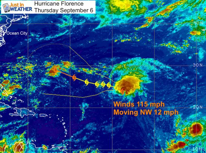
LOCATION...24.1N 47.9W
ABOUT 1060 MI...1705 KM ENE OF THE NORTHERN LEEWARD ISLANDS
ABOUT 1170 MI...1885 KM ESE OF BERMUDA
MAXIMUM SUSTAINED WINDS...115 MPH...185 KM/H
PRESENT MOVEMENT...NW OR 315 DEGREES AT 12 MPH...19 KM/H
MINIMUM CENTRAL PRESSURE...964 MB...28.47 INCHES
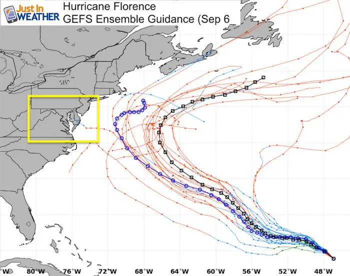
Hurricane Florence Forecast Tracks
There is definitely a climatological curve away from the US in the latest run. There are still many factors that can direct the track of Florence. The progress of the stalled front this weekend and early next week is one of them and we don’t have a firm grip on that yet.
Now Scheduling School Assemblies
- Storm Smart – Severe Weather (September, October; March through May)
- FITF – Snow and ice (November through March)
Programs for K through Middle School
Choose flat fee or FREE along with a spirit wear shirt fundraiser that earns your school money.
Please share your thoughts, best weather pics/video, or just keep in touch via social media
-
Facebook: Justin Berk, Meteorologist
-
Twitter: @JustinWeather
-
Instagram: justinweather
Keep In Touch Every Day
Click here to sign up for email alerts…. Just in case you don’t get the post on your social media feed
Power Partner Just In Power Kids and Maryland Trek 5:

Still Time To Support Just In Power Kids
We are still taking donations for our best Maryland Trek yet. Every penny goes to Just In Power Kids programs to provide FREE holistic care for kids in cancer treatment and up to 5 years post treatment.
![]()