Wednesday August 22 2018
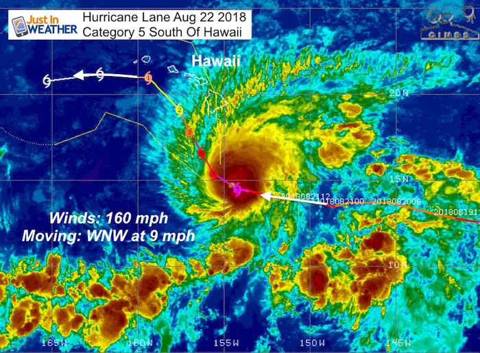
The headline weather story today is extreme super Hurricane Lane on the move towards Hawaii. This Category 5 storm has winds measured at 160 mph with gusts to 195mph. This is the strongest measured storm this close to the island chain in recorded history. Rainfall up to 20 inches is possible as the mountains will help to enhance storm bands. It is a moderate size storm with tropical storm force winds extending 140 miles from the center. The pressure at the center is 930 mb and it is moving to the WNW at 9 mph. Forecast models have this passing just south of the big island and then missing a direct hit over the next few days. Colder waters and wind sheer will help to weaken this storm as it gets close, but high waves and rain bands will impact vacationers.
A Hurricane Warning is in effect for...
* Hawaii County

A Hurricane Watch is in effect for...
* Maui County...including the islands of Maui, Lanai, Molokai and
Kahoolawe
* Oahu
Local Weather
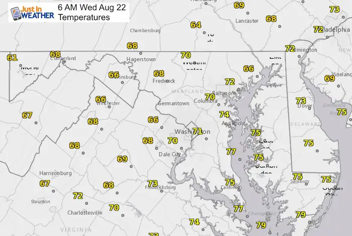
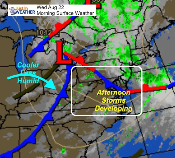
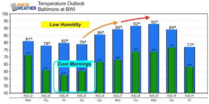
We still have one more day of showers and storms. But the bulk will be shifting to the south and towards Ocean City later this afternoon and evening. Some isolated showers are possible around and north of Baltimore, but cooler and less humid air will be moving in. The next few days will show that for sure as morning temperatures will be in the 50s Thursday and Friday. Next week however we will be back into the lower 90s.
Stats For August 22 in Baltimore
Average High: 85ºF
Record High: 99ºF in 1983
Average Low: 65ºF
Record Low: 52ºF in 1956
Sunrise: 6:25 AM
Sunset 7:52 PM
*Daylight = 2:21 shorter than yesterday
*Bay Water Temperature = 80ºF at Thomas Pt. Light House
Morning Set Up
Radar Simulation —> slider
[metaslider id=64861]
Afternoon High Temperatures
Temperature Outlook
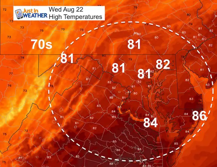
A hint of autumn especially in the mornings starting Thursday and into the start of the weekend. The afternoons will be sunny with low humidity. Then we climb back into the 90s early next week.
 Get the award winning Kid Weather App I made with my oldest son and support our love for science, weather, and technology. Our 3 year anniversary of the release and our contribution to STEM education is this November. It has been downloaded in 60 countries, and works in both temperature scales. With your support we can expand on the fun introduction to science and real weather.
Long Range Outlook
Rainfall will be scarce over the next week. This forecast animation shows our region mostly dry through most of next week.

Power Partner Just In Power Kids and Maryland Trek 5:
Please share your thoughts, best weather pics/video, or just keep in touch via social media
-
Facebook: Justin Berk, Meteorologist
-
Twitter: @JustinWeather
-
Instagram: justinweather
Keep In Touch Every Day
Click here to sign up for email alerts…. Just in case you don’t get the post on your social media feed
Still Time To Support Just In Power Kids
We are still taking donations for our best Maryland Trek yet. Every penny goes to Just In Power Kids programs to provide FREE holistic care for kids in cancer treatment and up to 5 years post treatment.


