 July 24 2018
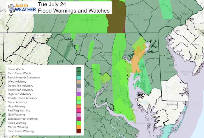
The record rain continues and the local rivers and Chesapeake Bay shorelines are flooding. The heavy persistent rain has been training over the same areas, making for bands of extreme rain within the region-wide soggy mess. Baltimore’s BWI is in one of those zones and easily broke the all time wettest July earlier today. Record rain for this date of July 24 also going to be set!
Here is all the latest info about the rain and flooding. Please take a moment after to see the bottom about Maryland Trek 5. We being a week form Sunday and would love for your support.
As of 11:30 AM, BWI has recorded 2.21″ of rain. That breaks the daily record of 1.73″ set in 1961
Record Rain Numbers: Long Standing Dates
- 13.18″ (10.97″+2.21″ up through 11:30 AM) in 2018
- 11.03″ in 1889
- 10.65″ 1905
- 9.68″ in 1945
- 9.43″ in 1884
It is likely that today will place July 2018 as the second wettest month of all time for Baltimore. The top spot is August 1955 with 18.35″
Flood Stage
Given all of the rain we have received, the flood contentions could be worse… These are the river gauge reporting stations at or approaching flood stage. See each station chart in the slider below.
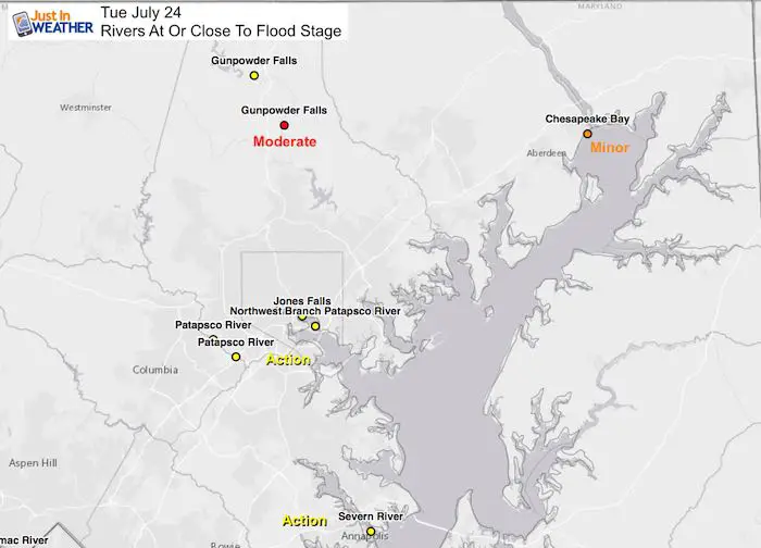
Flood Stage Station Plots —> slider
Note: The forecast plots may not account for the higher rainfall I expect the models are missing. See below.
Patapsco River at Elkridge (near Ellicott City) is only in Action stage now. Their flooding will depend on where the training or banding sets up.
[metaslider id=64318]
The flow has been right up the Chesapeake Bay preventing tides from flowing out. The result has been rising water along many areas from Annapolis to Havre de Grace on the Susquehanna River. The other problem has been too much rain falling down. So flooding has ranged from clogged drains to swelling streams and rivers.
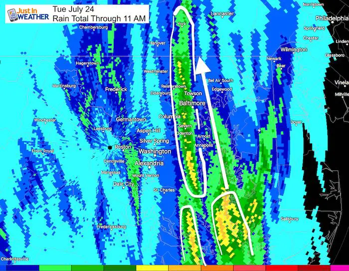
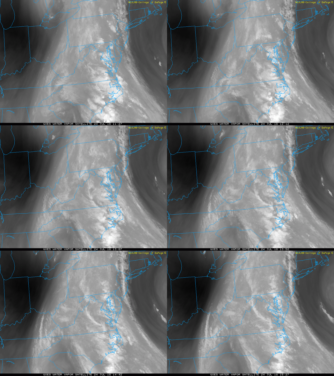
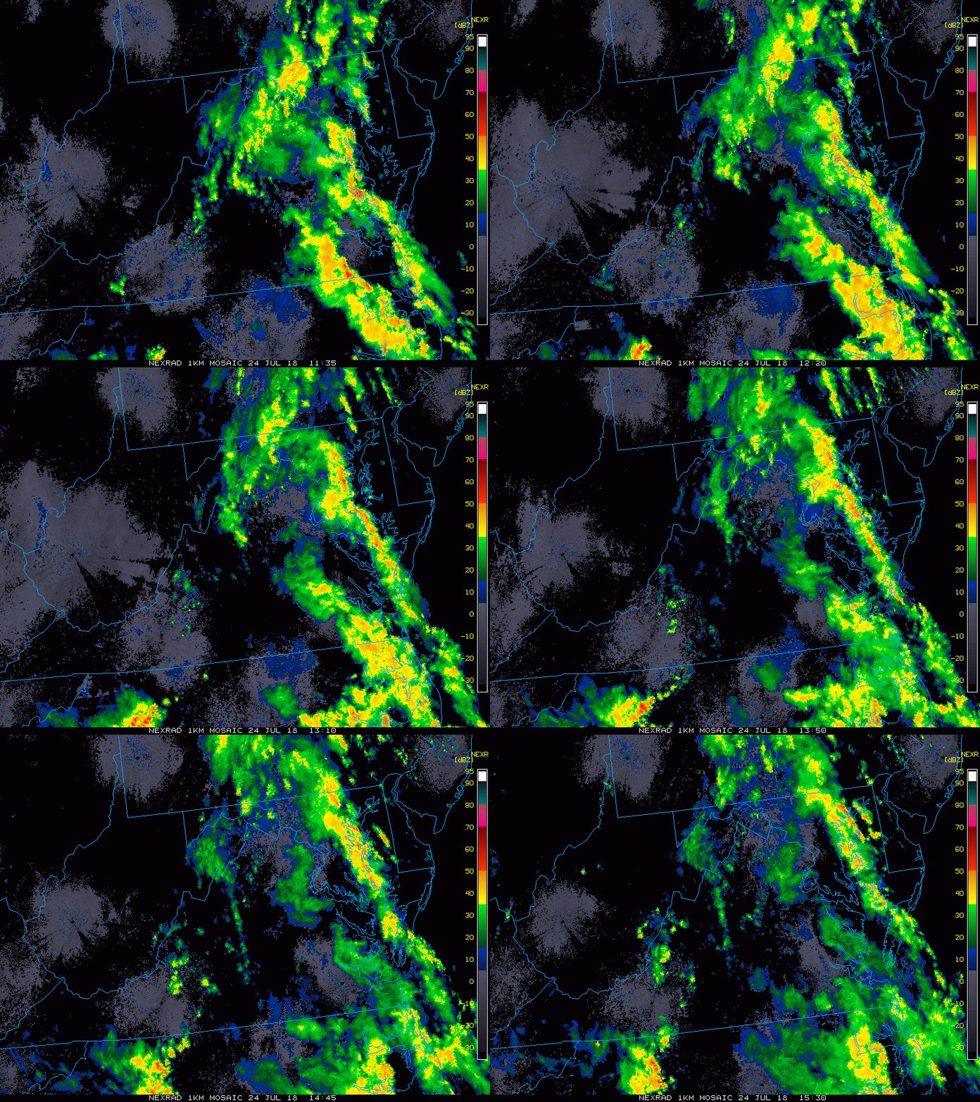
Set Up Shows The Flow Continuing
Satellite Loop
Doppler Radar Loop
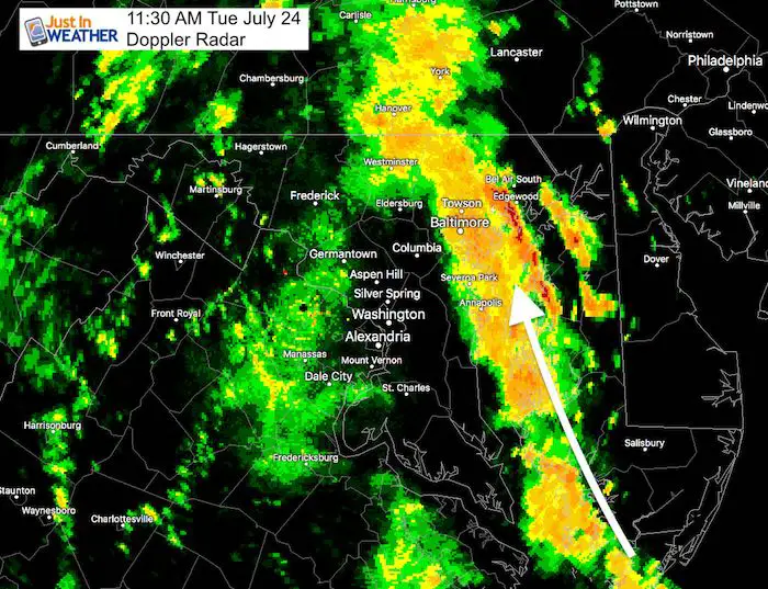
Doppler Radar Snapshot
The intense rain continues to ride up along the Chesapeake Bay adding more moisture to dump in central Maryland and southern PA
Radar Simulation —> slider
The problem is that the computer models have been underestimating the rain. Also having trouble holding these rain bands together. So I would not put too much stock in this forecast plot. Expect more than what is shown
[metaslider id=64289]
Please share your thoughts, best weather pics/video, or just keep in touch via social media
-
Facebook: Justin Berk, Meteorologist
-
Twitter: @JustinWeather
-
Instagram: justinweather
Keep In Touch Every Day
Click here to sign up for email alerts…. Just in case you don’t get the post on your social media feed
Maryland Trek 5 Starts In 2 Weeks
329 miles hiking and biking in 7 days
To provide free integrated wellness programs for kids in and post cancer treatment
Power Sponsor of Maryland Trek 5:
Shine On
Proceeds from all sales go to Just In Power Kids. Click the image to shop and show your support.

 Get the award winning Kid Weather App I made with my oldest son and support our love for science, weather, and technology. Our 3 year anniversary of the release and our contribution to STEM education is this November. It has been downloaded in 60 countries, and works in both temperature scales. With your support we can expand on the fun introduction to science and real weather.

