Wednesday July 25 2018
It is possible that you see some patches of blue sky or even the sun this morning. The tropical pattern is still with us, but it is showing signs of breaking down. The flow of moisture will still come from the south, but shift a little to the southwest. That is subtle but significant in stopping the training of rain bands along the Chesapeake Bay region.
There will be more rain at the beaches this morning and more heavy downpours developing inland this afternoon. Some storms will have heavy downpours and might turn severe. We are not done yet. But, there is a cold front to our west that will help to push this stuff out of here by tomorrow. But it will ignite one more day to track the rain. The good news is that we may get one full rain free day this weekend.
Record Rain Update:
BWI had 4.07″ rain on July 24 setting a new record. That was NOT the wettest July day ever. That spot is still locked in from July 8, 1952 with 5.85 inches in a single day!
Here is the updated list of wettest July months
Record Rain Numbers: Long Standing Dates
- 15.04″ in 2018
- 11.03″ in 1889
- 10.65″ 1905
- 9.68″ in 1945
- 9.43″ in 1884
Stats For July 25 in Baltimore
Check out the record High (2016), and Low (2014)
Average High: 87ºF
Record High: 100ºF in 2016
Average Low: 67ºF
Record Low: 57ºF in 2014
Sunrise: 6:00 AM
Sunset 8:26 PM
*Daylight = 1:42 shorter than yesterday
*Bay Water Temperature = 78ºF at Thomas Pt. Light House
Maryland Trek 5 Starts In 2 Weeks
329 miles hiking and biking in 7 days
To provide free integrated wellness programs for kids in and post cancer treatment
Power Sponsor of Maryland Trek 5:

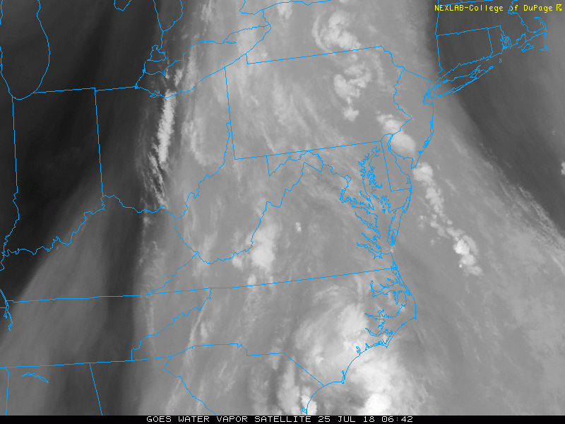
Water Vapor Satellite Loop (4 Hours)
We are still stuck in the tropical flow, but there has been a slight shift from the south to southwest.
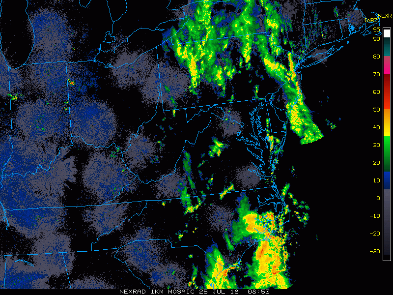
Radar Loop
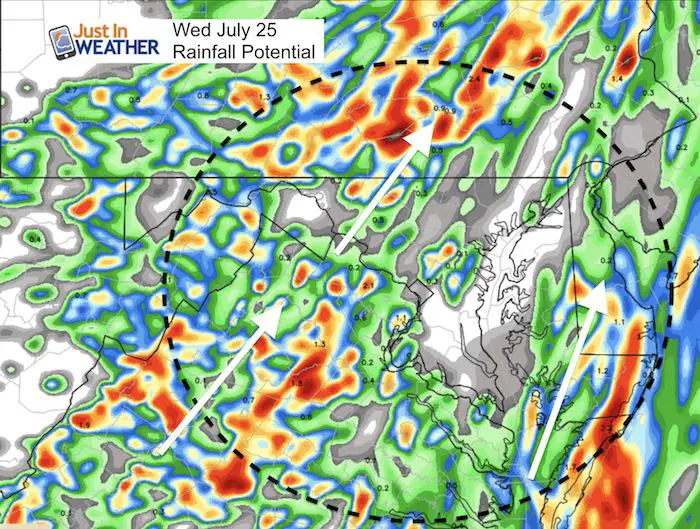
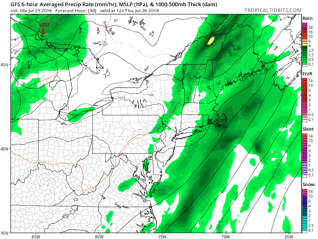
Rainfall Potential Today
The nest way to get a sense of the subtle change today is to look at the rain forecast. The banding here has shifted direction (white arrows), starting to cut off the seemingly endless feed of water.
Radar Simulation —> slider
[metaslider id=64331]
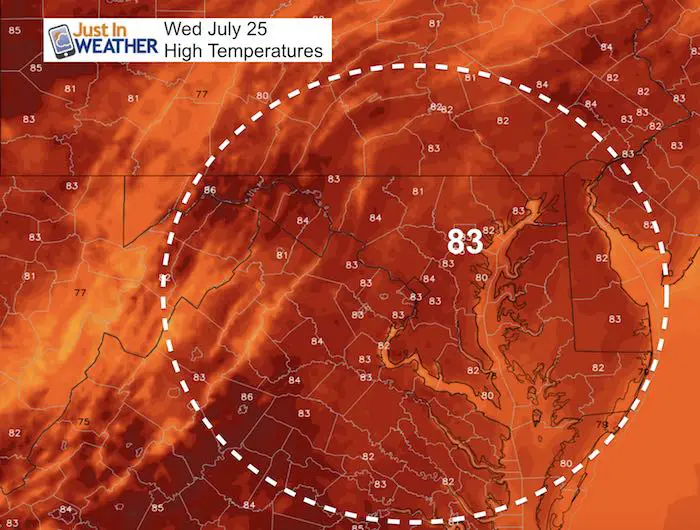
High Temperatures
Improving Pattern
While this animation shows some showers Thursday and Friday, they will be scattered in the afternoon. Saturday looks dry, before then next rainy pattern returns Sunday.
Please share your thoughts, best weather pics/video, or just keep in touch via social media
-
Facebook: Justin Berk, Meteorologist
-
Twitter: @JustinWeather
-
Instagram: justinweather
Keep In Touch Every Day
Click here to sign up for email alerts…. Just in case you don’t get the post on your social media feed
Shine On
Proceeds from all sales go to Just In Power Kids. Click the image to shop and show your support.

![]()
 Get the award winning Kid Weather App I made with my oldest son and support our love for science, weather, and technology. Our 3 year anniversary of the release and our contribution to STEM education is this November. It has been downloaded in 60 countries, and works in both temperature scales. With your support we can expand on the fun introduction to science and real weather.