July 4th 2018
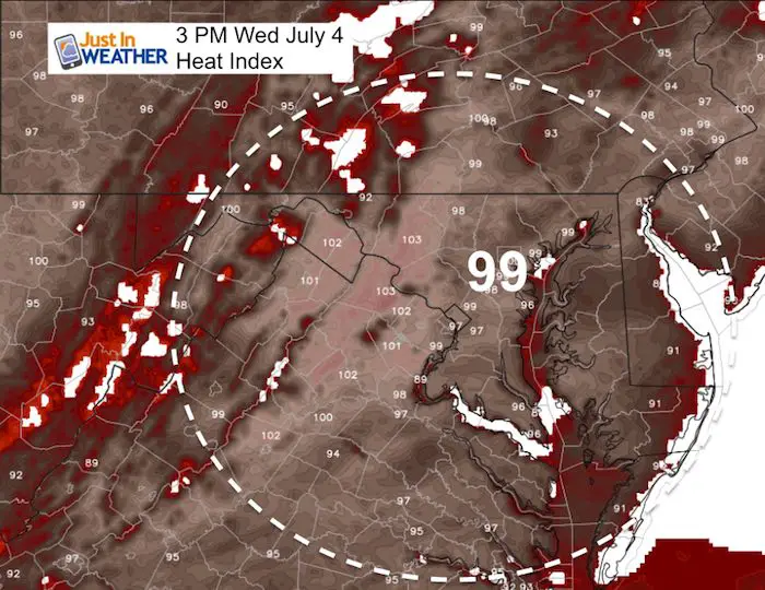
Happy Fourth Of July! This Independence Day will break us free of the strongest heat grip, but it will still be hot for parades. Temperatures will feel about 10 degrees cooler today, but the Heat Index will reach the upper 90s. Showers and storms erupted last night with damage in northern Harford County. Today will once again feature developing storms this afternoon and evening, with a focus north and west of Baltimore. Some may once again have enough fuel for dangerous lightning, hail, and locally heavy downpours. A better chance to remain dry for fireworks this evening in Baltimore, Washington, Annapolis and south to Ocean City.
The storm risk goes way up Thursday evening and Friday as a strong cold front will truly end our heat wave. Plan for a wet Friday, but the weekend will show an improvement with dry weather and a significant drop in temperatures.
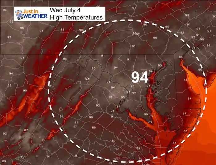
Note: BWI reached a high of 99ºF yesterday.
Stats For July 4 in Baltimore
Average High: 87ºF
Record High: 100ºF in 2002
Average Low: 66ºF
Record Low: 53ºF in 1986
Sunrise: 5:45 AM
Sunset 8:36 PM
*Daylight = 0:44 shorter than yesterday
*Bay Water Temperature = 80ºF at Thomas Pt. Light House
Keep In Touch Every Day
Click here to sign up for email alerts…. Just in case you don’t get the post on your social media feed
Please Support Maryland Trek 5
329 miles hiking and biking in 7 days
To provide free integrated wellness programs for kids in and post cancer treatment
*If you want to join my team for a day, a few days, or the whole week, please ask me for more info.
Morning Set Up
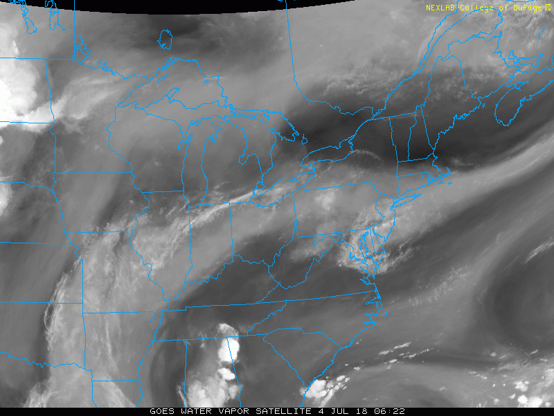
Satellite Loop
You may see the large swirl of moisture or ring of fire just clipping the Mid Atlantic. This will be the edge of the storm development today. Showers and storms will be more likely north of Baltimore and west into the mountains today.
Temperatures
High Temperatures
Max Heat Index
Radar Simulation —> slider
The focus of storms will be north of Baltimore in southern PA early this afternoon, and spread through the evening. This is NOT precise, but an idea of where they may form and how they may move.
[metaslider id=63648]
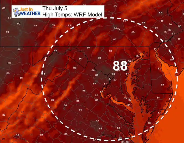
Thursday:
Rain And Storm Risk: Thursday Evening Through Friday
![]()
My High Temperature Outlook
Today: 93ºF
Thursday: 88ºF
Friday: 86ºF
Saturday: 79ºF
Sunday: 80ºF
Monday: 83ºF
Tuesday: 87ºF
Please share your thoughts, best weather pics/video, or just keep in touch via social media
-
Facebook: Justin Berk, Meteorologist
-
Twitter: @JustinWeather
-
Instagram: justinweather
Keep In Touch Every Day
Click here to sign up for email alerts…. Just in case you don’t get the post on your social media feed
Shine On
Proceeds from all sales go to Just In Power Kids. Click the image to shop and show your support.

![]()
 Get the award winning Kid Weather App I made with my oldest son and support our love for science, weather, and technology. Our 3 year anniversary of the release and our contribution to STEM education is this November. It has been downloaded in 60 countries, and works in both temperature scales. With your support we can expand on the fun introduction to science and real weather.