Thursday July 5
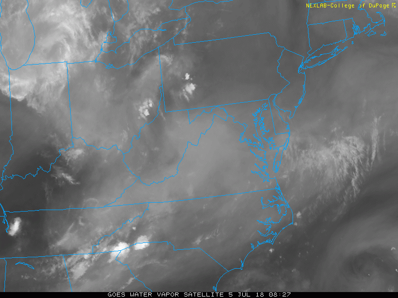
We are slowly nipping away at this heat wave, but it is not done yet. Today starts off with fog and clouds on the north end thanks to heavy rain. The lesson we can take away from the last two days is that the few areas that get into the storms, can stay in the rain for hours as the cells remain nearly stationary. Another round of showers will pop up this afternoon that could do the same thing. The bulk of the rain will be in the mountains and north in Pennsylvania. The slow movement may produce flooding as the slip towards the south.
Tomorrow is when the cold front will impact all of us and clear out the heat, leaving us with a nice weekend. If you loved the heat wave, hang on… It looks like it may try to make a return next week. Check it out below
Stats For July 5 in Baltimore
Average High: 87ºF
Record High: 102ºF in 1999
Average Low: 66ºF
Record Low: 55ºF in 2014
Sunrise: 5:45 AM
Sunset 8:36 PM
*Daylight = 0:47 shorter than yesterday
*Bay Water Temperature = 82ºF at Thomas Pt. Light House
Keep In Touch Every Day
Click here to sign up for email alerts…. Just in case you don’t get the post on your social media feed
Please Support Maryland Trek 5
329 miles hiking and biking in 7 days
To provide free integrated wellness programs for kids in and post cancer treatment
*If you want to join my team for a day, a few days, or the whole week, please ask me for more info.
Morning Set Up
Satellite Loop
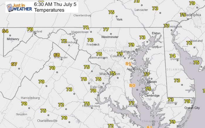
Temperatures (6:30 AM)
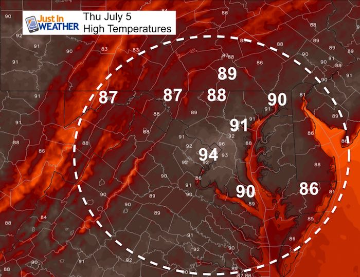
High Temperatures
Radar Simulation —> slider
Once again this looks like rain and storms will develop along the mountains and north in Pennsylvania. There will be a slow slide to the south, but this all depends on the max height of the cloud tops and the upper level winds. Some showers will reach central Maryland, but the bulk will be west and north of Baltimore.
[metaslider id=63693]
Rain Animation Friday
Slow moving front Friday will clear out for the weekend
![]()
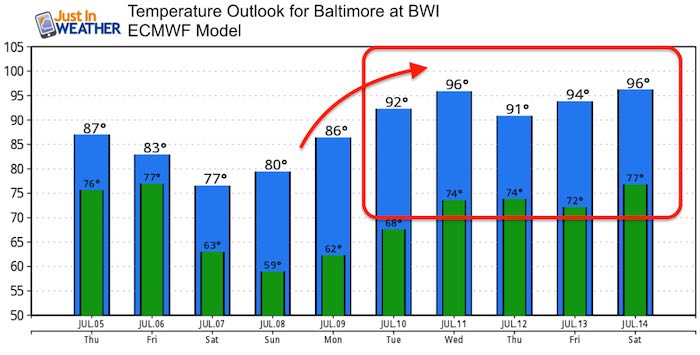
Temperature Outlook
Note: The ECMWF Model has been running cool. So the heat displayed next week might end up hotter. It looks like a nice weekend but another heat wave next week.
Please share your thoughts, best weather pics/video, or just keep in touch via social media
-
Facebook: Justin Berk, Meteorologist
-
Twitter: @JustinWeather
-
Instagram: justinweather
Keep In Touch Every Day
Click here to sign up for email alerts…. Just in case you don’t get the post on your social media feed
Shine On
Proceeds from all sales go to Just In Power Kids. Click the image to shop and show your support.

![]()
 Get the award winning Kid Weather App I made with my oldest son and support our love for science, weather, and technology. Our 3 year anniversary of the release and our contribution to STEM education is this November. It has been downloaded in 60 countries, and works in both temperature scales. With your support we can expand on the fun introduction to science and real weather.