Friday June 29 2018
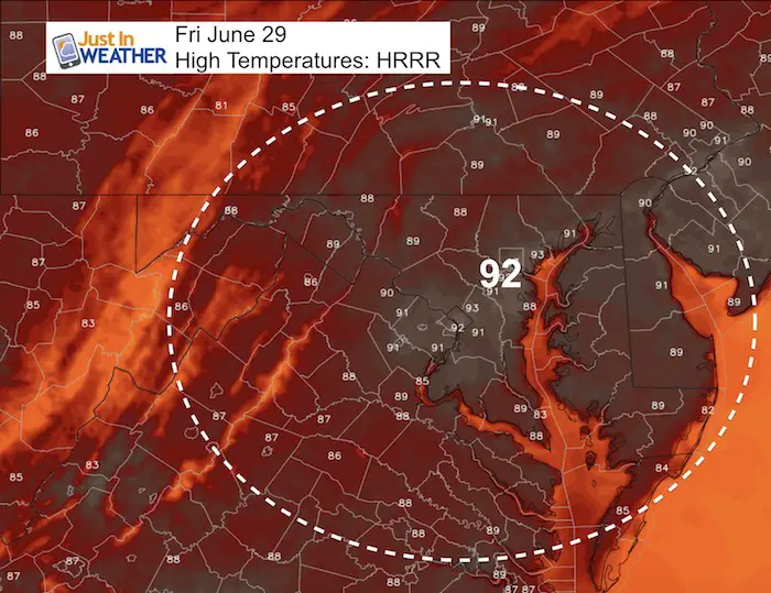
We are about to experience something typical in summer but very rare this year: A Heat Wave. Calling for temperatures in the 90s for a few days should not be a big deal, but check this out: Reaching 90ºF or higher today will only be the 4th time this month! We have hit the 90s for groups of 3 days on two occasions this year:
- June 17 – 19
- May 2-4
- Other single days were May 15 and 24.
We should be adding days to the list, possibly through Tuesday. Please consider the affects on children, elderly, and pets. Keep plenty of water handy for them. Also, please do not leave your pets outside and definitely NOT IN CARS.
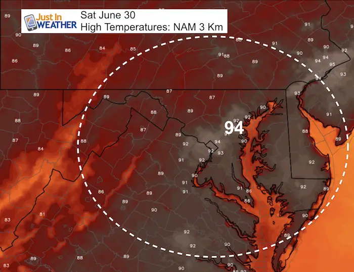
The hottest day is expected to be Sunday and relief will be indoors, at the pool, or the beaches. But, while you may have been waiting for this weather it comes with the price tag of poor air quality:
Air Quality Alert
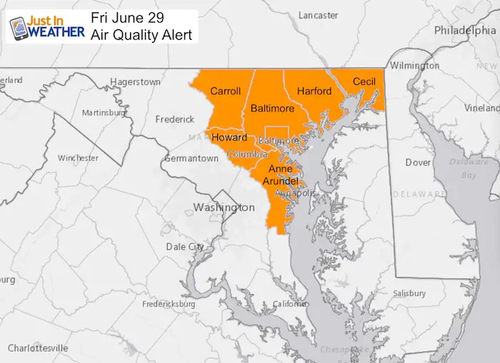
A Code Orange Air Quality Alert means that air pollution concentrations within the region may become unhealthy for sensitive groups.
Sensitive groups include children, people suffering from asthma, heart disease or other lung diseases and the elderly. The effects of air pollution can be minimized by avoiding strenuous activity or exercise outdoors.
Stats For June 29 in Baltimore
Average High: 87ºF
Record High: 105ºF in 1934
Average Low: 66ºF
Record Low: 53ºF in 1974
Sunrise: 5:43 AM
Sunset 8:37 PM
*Daylight = 0:29 shorter than yesterday
*Bay Water Temperature = 75ºF at Thomas Pt. Light House
Keep In Touch Every Day
Click here to sign up for email alerts…. Just in case you don’t get the post on your social media feed
Please Support Maryland Trek 5
329 miles hiking and biking in 7 days
To provide free integrated wellness programs for kids in and post cancer treatment
If you help my team get to $10,000 this week, you are eligible to win 1 of 10 Shine On Shirts
*If you want to join my team for a day, a few days, or the whole week, please ask me for more info.
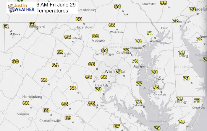
Morning Set Up
Temperatures
How Hot?
Today
Saturday
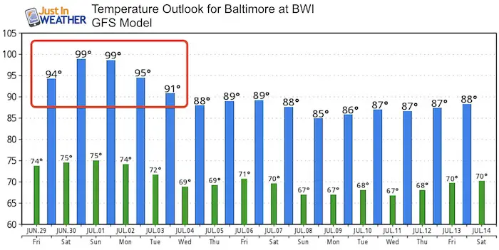
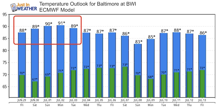
The Extended Outlook spotlights the error in temperature forecast between the two main models. Before showing the contrast, I just want to add my expectation:
This weekend will show temperatures in the middle 90s. I don’t think we will reach 100ºF, but the HEAT INDEX should top that mark, Especially in urban areas.
The error: GFS Has been running too warm and ECMWF has bee too cool:
Please share your thoughts, best weather pics/video, or just keep in touch via social media
-
Facebook: Justin Berk, Meteorologist
-
Twitter: @JustinWeather
-
Instagram: justinweather
Keep In Touch Every Day
Click here to sign up for email alerts…. Just in case you don’t get the post on your social media feed
Shine On
Proceeds from all sales go to Just In Power Kids. Click the image to shop and show your support.

 Get the award winning Kid Weather App I made with my oldest son and support our love for science, weather, and technology. Our 3 year anniversary of the release and our contribution to STEM education is this November. It has been downloaded in 60 countries, and works in both temperature scales. With your support we can expand on the fun introduction to science and real weather.

