 4 PM Sunday June 3 2018
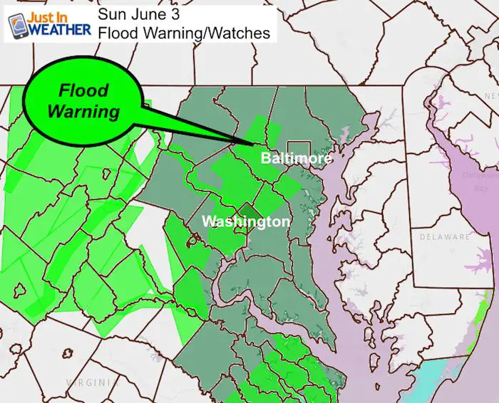
The heavy rain with our coastal Low Pressure has produced up to 1.5 inches of rain in the past hour in central Maryland’s Baltimore, Howard, and Carroll County on the west side of the beltway. Storm total over 3 inches on already soggy soil has led to additional flooding and prompted a Flood Warning in these areas until 9:30 PM. A Flood Watch remains in effect for much of the region until 6 PM. The latest radar simulation does suggest the heavy rain will be easing into the evening. See that update below.
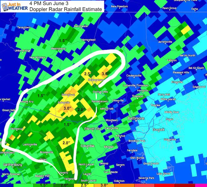
Rain Totals As of 4 PM
The heaviest rain has been between Sykesville, Eldersburg, and Reisterstown with 2 to 3 inches.
The other issue today has been the temperatures that have dropped into the upper 50s in some spots. This is where the normal morning low temperatures should be for June 3. We can think the Low Pressure and strong east to northeasterly winds off of the ocean for dragging on the chilly, damp air.
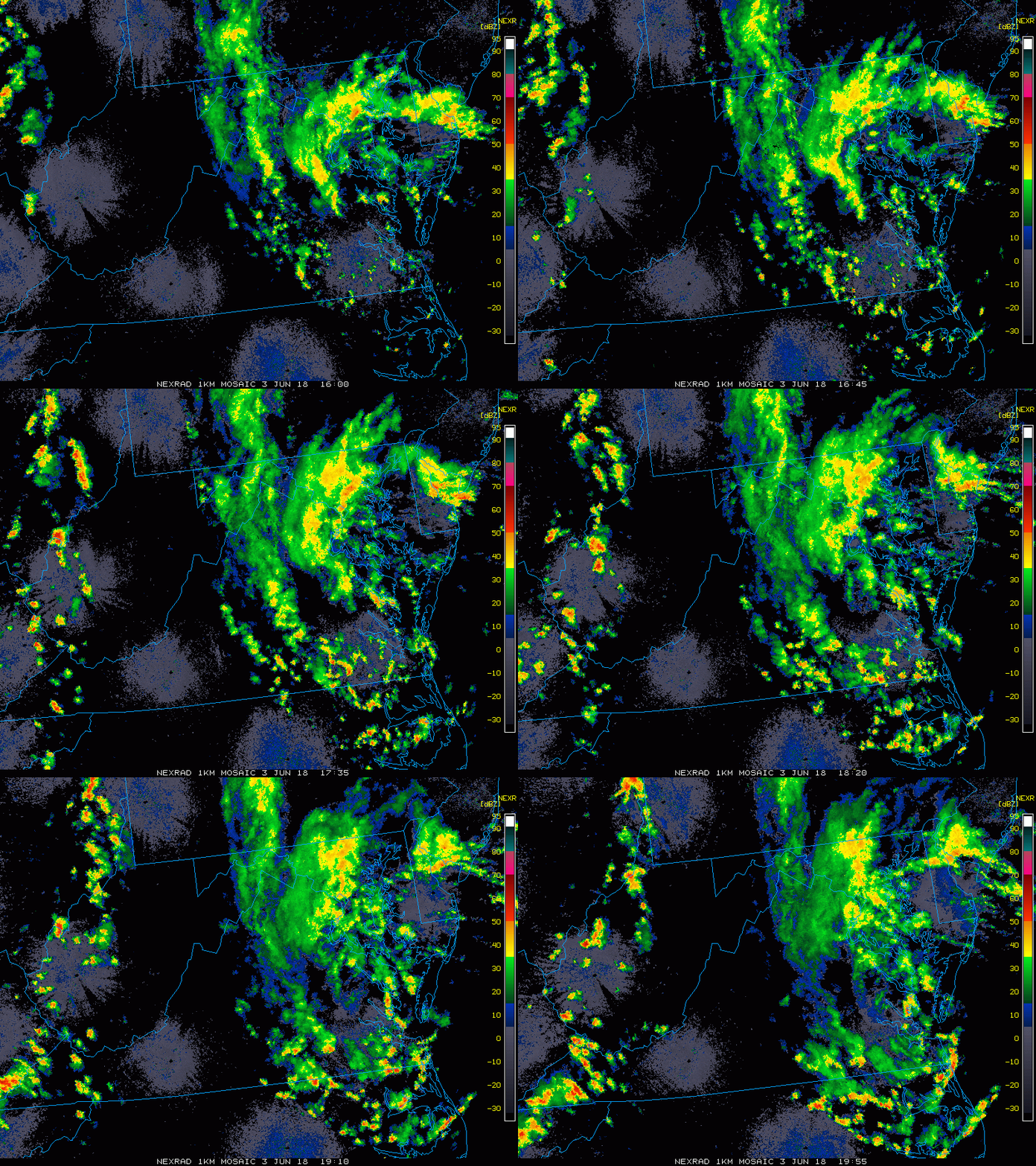
Radar Animation Noon to 4 PM
Radar Simulation 4 PM to 10 PM —> slider
[metaslider id=62918]
Satellite
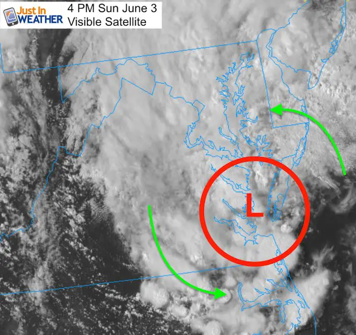
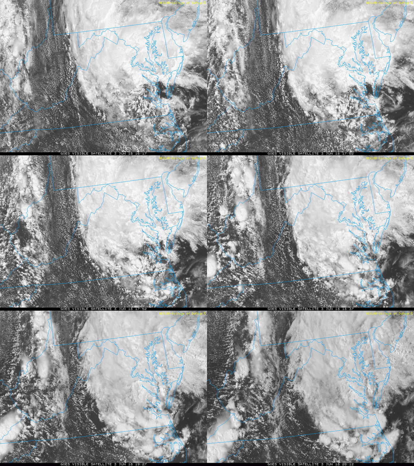
Satellite Animation (4 Hour Loop)

Shine On
Proceeds from all sales go to Just In Power Kids. Click the image to shop and show your support.
Please share your thoughts, best weather pics/video, or just keep in touch via social media
-
Facebook: Justin Berk, Meteorologist
-
Twitter: @JustinWeather
-
Instagram: justinweather
Keep In Touch Every Day
Click here to sign up for email alerts…. Just in case you don’t get the post on your social media feed
 Get the award winning Kid Weather App I made with my oldest son and support our love for science, weather, and technology. Our 3 year anniversary of the release and our contribution to STEM education is this November. It has been downloaded in 60 countries, and works in both temperature scales. With your support we can expand on the fun introduction to science and real weather.

