Tuesday May 29 2018
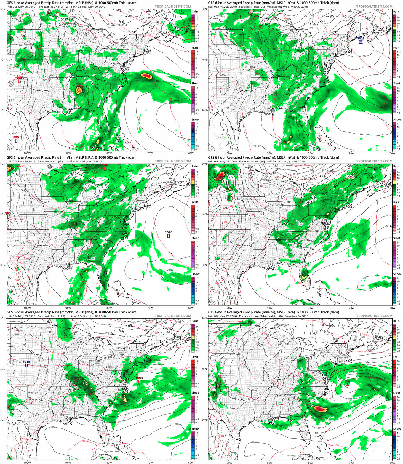
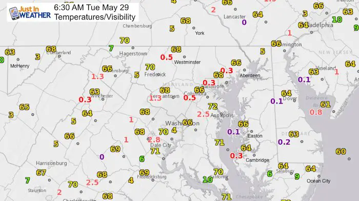
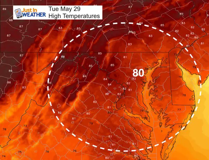
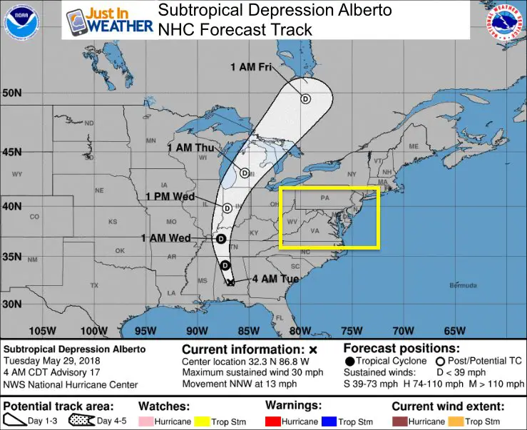
More rain is on the way this week. This morning the visibility is the main issue. Fog and some mist will be a dominant part of your commute. Event some mist or drizzle as visibility is under 1 mile as noted on this map with the red numbers. Fog advisories on the bridges, but NWS does not have one for the area. Please still consider this to slow you down. The day will remain mostly cloudy, but temps will get to near 80ºF. The rest of the week we will have increasing threats of showers, with thunderstorms later in the week and weekend. This is due to the moisture from Subtropical Depression Alberto. The center of the storm is heading towards the Great Lakes, but it will spread our way and possibly redevelop into a new Low Pressure near Ocean City this weekend.
See more below…
Stats For May 29 in Baltimore
Average High: 78ºF
Record High: 97ºF in 1969
Average Low: 56ºF
Record Low: 38ºF in 1956
Sunrise: 5:43 AM
Sunset 8:41 PM
*Daylight = 1:16 longer than yesterday
*Bay Water Temperature = 71ºF at Thomas Pt. Light House
Keep In Touch Every Day
Click here to sign up for email alerts…. Just in case you don’t get the post on your social media feed
Ellicott City Flood Reports:
Raw video, radar, and rain totals
Video of damage from the air, history, and area development concerns
This Morning
Visibility UNDER 1 MILE In RED
Afternoon High Temperatures
Subtropical Depression Alberto
LOCATION...32.3N 86.8W
ABOUT 30 MI...45 KM W OF MONTGOMERY ALABAMA
MAXIMUM SUSTAINED WINDS...30 MPH...45 KM/H
PRESENT MOVEMENT...NNW OR 345 DEGREES AT 13 MPH...20 KM/H
MINIMUM CENTRAL PRESSURE...995 MB...29.39 INCHES
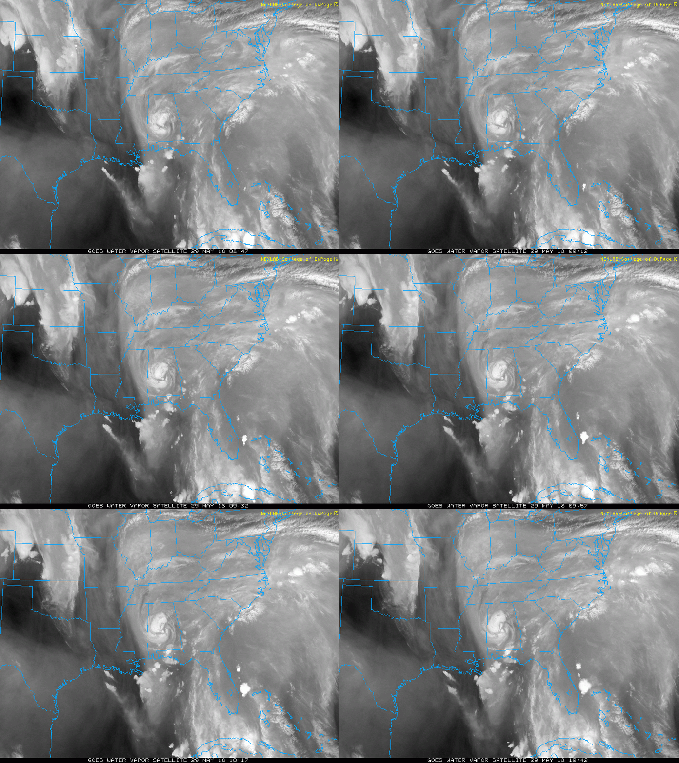
Water Vapor Satellite
The core circulation is over Alabama, but the moisture is pumping up to the north on the east side. That keeps us on the ‘wet side’ of this system.
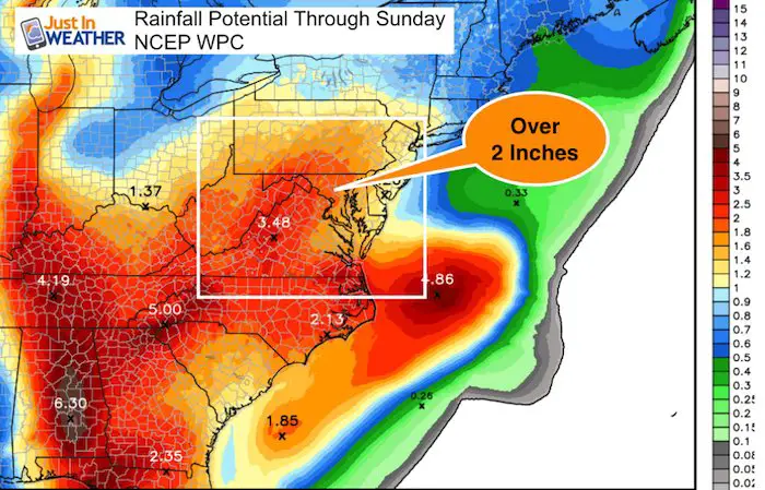
Forecast Rain Through The Weekend
Rainfall Potential This Week
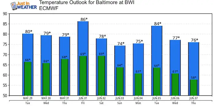
Temperature Outlook

Shine On
Proceeds from all sales go to Just In Power Kids. Click the image to shop and show your support.
Please share your thoughts, best weather pics/video, or just keep in touch via social media
-
Facebook: Justin Berk, Meteorologist
-
Twitter: @JustinWeather
-
Instagram: justinweather
Keep In Touch Every Day
Click here to sign up for email alerts…. Just in case you don’t get the post on your social media feed
 Get the award winning Kid Weather App I made with my oldest son and support our love for science, weather, and technology. Our 3 year anniversary of the release and our contribution to STEM education is this November. It has been downloaded in 60 countries, and works in both temperature scales. With your support we can expand on the fun introduction to science and real weather.

