 Thursday May 24 2018
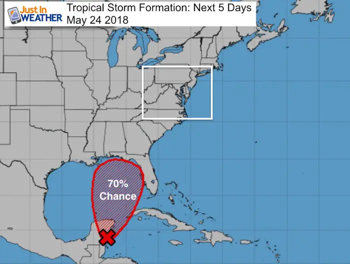
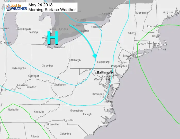
Nearly perfect weather today and tomorrow as High Pressure keeps the sky mostly clear and humidity low. As we enter the weekend, we need to watch the Gulf Coast for moisture flowing our way and the likely formation of a new tropical storm. While the expectation for this early developing is up to 70% in the next 5 days, the track is unsure. The slower this thing moves, the better for us. But it is so far away, any little shift can throw this off. It is possible it lingers for much of the next week around the Gulf Coast making for problems wherever it ends up.
The most likely time this weekend we get rain locally will be Saturday and Sunday afternoon/evening with showers and storms. Since this is a holiday, there is added stress on the specifics. This type of pattern can’t lock in timing and location of storms until the day of and when they actually develop. But this is not the best weekend for the pool or outdoor party. Sorry… but you may get a few lucky dry hours by you. Especially on the Delmarva and beaches.
A special model run for this system is being generated and I have the latest posted below.
Stats For May 24 in Baltimore
Average High: 76ºF
Record High: 93ºF in 1933
Average Low: 55ºF
Record Low: 41ºF in 1963
Sunrise: 5:46 AM
Sunset 8:21 PM
*Daylight = 1:30 longer than yesterday
*Bay Water Temperature = 69ºF at Thomas Pt. Light House
Morning Set Up
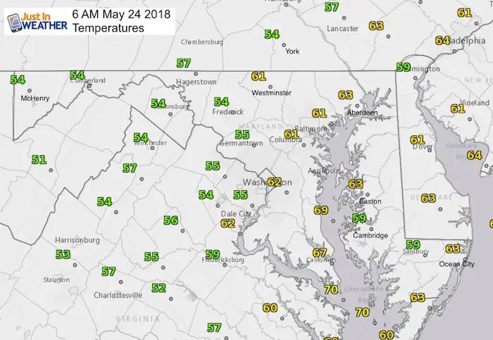
Morning Temperatures
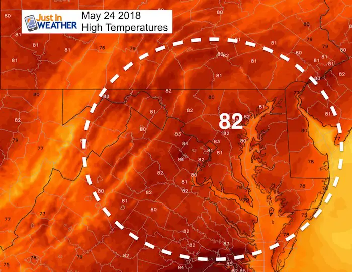
Afternoon Temperatures
Tropical Outlook-Alberto?
The 70% chase of a tropical storm forming this weekend is over a broad area of the eastern Gulf of Mexico. The name will be Alberto and the speed will determine where it could hit the US shores… plus the impact on us. The one good thing is that it looks slower, which could allow for our region to get some protection from a cold front around Memorial Day. However, there has been a global trend for tropical systems to verify farther east than projections. Since this is the first of our season, we need to see if that is a trend for us as well.
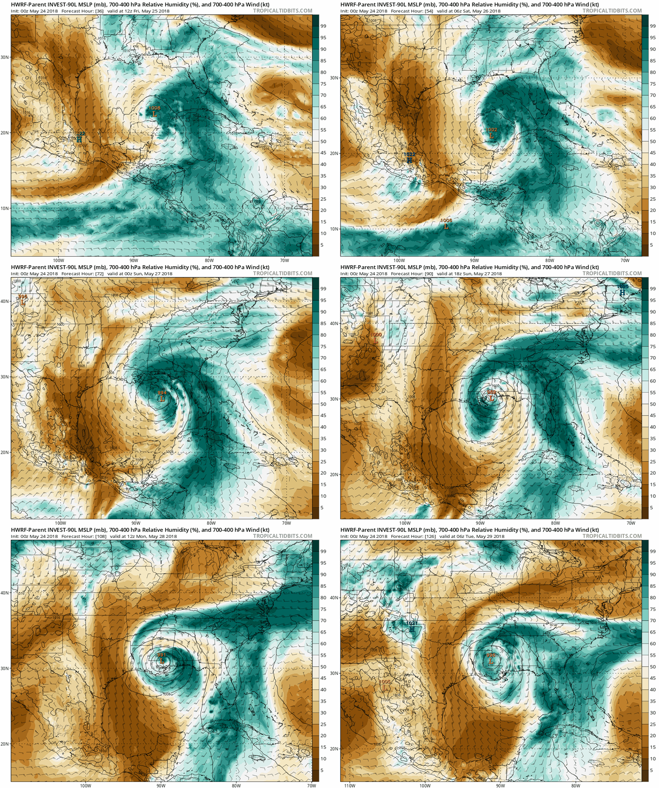
Animation- HWRF- Model with cloud based moisture
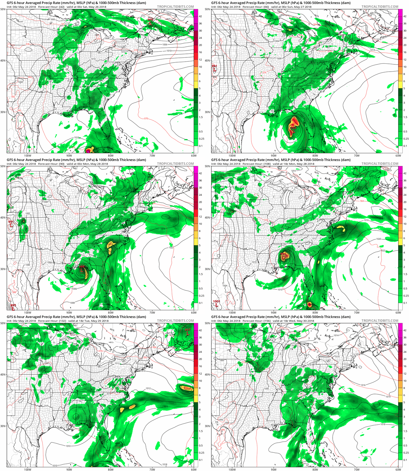
Animation – GFS Model Rainfall
Our best risk of rain will be Saturday and Sunday… especially with afternoon and evening storms.
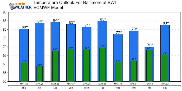
Temperature Outlook
Keep In Touch Every Day
Click here to sign up for email alerts…. Just in case you don’t get the post on your social media feed

Shine On
Proceeds from all sales go to Just In Power Kids. Click the image to shop and show your support.
Please share your thoughts, best weather pics/video, or just keep in touch via social media
-
Facebook: Justin Berk, Meteorologist
-
Twitter: @JustinWeather
-
Instagram: justinweather
 Get the award winning Kid Weather App I made with my oldest son and support our love for science, weather, and technology. Our 3 year anniversary of the release and our contribution to STEM education is this November. It has been downloaded in 60 countries, and works in both temperature scales. With your support we can expand on the fun introduction to science and real weather.

