 3:20 PM Saturday May 12 2018
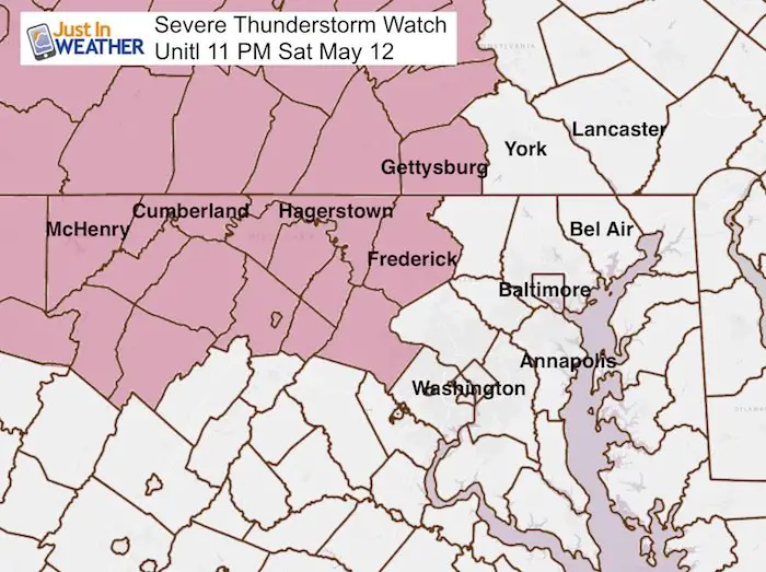
A Severe Thunderstorm Watch has been issued for the western half of our area until 11 PM. This appears to stop short of York, Carroll, and Howard. Counties, but I would not let your guard down. Its just the timing may be beyond this window or NWS assuming the storms drop below severe limits by then. See more here…
This Watch means severe storms might happen. Conditions are present to build storms that may contain winds over 60 mph, large hail marble to golf ball size, and an isolated tornado. There is a stationary front that has wobbled back north today… but it has held back temperatures a little.
As I see it, there will be two rounds of storms. The first this evening wil be north of Baltimore and should prompt extended advisories for southern Pennsylvania into possibly Cecil county Maryland and northern Delaware. The second round will be the larger complex that will reach much of the watch area before 11 PM. This may reach metro Baltimore and Washington between 10 PM and midnight. So if they hold together, alerts may be issued outside of the current map shown here. I would plan for that possibility.
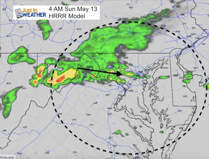
There will be another round of showers and storms just before sunrise Sunday.
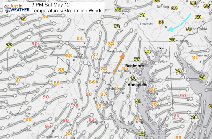
Mid Afternoon Conditions
The stationary front at 3 PM shows the mid 80 and 90 degree heat trying to push north. This can be seen in orange and red numbers. Observations show it just west of the Bay. But the Chesapeake is hanging on the the chill. The cool air is lingering with the easterly winds on the other side in northeastern Maryland and southern Pennsylvania.
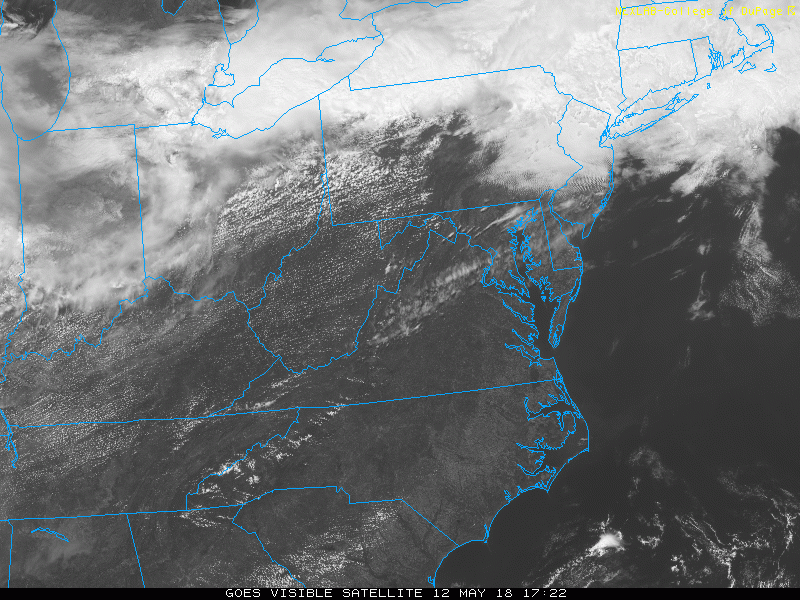
Satellite Loop
The main convection is well to our north and west, but along the front, there are waves of clouds across northern Maryland.
Radar Loop
The main rain line is across the northern tier of Pennsylvania, but with the flare up of severe storms near Pittsburgh. This is the first round of action we need to watch between 5 PM and 8 PM. The next wave will arrive from the west into our area after 10 PM

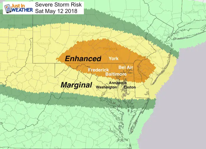
Enhanced Risk For Severe Storms
*From the Storm Predicition Center still has York, Baltimore, and northern Delmarva covered.
Radar Simulation —> slider
- The first wave of severe storms is shown across Southern Pennsylvania and into northern Delaware between 5 PM and 8 PM. These are not in the current watch but may be added.
- The second wave will be al larger cluster from the west that will cross western Maryland and enter central Maryland after 9 PM. This will cross metro areas around midnight.
[metaslider id=61991]
Sunday Morning… More Rain And Moderate Storms
Please share your thoughts, best weather pics/video, or just keep in touch via social media
-
Facebook: Justin Berk, Meteorologist
-
Twitter: @JustinWeather
-
Instagram: justinweather
Keep In Touch Every Day
Click here to sign up for email alerts…. Just in case you don’t get the post on your social media feed
![]()
Shine On
Proceeds from all sales go to Just In Power Kids. Click the image to shop and show your support.

 Get the award winning Kid Weather App I made with my oldest son and support our love for science, weather, and technology. Our 3 year anniversary of the release and our contribution to STEM education is this November. It has been downloaded in 60 countries, and works in both temperature scales. With your support we can expand on the fun introduction to science and real weather.