Saturday April 14 2018
Do you want to hear about extreme weather? On this date in 1940, Baltimore picked up a record 0.3 inches of snow. One year later on the same date, the record high of 91ºF. The extreme conditions we have piled into a few days is why I am writing this morning. I was actually going to skip this report and just enjoy a weekend morning. But I need to show you this abrupt change in temperatures and rain on the way. So enjoy today because it will not last.
Back Door Cold Front
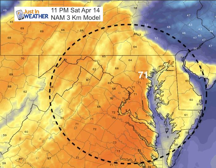
Our warm spell is going to come to a crashing halt overnight as a cold front will be sliding down from New England. Instead of our warm southwesterly winds, the air wil be coming from the east and northeast. The result: After reaching the mid 80s today, we will be stuck in the mid 40s most of Sunday with clouds and rain.
IF YOU SEE 70s FOR SUNDAY HIGH TEMP ON YOU APP, THAT WILL BE JUST AFTER MIDNIGHT
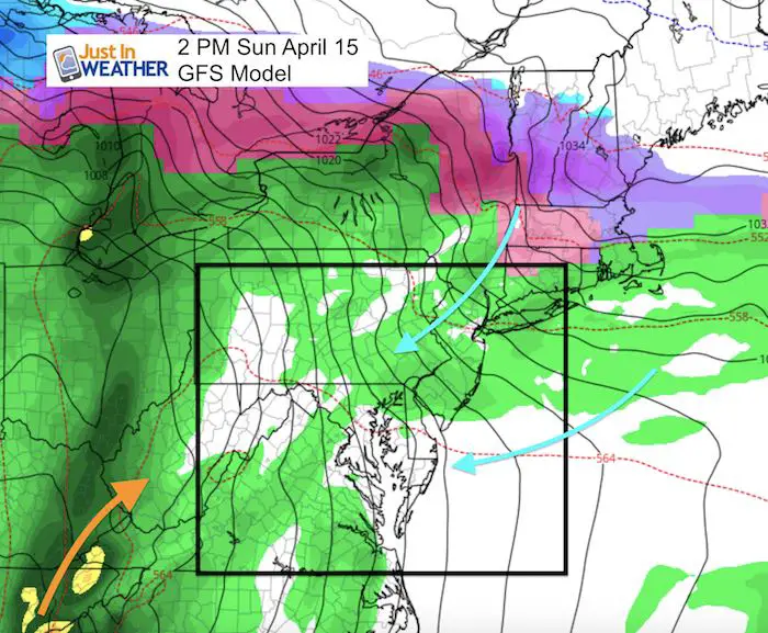
There still is a strong cold front expecting to reach us early Monday, but thanks to the colder day time and cold air in place, this may limit our severe storm potential. But Monday morning will be a rough ride. Here check out these maps:
Stats For April 14
Average High: 64ºF
Record High: 91ºF in 1941
Average Low: 42ºF
Record Low: 24ºF in 1950
Snow Record: 0.3″ in 1940
Seasonal Snow To Date (at BWI): 15.2
Sunrise: 6:31 AM
Sunset 7:43 PM
*Daylight = 2:29 longer than yesterday
*Bay Water Temperature = 49ºF at Thomas Pt. Light House
Keep In Touch Every Day
Click here to sign up for email alerts…. Just in case you don’t get the post on your social media feed
Ready To Shine On This Spring?
Proceeds from all sales go to Just In Power Kids. Click the image to shop and show your support.

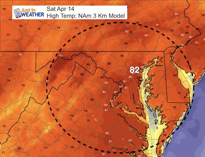
Temperatures
Afternoon High Temps
This is the NAM version of the afternoon and as I showed yesterday, we often end up warmer. Plan for mid to upper 80s again, but maybe just a notch or two lower than Friday.
Back Door Cold Front
This is the front that will shift our winds and bring in rain showers Sunday. We will begin to see it overnight. See the temps below.
Temperature Trending Down Sunday
Saturday Night
IF YOU SEE 70s FOR SUNDAY HIGH TEMP ON YOU APP, THAT WILL BE JUST AFTER MIDNIGHT
Sunday Morning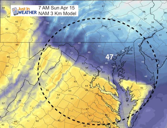
Sunday Afternoon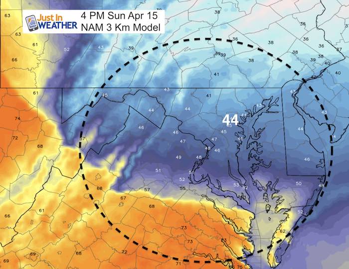
Rain Timelines
Here is a look a Sunday and Monday rain in two separate sliders
Sunday Rain —-> slider
[metaslider id=61184]
Monday Rain —-> slider
[metaslider id=61201]
Shine On
Proceeds from all sales go to Just In Power Kids. Click the image to shop and show your support.
![]()
 Get the award winning Kid Weather App I made with my oldest son and support our love for science, weather, and technology. Our 3 year anniversary of the release and our contribution to STEM education is this November. It has been downloaded in 60 countries, and works in both temperature scales. With your support we can expand on the fun introduction to science and real weather.
Also See:
My Winter Outlook 2017-2018 for more snow
La Nina Formed: What it could mean to our winter
NOAA Winter Outlook: Not The Best But Not The Worst For Snow
Two Farmers Almanacs Winter 2018 Outlooks
Winter Weather Folkore: Suggestions from Animals and Crops
First Frost and Freeze Dates For Maryland (southern PA and northern VA)
My Preliminary Winter Outlook Notes
Low Snow Winters In Baltimore: To Repeat Or Not Repeat
NOAA Ranks Blizzard 2016 4th Worst Snowstorm On Record
Blizzard 2016 Record Top Snowstorm: Area Totals
Extreme Weather of 2015 balanced out on both ends