 April 9 2018
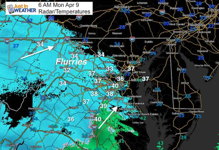
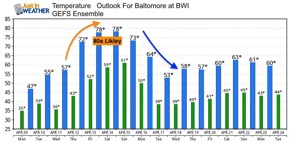
A little disturbance this morning looks more impressive on radar than it really is. There are some flurries but not all of this snow (in blue) is reaching the ground. You may see some snow flurries or rain sprinkles today, but most of us are already above freezing and the pattern is trying to shift north. The net result will eventually get us to flip the switch and allow temperatures to soar through the 70s at the end of the week. There is a tendency in spring to end up warmer than first though, so I think we have a good shot at hitting 80ºF in Baltimore by the end of the week. However, the colder pattern trend will return next week.
Stats For April 7
Average High: 62ºF
Record High: 89ºF in 1959
Average Low: 41ºF
Record Low: 22ºF in 2007
Snow Record: 3.0″ in 1917
Seasonal Snow To Date (at BWI): 15.2
Sunrise: 6:38 AM
Sunset 7:38 PM
*Daylight = 2:30 longer than yesterday
*Bay Water Temperature = 45ºF at Thomas Pt. Light House
Keep In Touch Every Day
Click here to sign up for email alerts…. Just in case you don’t get the post on your social media feed
Ready To Shine On This Spring?
Proceeds from all sales go to Just In Power Kids. Click the image to shop and show your support.

Rain/Snow Radar Simulation Today —> slider
[metaslider id=61077]
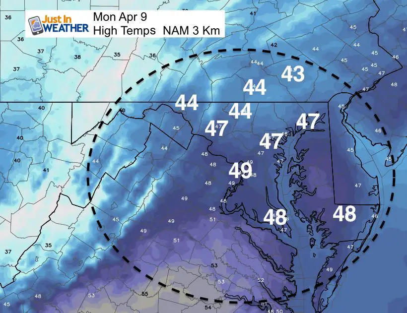
High Temperatures
Even if you see flurries, temperatures will be rising into the 40s. Still 15 to 20 degrees below average.
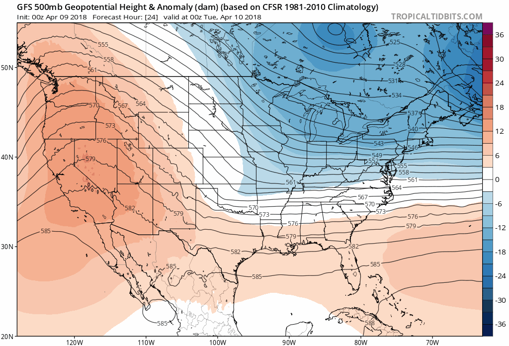
Jet Stream
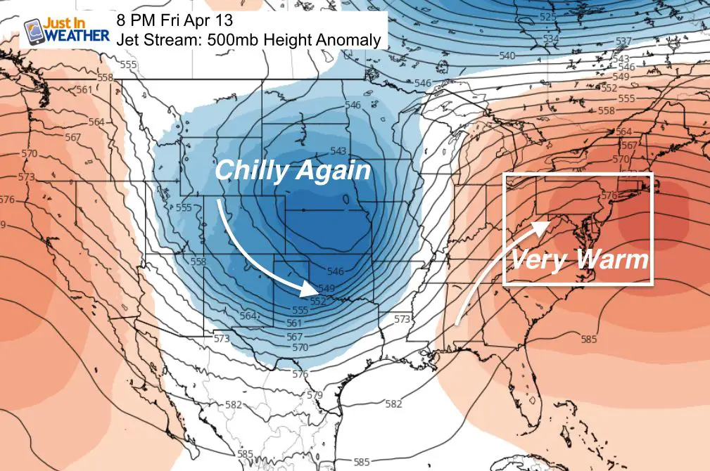
This look at the 500mb Heigh Anomaly is around 18,000 Ft above the ground. We have been stuck in a cold pattern with a trough and lower heights (blue). The warm air in southern California works our way this week and we will feel it by the weekend. This ridge (orange) will lift temps into the upper 70s to near 80ºF. I would lean on the warmer side as spring tendencies is to end up warmer than first thought. This will only last a few days as we return back to the colder pattern next week.
Jet Stream Animation
Temperature Outlook
Shine On
Proceeds from all sales go to Just In Power Kids. Click the image to shop and show your support.
![]()
 Get the award winning Kid Weather App I made with my oldest son and support our love for science, weather, and technology. Our 3 year anniversary of the release and our contribution to STEM education is this November. It has been downloaded in 60 countries, and works in both temperature scales. With your support we can expand on the fun introduction to science and real weather.
Also See:
My Winter Outlook 2017-2018 for more snow
La Nina Formed: What it could mean to our winter
NOAA Winter Outlook: Not The Best But Not The Worst For Snow
Two Farmers Almanacs Winter 2018 Outlooks
Winter Weather Folkore: Suggestions from Animals and Crops
First Frost and Freeze Dates For Maryland (southern PA and northern VA)
My Preliminary Winter Outlook Notes
Low Snow Winters In Baltimore: To Repeat Or Not Repeat
NOAA Ranks Blizzard 2016 4th Worst Snowstorm On Record
Blizzard 2016 Record Top Snowstorm: Area Totals
Extreme Weather of 2015 balanced out on both ends